Landmark: Arenal Volcano National Park
City: Alajuela
Country: Costa Rica
Continent: North America
Arenal Volcano National Park, Alajuela, Costa Rica, North America
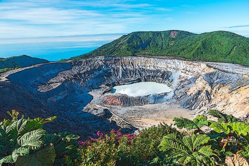
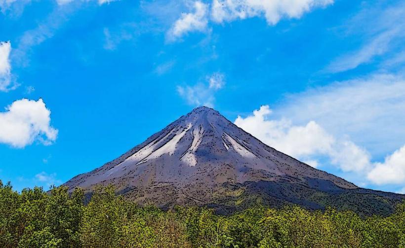
Arenal Volcano National Park is a protected area containing the Arenal Volcano, a stratovolcano located in the Alajuela Province of Costa Rica.
The park encompasses a significant portion of the volcano and its surrounding rainforest ecosystem.
Visual Characteristics
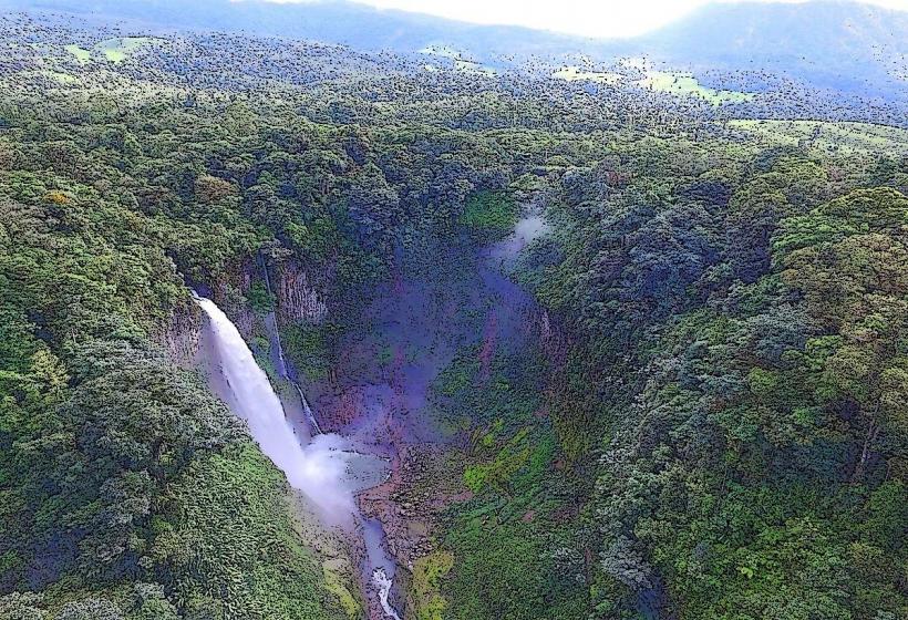
The Arenal Volcano is a conical stratovolcano, approximately 1,670 meters (5,479 feet) in elevation. Its slopes are covered in dense, primary rainforest. The summit crater is typically obscured by clouds. Lava flows from past eruptions are visible as dark, rocky scars on the upper flanks. The surrounding landscape features numerous rivers and streams, with water coloration varying from clear to sediment-laden brown depending on rainfall.
Location & Access Logistics
The park is situated approximately 90 kilometers (56 miles) northwest of San José, the capital city. Access is primarily via Route 141, which connects to Route 4. The main entrance is located near the town of La Fortuna. Parking is available at designated visitor centers and trailheads. Public transport options include intercity buses from San José to La Fortuna, followed by local taxis or pre-arranged shuttles to the park entrances.
Historical & Ecological Origin
Arenal Volcano is geologically classified as a stratovolcano, formed by the accumulation of lava and ash. Its most recent significant eruptive period began in 1968 and continued intermittently until 2010. The park protects a diverse tropical rainforest ecosystem, characterized by high biodiversity and a complex network of rivers and thermal springs.
Key Highlights & Activities
Hiking is available on marked trails such as the Las Coladas trail, which leads to viewpoints of old lava flows, and the El Ceibo trail, featuring a giant Ceiba tree. Observation of wildlife, including monkeys, sloths, and numerous bird species, is possible. Thermal hot springs are located in the vicinity of La Fortuna, fed by the volcano's geothermal activity. Guided nature walks are offered.
Infrastructure & Amenities
Restrooms are available at the main visitor center and some trailheads. Shaded areas are present along some trails and at designated picnic spots. Cell phone signal (4G/5G) is generally available in the vicinity of La Fortuna but can be intermittent within the park's denser forest areas. Food vendors and restaurants are concentrated in La Fortuna, with limited options directly at park entrances.
Best Time to Visit
The dry season, from December to April, generally offers clearer views of the volcano. The best time of day for wildlife viewing is typically early morning or late afternoon. For photography, early morning light can provide good illumination, though cloud cover is a frequent factor. High tide is not a relevant consideration for this inland park.
Facts & Legends
Local indigenous folklore refers to the volcano as "Atrato," meaning "lightning," due to its frequent electrical storms during eruptions. A specific tip for visitors is to check the volcano's activity status with park rangers before planning hikes on trails close to the summit, as access can be restricted due to safety concerns.
Nearby Landmarks
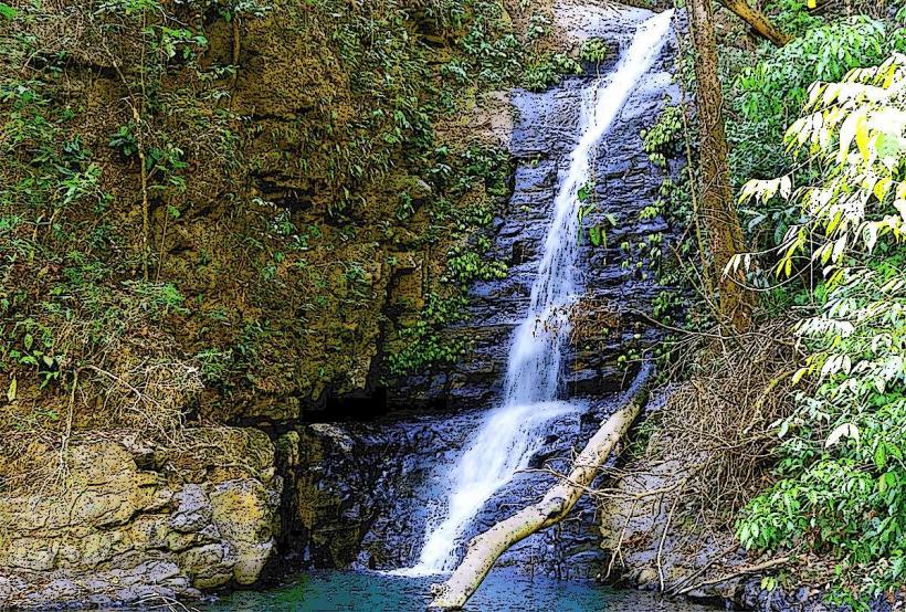
- La Fortuna Waterfall (1.5km Southeast)
- Tabacon Thermal Resort & Spa (5km Southwest)
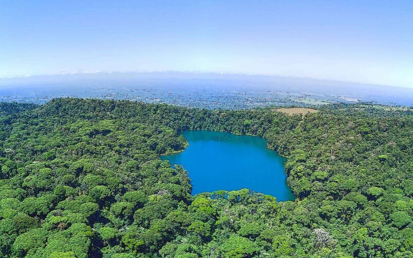
- Lake Arenal (8km West)
- Mistico Arenal Hanging Bridges Park (6km Northwest)
- Arenal Observatory Lodge & Spa (4km Southwest)