Information
Landmark: Barton Creek GreenbeltCity: Austin
Country: USA Texas
Continent: North America
Barton Creek Greenbelt, Austin, USA Texas, North America
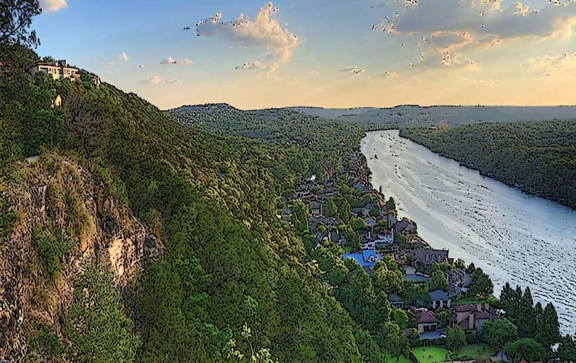
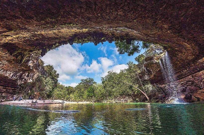
The Barton Creek Greenbelt is a protected natural area located in Austin, Texas, USA. It comprises approximately 12 miles of undeveloped land along Barton Creek.
Visual Characteristics
The terrain consists of limestone cliffs, rocky creek beds, and dense deciduous and evergreen vegetation. Water clarity in Barton Creek varies seasonally, often appearing clear to light green in drier periods and becoming turbid after rainfall. Rock formations include exposed limestone strata and natural pools.
Location & Access Logistics
Access points are distributed along the greenbelt. The main entrance is at the Zilker Park entrance on Barton Springs Road, approximately 3 miles southwest of downtown Austin. Parking is available at designated trailheads, including the Gus Fruh trailhead (2700 Barton Springs Road) and the Twin Falls trailhead (3300 Barton Springs Road). Public transport options include the Capital Metro Bus Route 1, which stops near Zilker Park.
Historical & Ecological Origin
The area is a natural riparian zone shaped by the erosive power of Barton Creek over millennia. The limestone bedrock is part of the Edwards Plateau, a significant geological formation in Central Texas. The greenbelt was established through a series of land acquisitions by the City of Austin starting in the 1970s to preserve its natural state.
Key Highlights & Activities
Activities include hiking on marked trails, rock climbing on designated limestone faces, and swimming in natural pools such as Barton Pool and Sculpture Falls during periods of adequate water flow. Mountain biking is permitted on specific trails.
Infrastructure & Amenities
Restrooms are available at the Zilker Park entrance and some trailheads. Shade is provided by mature trees. Cell phone signal is intermittent throughout the greenbelt, with 4G/5G coverage generally limited to the edges and higher elevations. No food vendors are present within the greenbelt itself; amenities are available in nearby commercial areas.
Best Time to Visit
For photography, early morning or late afternoon light offers optimal illumination of the rock formations and water. The best months for comfortable hiking and swimming are typically April through October. Swimming is dependent on water levels; pools are generally full and safe for swimming after significant rainfall, but can be dry during extended drought periods.
Facts & Legends
The greenbelt is a critical habitat for several endangered species, including the Barton Springs salamander. A local legend suggests that the deepest pool, known as "The Grotto," has a hidden underwater cave system, though this remains unverified.
Nearby Landmarks
- Zilker Park (0.5km Northeast)
- Barton Springs Pool (1km Northeast)
- Umlauf Sculpture Garden and Museum (1.5km Northeast)
- South Congress Avenue (3km East)
- Texas State Capitol (4km Northeast)