Landmark: Boysen State Park
City: Riverton
Country: USA Wyoming
Continent: North America
Boysen State Park, Riverton, USA Wyoming, North America
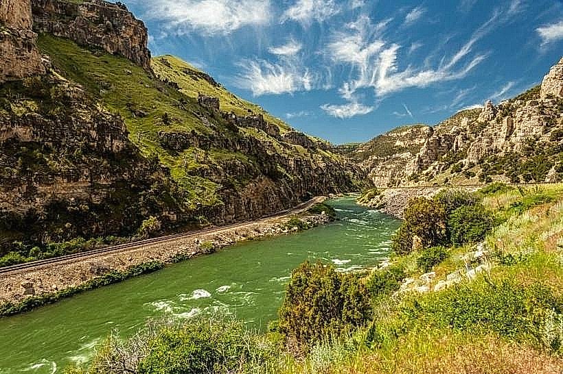
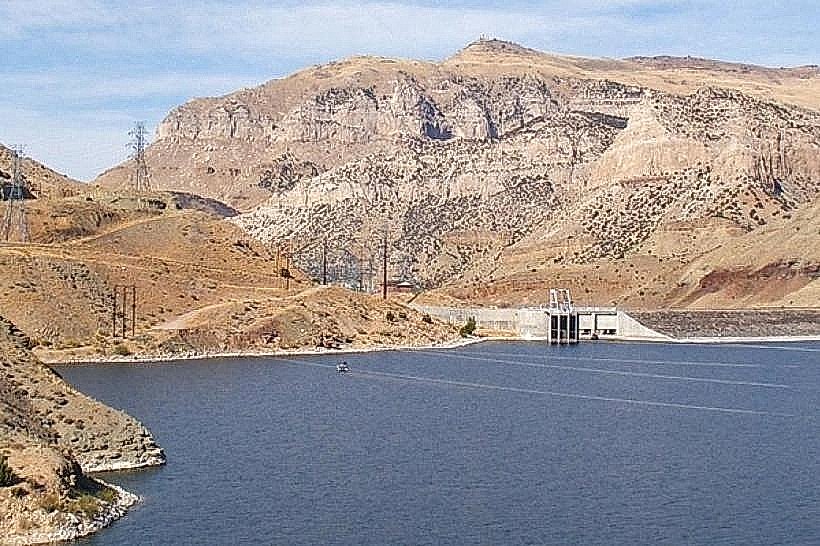
Boysen State Park is a state park located in central Wyoming, USA, centered around Boysen Reservoir.
Visual Characteristics
The park features a large, man-made reservoir with water ranging in color from deep blue to greenish-gray depending on sediment levels. The surrounding terrain consists of arid, rolling hills and badlands composed of sedimentary rock formations, primarily sandstone and shale. Vegetation is sparse, dominated by sagebrush, grasses, and scattered juniper trees. The reservoir shoreline is a mix of sandy beaches, gravel bars, and exposed rock.
Location & Access Logistics
Boysen State Park is situated approximately 20 miles northwest of Riverton, Wyoming. Access is via Wyoming Highway 20/26. The main entrance is clearly marked from the highway. Ample parking is available at designated areas, including boat ramps and picnic sites. No public transport services operate directly to the park.
Historical & Ecological Origin
Boysen State Park was established to protect the area surrounding the Boysen Dam, which was constructed between 1947 and 1951 as part of the Missouri River Basin Project. The dam created Boysen Reservoir, a primary water storage facility for irrigation and flood control. Ecologically, the area is part of the Wyoming Basin ecoregion, characterized by semi-arid conditions and a landscape shaped by erosion over millennia.
Key Highlights & Activities
Activities include boating, fishing for species such as walleye, trout, and perch, and waterskiing on Boysen Reservoir. Hiking trails are available, offering views of the reservoir and surrounding geological features. Camping is permitted at designated campgrounds. Birdwatching is also a common activity, with various species present in the riparian and arid zones.
Infrastructure & Amenities
Restrooms are available at campgrounds and day-use areas. Picnic tables and shelters provide shade in some locations. Cell phone signal is intermittent within the park, with 4G coverage generally limited to higher elevations or near the park entrance. No food vendors are permanently located within the park; visitors should bring their own supplies.
Best Time to Visit
The best months for visiting are from May through September, when temperatures are most favorable for outdoor activities. Mid-morning and late afternoon offer optimal lighting for photography due to the angle of the sun on the rock formations. Water levels in the reservoir are typically highest in early summer. High tide is not a relevant factor for this inland reservoir.
Facts & Legends
A notable historical oddity is the presence of fossilized dinosaur bones discovered in the park's vicinity, indicating a prehistoric ecosystem. Local lore sometimes speaks of unusual rock formations attributed to ancient spirits, though these are not substantiated by geological evidence.
Nearby Landmarks
- Wind River Indian Reservation (Adjacent, South)
- Dubois Badlands (25km Northwest)
- Thermopolis Hot Springs State Park (40km North)
- Shoshone National Forest (50km West)
- Bighorn Basin (Surrounding Region)