Information
Landmark: Caldera de Taburiente National ParkCity: La Palma
Country: Canary Islands
Continent: Europe
Caldera de Taburiente National Park, La Palma, Canary Islands, Europe
The Caldera de Taburiente National Park is a large erosion caldera situated in the central part of La Palma, one of the Canary Islands. It is characterized by a vast natural basin with steep, forested walls and a complex network of ravines.
Visual Characteristics
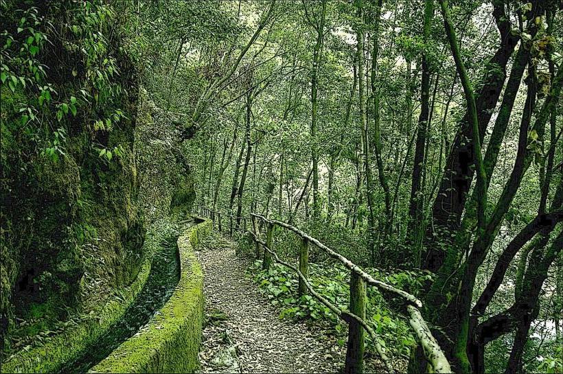
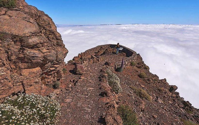
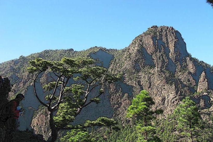
The caldera measures approximately 8 kilometers in diameter and has walls rising up to 2,000 meters from its base. Dominant features include dense forests of Canary Island Pine (Pinus canariensis) covering the slopes, interspersed with volcanic rock formations and deep ravines. Water features include the Taburiente River and the multi-colored Cascada de Colores, formed by mineral deposits. The highest point on the rim is Roque de los Muchachos at 2,426 meters.
Location & Access Logistics
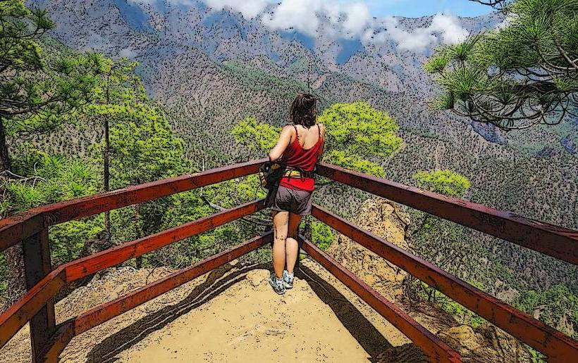
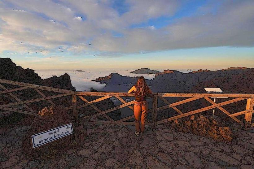
The primary access point for visitors is the Mirador de la Cumbrecita, located on the eastern side of the caldera. This viewpoint is reached via a narrow, winding road (LP-302) branching off the LP-3 highway. Parking at La Cumbrecita requires a prior reservation, especially during peak seasons. Alternatively, access to the caldera floor is possible via the Barranco de las Angustias gorge, typically starting from the town of Los Llanos de Aridane, approximately 15 kilometers southwest. Public transport options are limited; a taxi service often operates from Los Llanos to the entrance of Barranco de las Angustias.
Historical & Ecological Origin
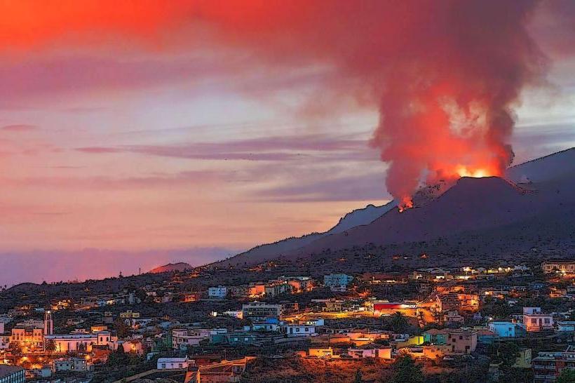
The Caldera de Taburiente is an erosion caldera, not a volcanic crater formed by an explosion. Its formation began approximately 2 million years ago with the collapse of a large shield volcano, followed by extensive erosion by water and landslides over millennia, carving out the deep basin. It was declared a National Park in 1954, recognizing its unique geological and ecological value, particularly its endemic flora and fauna.
Key Highlights & Activities
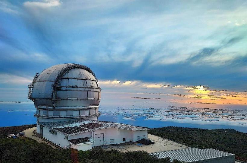
Hiking is the primary activity, with trails such as the descent into the caldera via the Barranco de las Angustias (requiring a full day) or shorter routes around the rim from viewpoints like La Cumbrecita. Specific trails include the PR LP 13, which leads to the Zona de Acampada (camping area) and the Cascada de Colores. Stargazing is possible from the caldera rim, particularly at Roque de los Muchachos, which hosts an international astronomical observatory.
Infrastructure & Amenities
A visitor center is located outside the park near El Paso, offering information and exhibits. Within the park, basic restrooms are available at the Zona de Acampada (camping area) on the caldera floor. Shade is provided by the extensive pine forests. Cell phone signal (4G/5G) is generally intermittent within the caldera itself but available at higher viewpoints on the rim. There are no permanent food vendors within the park; visitors must carry their own provisions.
Best Time to Visit
The best months for hiking are typically spring (April-June) and autumn (September-November) when temperatures are moderate and rainfall is lower. Summer can be hot, and winter may bring snow to the highest peaks. For photography, early morning or late afternoon light provides optimal conditions for capturing the caldera's scale and colors. Visiting the Cascada de Colores is best after periods of rain when water flow is higher.
Facts & Legends
The indigenous Benahoaritas, the original inhabitants of La Palma, considered the caldera a sacred place. They believed it was home to their god, Abora, and used its inaccessible interior as a refuge during the Castilian conquest. The name "Taburiente" itself is derived from the Guanche language, though its exact meaning is debated, often linked to "mountain" or "place of refuge."
Nearby Landmarks
- Roque de los Muchachos Observatory: 0.5km North (from the northern rim of the park)
- Mirador de La Cumbrecita: 0km East (a primary access point and viewpoint within the park's immediate vicinity)
- Pico de la Nieve: 2km Northeast (a peak on the caldera rim)
- Los Llanos de Aridane: 15km Southwest (the nearest major town, serving as a base for park access)