Information
Landmark: Camelback MountainCity: Phoenix
Country: USA Arizona
Continent: North America
Camelback Mountain, Phoenix, USA Arizona, North America
Camelback Mountain is a prominent geological formation located within the city limits of Phoenix, Arizona. It is a significant natural landmark recognized for its distinctive shape and recreational opportunities.
Visual Characteristics
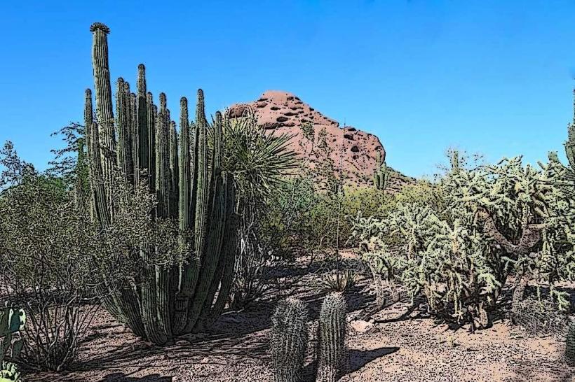
Camelback Mountain is composed of Precambrian granite and younger Paleozoic sedimentary rock. Its slopes are characterized by steep, rocky inclines and desert vegetation, primarily creosote bush, saguaro cactus, and palo verde trees. The summit reaches an elevation of 2,704 feet (824 meters). The mountain's silhouette resembles the humped back and head of a camel.
Location & Access Logistics
The mountain is situated in the central part of Phoenix, approximately 5 miles (8 km) east of the downtown core. Access is primarily via two trailheads: The Echo Canyon Trailhead, located at 4900 E. McDonald Drive, and the Cholla Trailhead, accessible from the end of Camelback Road at 5700 N. Cholla Lane. Both trailheads have dedicated parking lots, which can fill quickly during peak hours. Public transportation options are limited; the closest bus routes require a significant walk to the trailheads.
Historical & Ecological Origin
Camelback Mountain is a remnant of ancient geological processes, including volcanic activity and tectonic uplift, dating back over 1.2 billion years. It is part of the South Mountain Uplift. Ecologically, it is a representative example of the Sonoran Desert biome, supporting a diverse range of desert flora and fauna adapted to arid conditions.
Key Highlights & Activities
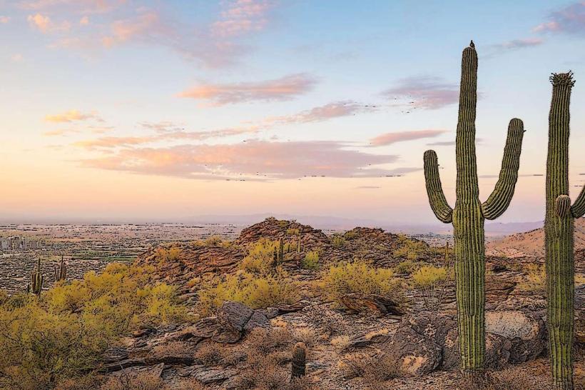
The primary activity is hiking. Two main trails ascend the mountain: the Echo Canyon Trail (1.2 miles one-way, strenuous) and the Cholla Trail (1.4 miles one-way, strenuous). Both trails offer significant elevation gain and require good physical condition. Summiting provides panoramic views of the Phoenix metropolitan area and surrounding mountain ranges. Rock climbing is also permitted in designated areas.
Infrastructure & Amenities
Restrooms are available at both the Echo Canyon and Cholla Trailhead parking areas. Shade is minimal on the trails themselves, with limited natural cover. Cell phone signal is generally available on the trails and at the summit, though it can be intermittent in certain sections. No food vendors are present at the trailheads or on the mountain; visitors should carry sufficient water and snacks.
Best Time to Visit
The best time of day for hiking is early morning, from sunrise to approximately 10 AM, to avoid the most intense heat. The most favorable months for visiting are from October through April, when temperatures are cooler. Summer months (May-September) can be dangerously hot, with temperatures frequently exceeding 100°F (38°C).
Facts & Legends
A local legend suggests that the mountain was once a living camel that was turned to stone. Geologically, the mountain is composed of two distinct rock types: Precambrian granite forming the base and Paleozoic sedimentary layers, including sandstone and limestone, capping the summit.
Nearby Landmarks
- Piestewa Peak (1.5km Northwest)
- Arizona Canal (1km South)
- Phoenix Mountains Preserve (Adjacent)
- McCormick-Stillman Railroad Park (3km Southeast)
- Desert Botanical Garden (4km Southwest)