Information
Landmark: Coconino National ForestCity: Flagstaff
Country: USA Arizona
Continent: North America
Coconino National Forest, Flagstaff, USA Arizona, North America
Coconino National Forest is a protected area located in northern Arizona, USA, encompassing a significant portion of the San Francisco Peaks and surrounding high-elevation plateaus. It is situated adjacent to the city of Flagstaff.
Visual Characteristics
The forest exhibits varied topography, including ponderosa pine forests at lower elevations, transitioning to mixed conifer forests and alpine tundra at higher altitudes on the San Francisco Peaks. The landscape features volcanic rock formations, cinder cones, and meadows. Elevation ranges from approximately 6,000 feet to over 12,000 feet at Humphreys Peak.
Location & Access Logistics
Coconino National Forest surrounds Flagstaff, Arizona. Access is primarily via U.S. Route 180 and U.S. Route 89, which traverse the forest. Numerous forest roads, many unpaved, provide access to trailheads and campgrounds. Parking is available at designated trailheads and visitor centers. Public transport within the forest is limited; the Flagstaff public bus system (Mountain Line) serves areas on the periphery of the forest, with limited service to trailheads like Snowbowl Road.
Historical & Ecological Origin
The forest was established as the San Francisco Mountains Forest Reserve in 1902 and later redesignated as Coconino National Forest in 1908. Its ecological origin is rooted in volcanic activity that formed the San Francisco Peaks, a dormant stratovolcano complex. The area supports diverse ecosystems adapted to high-altitude conditions, including a significant ponderosa pine ecosystem.
Key Highlights & Activities
Activities include hiking on over 300 miles of trails, including sections of the Arizona Trail. Winter recreation includes skiing and snowboarding at Arizona Snowbowl. Opportunities exist for camping, backpacking, wildlife viewing, and scenic drives. Rock climbing is available at certain designated areas.
Infrastructure & Amenities
Facilities include developed campgrounds, picnic areas, and restrooms at some locations. Visitor centers, such as the Peaks Ranger District Station, offer information. Cell phone signal is intermittent and generally unavailable in remote areas. Food vendors are typically located in Flagstaff or at commercial operations like Arizona Snowbowl.
Best Time to Visit
The best time for hiking and general forest exploration is from late spring (May) through fall (October), avoiding the monsoon season (July-August) which can bring thunderstorms. Summer offers cooler temperatures at higher elevations. Winter (November-April) is suitable for snow sports. Humphreys Peak summit is best attempted from July to September due to snowpack.
Facts & Legends
Humphreys Peak is the highest point in Arizona. Local Hopi legend speaks of the San Francisco Peaks as the home of the Kachina spirits. A specific tip for visitors is to be aware of the rapid weather changes at higher elevations, even in summer; carrying layers is essential.
Nearby Landmarks
- Arizona Snowbowl (3.5km Northwest)
- Sunset Crater Volcano National Monument (25km Northeast)
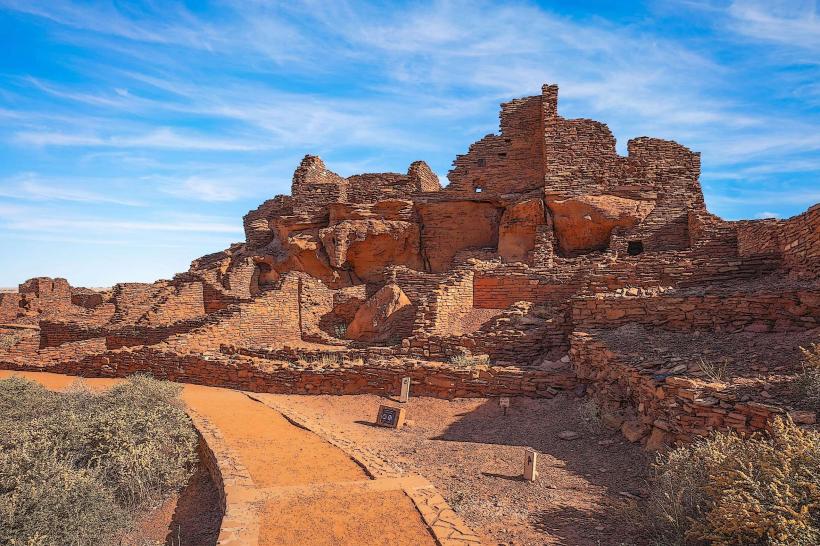
- Wupatki National Monument (35km Northeast)
- Walnut Canyon National Monument (15km Southeast)
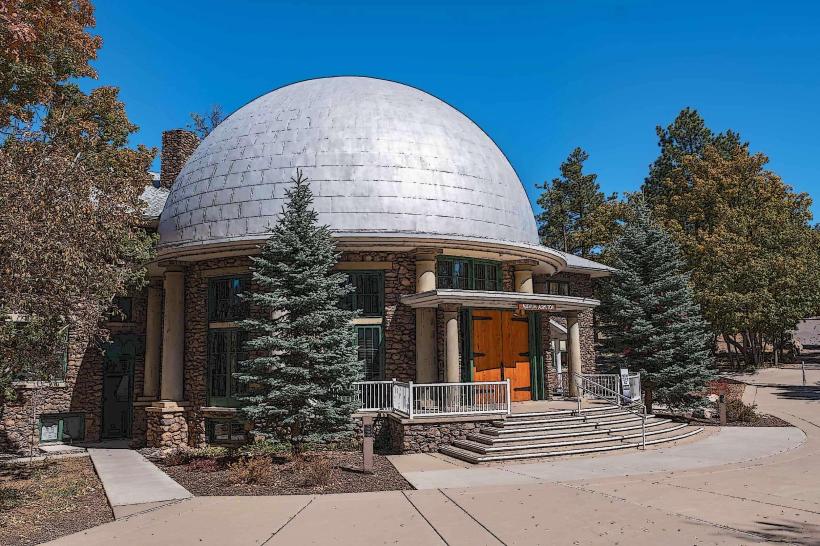
- Lowell Observatory (8km Southwest)