Landmark: Constitution Trail
City: Bloomington Normal
Country: USA Illinois
Continent: North America
Constitution Trail, Bloomington Normal, USA Illinois, North America
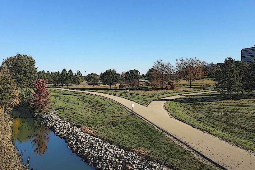
The Constitution Trail is a paved multi-use path traversing Bloomington and Normal, Illinois. It follows the path of the former Illinois Central Railroad.
Visual Characteristics
The trail is a 10-foot wide asphalt surface. It is bordered by grass, trees, and occasional urban landscaping. The terrain is generally flat with gentle inclines and declines. The path is illuminated in sections for evening use.
Location & Access Logistics
The trail spans approximately 24 miles across Bloomington and Normal. Access points are numerous, with designated parking lots at major parks including O'Neil Park (1500 N. Linden St., Normal), Constitution Trail Trailhead (1100 N. Main St., Bloomington), and Miller Park (1000 N. Linden St., Bloomington). Public transport access is available via the Bloomington-Normal Public Transit System (BN Trans) with several bus routes running adjacent to or crossing the trail, including Route 3 and Route 7.
Historical & Ecological Origin
The trail was established on the abandoned right-of-way of the Illinois Central Railroad, which ceased operations in the area. The conversion to a recreational trail began in the late 1980s and has been expanded over time. The surrounding environment is primarily deciduous forest and prairie remnants.
Key Highlights & Activities
Activities include walking, running, cycling, and inline skating. The trail connects multiple city parks, providing access to playgrounds, picnic areas, and sports facilities. Specific segments offer views of Sugar Creek and Evergreen Lake.
Infrastructure & Amenities
Restrooms are available at park access points. Benches are located at regular intervals along the trail. Shade is provided by mature trees in many sections. Cell phone signal (4G/5G) is generally consistent throughout the trail's urban and suburban segments. Food vendors are not directly on the trail but are available in nearby commercial areas.
Best Time to Visit
For photography, early morning or late afternoon provides optimal lighting conditions due to the angle of the sun. The months of April through October offer the most favorable weather for outdoor activity. No tide considerations apply.
Facts & Legends
A unique feature is the "Mile Marker" system, indicating distance from the original Illinois Central depot in Bloomington. Local lore sometimes refers to the trail as the "Green Ribbon" due to its linear, verdant path through the cities.
Nearby Landmarks
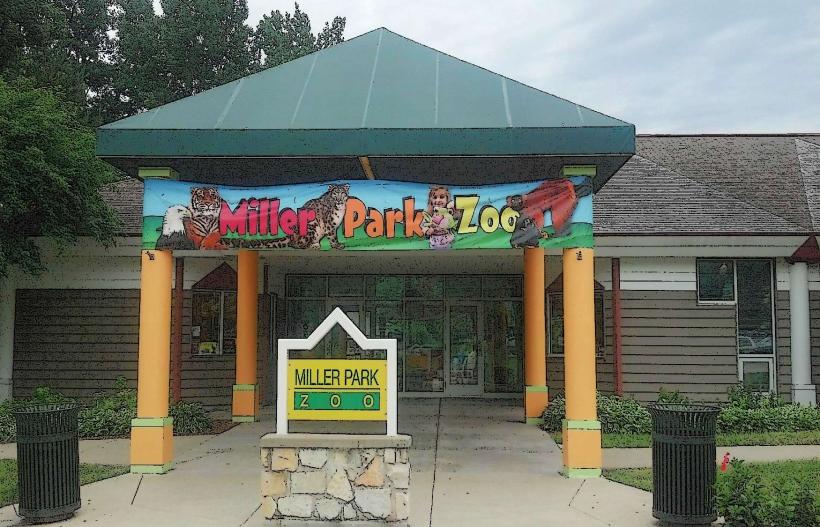
- Miller Park (0.1km South)
- Illinois State University (1.5km West)
- Downtown Bloomington (1.0km South)
- Children's Discovery Museum of Central Illinois (1.2km South)
- McLean County Museum of History (1.3km South)