
Landmark: Cunene National Park
City: Cunene
Country: Angola
Continent: Africa
Cunene National Park, Cunene, Angola, Africa
Cunene National Park is a protected area located in the Cunene Province of Angola. It encompasses a significant portion of the southwestern Angolan landscape.
Visual Characteristics
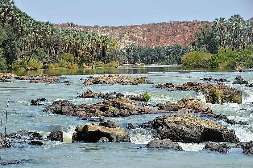
The park's terrain is characterized by arid savanna, rocky outcrops, and sandy plains. Vegetation is sparse, consisting primarily of drought-resistant shrubs, acacia trees, and mopane woodlands. The Cunene River forms a prominent feature, with its banks supporting denser riparian vegetation. Rock formations are common, including granite inselbergs and sandstone mesas. The dominant colors are earthy tones of brown, ochre, and muted green, with the river providing a contrasting blue-green ribbon.
Location & Access Logistics
Cunene National Park is situated in southwestern Angola, bordering Namibia. The primary access point is via the town of Ruacana, approximately 150 kilometers west of Ondjiva, the provincial capital. From Ruacana, unpaved roads lead into the park. Vehicle access can be challenging, particularly during the rainy season, and a 4x4 vehicle is recommended. There are no public transport services directly to or within the park. No designated parking areas exist; vehicles are typically parked at designated campsites or observation points.
Historical & Ecological Origin
The park was established to protect the unique desert-adapted wildlife and ecosystems of southwestern Angola. Its geological origins are tied to ancient geological processes, including the formation of the Kalahari Basin and the erosion that shaped the current landscape. Ecologically, it represents a transition zone between the Namib Desert and the Angolan savanna, supporting species adapted to arid conditions.
Key Highlights & Activities
Wildlife viewing is a primary activity, with opportunities to observe desert-adapted elephants, lions, hyenas, and various antelope species such as gemsbok and springbok. Birdwatching is also significant. Hiking is possible on designated trails, though often requires local guidance due to the terrain and wildlife. Photography is facilitated by the open landscapes and unique geological features. Observing the Cunene River and its associated wildlife is a key focus.
Infrastructure & Amenities
Basic infrastructure is limited. Designated campsites are available in some areas, offering rudimentary facilities. Restrooms are typically found only at the main entrance or designated camping zones. Shade is scarce outside of riparian areas and mopane woodlands. Cell phone signal is unreliable and generally absent in most of the park. Food vendors are not present within the park; visitors must bring all supplies.
Best Time to Visit
The dry season, from May to October, is the optimal period for wildlife viewing as animals congregate around water sources. The best time of day for photography is early morning and late afternoon, when the light is softer and shadows are longer. High tide is not a relevant factor for this terrestrial park. Temperatures can be extreme, with daytime highs exceeding 40°C (104°F) in the hottest months.
Facts & Legends
The park is home to the Himba people, an indigenous ethnic group who traditionally inhabit the region. Their semi-nomadic lifestyle and distinct cultural practices are a significant aspect of the area's heritage. A specific tip for visitors is to carry ample water and fuel, as services are non-existent once inside the park boundaries.
Nearby Landmarks
- Ruacana Falls (15km West)
- Epupa Falls (80km Northwest)
- Ondjiva (150km East)
- Etosha National Park (Namibia) (Approx. 200km South, across the border)