Information
Landmark: Dockyard CreekCity: Senglea
Country: Malta
Continent: Europe
Dockyard Creek, Senglea, Malta, Europe
Visual Characteristics
The creek is a long, narrow waterway characterized by its deep blue-green water, reflecting the surrounding limestone fortifications and industrial structures. Its shores are lined with historic dry docks, slipways, and workshops constructed from local globigerina limestone, exhibiting a weathered, ochre-to-grey coloration. The architectural style is predominantly utilitarian and military, with robust stone walls and functional buildings. The creek is approximately 1.5 kilometers in length and varies in width, accommodating various vessels from small boats to larger ships undergoing maintenance.
Location & Access Logistics
Dockyard Creek is located within the Three Cities area of Malta. Access is primarily from the waterfront promenades of Senglea (Triq ix-Xatt) or Cospicua (Xatt ir-Risq). From Valletta city center, it is approximately 3 kilometers southeast. Public transport includes several bus lines serving Senglea and Cospicua, such as routes 1, 2, and 3. A ferry service operates from Valletta to Cospicua (Bormla) and Senglea (Isla), providing direct access across the Grand Harbour. Limited street parking is available in the surrounding residential areas, often requiring local knowledge or paid parking zones.
Historical & Ecological Origin
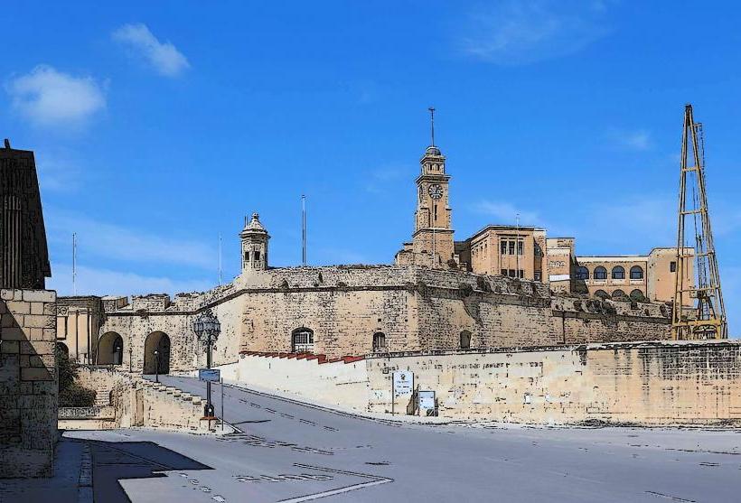
Dockyard Creek is a natural geological formation, a deep water inlet of the Grand Harbour. Its strategic importance was recognized by the Knights of St. John upon their arrival in Malta in 1530, who began developing it for naval purposes. Significant expansion and modernization occurred under British rule, particularly from the 19th century onwards, transforming it into a major naval base and shipbuilding facility. Its original purpose was to provide a sheltered harbor for galleys and later, a comprehensive dockyard for the British Mediterranean Fleet.
Key Highlights & Activities
Walking along the waterfront promenades of Senglea and Cospicua offers views of the historic dockyard infrastructure. Observing the active dry docks and various vessels is possible from designated public areas. Photography of the industrial heritage and the fortified cities is a common activity. Boat tours of the Grand Harbour often pass through or near the creek, providing a water-level perspective.
Infrastructure & Amenities
Public restrooms are generally available in nearby cafes and restaurants along the waterfronts. Shade is limited directly over the water but can be found under the arcades of some buildings or within adjacent parks. Cell phone signal (4G/5G) is consistently strong throughout the area. Numerous cafes, restaurants, and small shops are located along the waterfronts of Senglea and Cospicua, offering food and beverages.
Best Time to Visit
The best time to visit for general viewing is during daylight hours. For photography, early morning or late afternoon provides softer light, enhancing the textures of the stone fortifications and water reflections. The most comfortable months for weather are April to June and September to October, avoiding the peak summer heat. There are no specific tide requirements for visiting Dockyard Creek, as its depth allows for constant access.
Facts & Legends
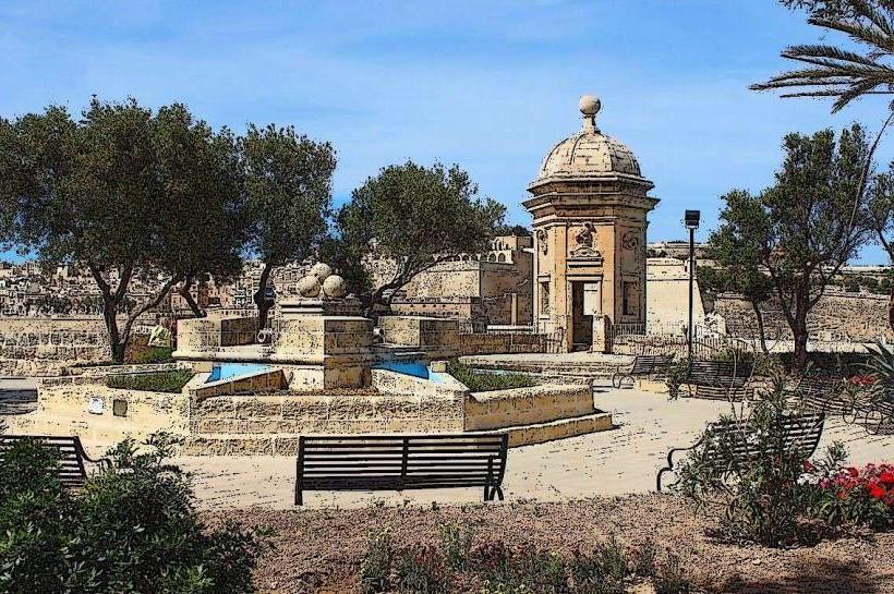
During World War II, Dockyard Creek and the surrounding areas were heavily bombed due to their strategic importance as a British naval base, earning Malta the George Cross for its resilience. A specific tip for visitors is to ascend to the Gardjola Gardens in Senglea for a panoramic view of the entire creek and the Grand Harbour, offering a unique perspective on its scale and historical context.
Nearby Landmarks
- Gardjola Gardens (Senglea): 0.3km West
- Fort Saint Angelo (Birgu/Vittoriosa): 1.5km Northeast
- Malta Maritime Museum (Birgu/Vittoriosa): 1.2km Northeast
- Inquisitor's Palace (Birgu/Vittoriosa): 1.3km Northeast
- Valletta City Gate: 3.0km Northwest (via land) or 1.5km Northwest (via ferry)