
Landmark: E Street Pier
City: Bayonne
Country: USA New Jersey
Continent: North America
E Street Pier, Bayonne, USA New Jersey, North America
E Street Pier is a public access pier located in Bayonne, New Jersey, USA.
It extends into the Upper New York Bay, providing views of the New York City skyline and harbor traffic.
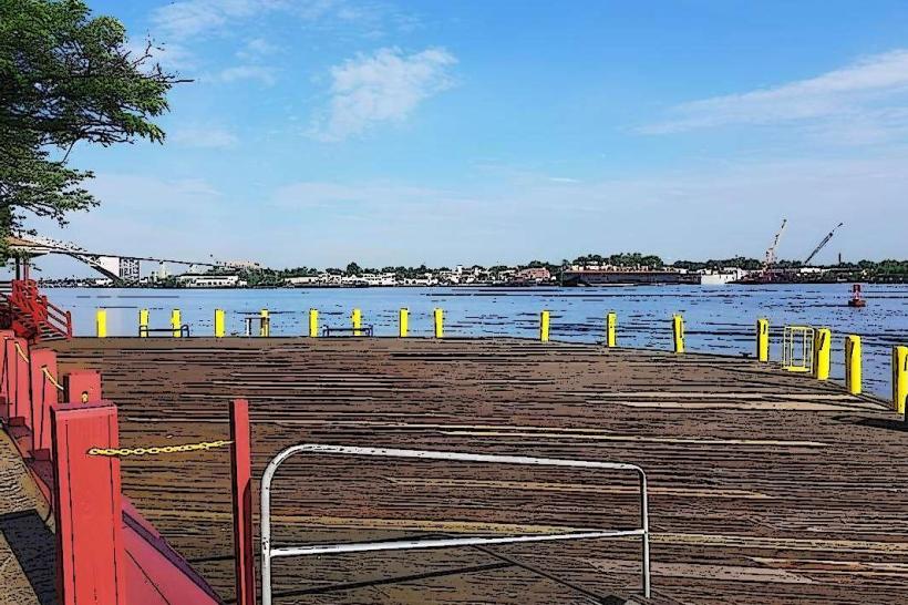
Visual Characteristics
The pier is constructed primarily of concrete and steel. It features a rectangular deck approximately 100 meters in length and 15 meters in width. The deck is lined with metal railings and concrete bollards. Lighting fixtures are spaced along the perimeter. The surrounding water is typically a murky brown, characteristic of harbor environments. Vegetation is minimal, consisting of hardy grasses and weeds in the adjacent undeveloped areas.
Location & Access Logistics
E Street Pier is situated at the eastern end of E Street in Bayonne, New Jersey. It is approximately 3 kilometers east of the Bayonne city center. Access is via E Street, which terminates at the pier entrance. Limited street parking is available along E Street and adjacent side streets. Public transport options include the NJ Transit 10 bus line, which stops at the intersection of E Street and Avenue A, approximately 500 meters from the pier entrance.
Historical & Ecological Origin
The pier's construction date and original purpose are not precisely documented in publicly accessible records. It is understood to have been developed as part of the industrial and maritime infrastructure of the Port of New York and New Jersey. Its ecological origin is a man-made structure built upon fill material and pilings within the estuarine environment of the Upper New York Bay.
Key Highlights & Activities
Fishing is permitted from the pier. Observation of maritime traffic, including container ships and ferries, is a primary activity. Photography of the New York City skyline is possible from the pier's eastern end. Walking and passive recreation are also common.
Infrastructure & Amenities
Restrooms are not available directly on the pier. There is no dedicated shade structure. Cell phone signal (4G/5G) is generally available. Food vendors are not present on the pier; however, commercial establishments are located within a 1-kilometer radius in the city center.
Best Time to Visit
For photography of the New York City skyline, early morning or late afternoon light provides optimal conditions. Weather is generally most favorable during spring (April-May) and fall (September-October). Tidal fluctuations have minimal impact on access or activity on the pier itself.
Facts & Legends
During periods of heavy fog, the pier has been a point of reference for mariners navigating the Upper New York Bay. Local anecdotal accounts suggest that during the Prohibition era, the pier was a discreet drop-off point for illicit cargo.
Nearby Landmarks
- Rutgers University - Newark Campus (4.5km West)
- Liberty State Park (3.0km Northwest)
- Staten Island Ferry Terminal (Manhattan) (5.0km Northeast, across the bay)
- Ellis Island (4.0km Northwest, across the bay)
- Empty Sky - 9/11 Memorial (3.2km Northwest)


