Information
Landmark: Île de la GonâveCity: Les Iles Cayemites
Country: Haiti
Continent: North America
Île de la Gonâve, Les Iles Cayemites, Haiti, North America
Île de la Gonâve is an island located off the western coast of Haiti, within the administrative division of Les Iles Cayemites.
This island functions as a significant geographical and administrative entity within the Haitian archipelago.
Visual Characteristics
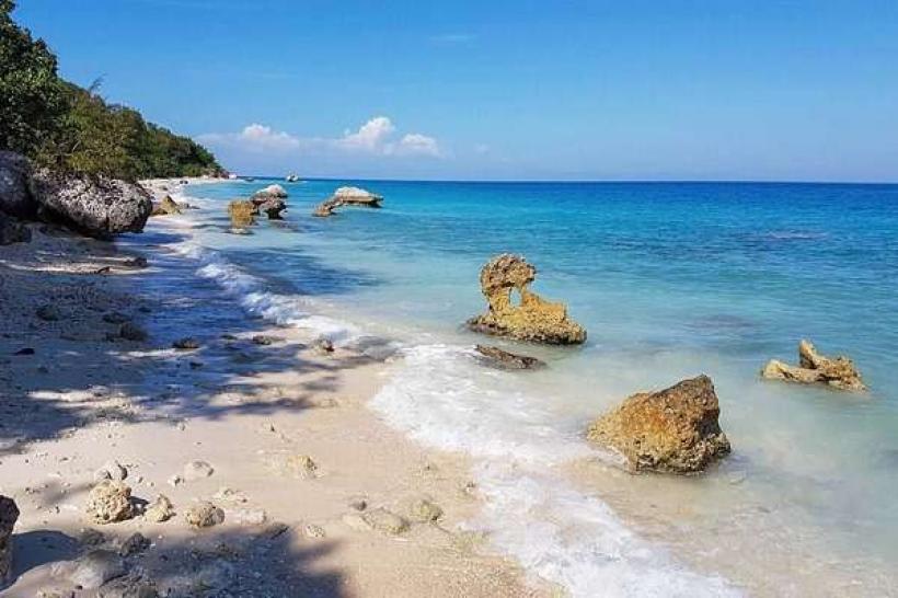
Île de la Gonâve presents a varied topography, characterized by arid to semi-arid plains in the south and more elevated, rugged terrain in the north. Vegetation is sparse in many areas, consisting primarily of scrub brush and drought-resistant trees. The coastline features sandy beaches interspersed with rocky outcrops. The island's elevation ranges from sea level to approximately 792 meters (2,600 feet) at its highest point.
Location & Access Logistics
Île de la Gonâve is situated in the Gulf of Gonâve, approximately 50 kilometers west of Port-au-Prince. Access is primarily via ferry or boat services departing from Port-au-Prince or Saint-Marc. The journey duration can range from 2 to 4 hours depending on the vessel and sea conditions. There are no major paved roads connecting to the mainland; internal transportation relies on unpaved tracks and local vehicles. Limited parking is available at ferry terminals on the mainland.
Historical & Ecological Origin
Geologically, Île de la Gonâve is part of the Hispaniola island chain, formed by tectonic plate movement. Its ecological classification is that of a tropical dry forest ecosystem, adapted to limited rainfall. Historically, the island was inhabited by indigenous Taíno people before European colonization. It later served various roles, including as a penal colony and a naval base for the United States during its occupation of Haiti.
Key Highlights & Activities
Activities on Île de la Gonâve are primarily centered around its natural environment and local culture. Visitors can explore the island's coastline, engage in swimming, and observe local fishing practices. Hiking trails exist in the more mountainous northern regions, offering views of the surrounding sea. Opportunities for interacting with the local population and experiencing Haitian rural life are available.
Infrastructure & Amenities
Basic infrastructure is present in the main settlements, including small guesthouses and local eateries. Restrooms are generally available at accommodations and public gathering points. Shade is provided by natural vegetation and simple structures. Cell phone signal (2G/3G) is intermittent and varies by location. Food vendors are typically found in the main villages, offering local cuisine.
Best Time to Visit
The best time to visit Île de la Gonâve is during the dry season, from November to April, to avoid heavy rainfall. The best time of day for photography is generally in the morning or late afternoon when the sun's angle provides softer light. There are no specific tide requirements for general island access.
Facts & Legends
A notable historical fact is that Île de la Gonâve was the site of a significant agricultural experiment in the early 20th century, aiming to improve local farming techniques. Local folklore often speaks of spirits inhabiting the island's more remote, rugged areas.
Nearby Landmarks
- Île de la Tortue (100km North-West)
- Port-au-Prince (50km East)
- Pointe des Barres (15km South-West)
- Anse-à-Galets (5km North-East)