Landmark: Krikia Beach
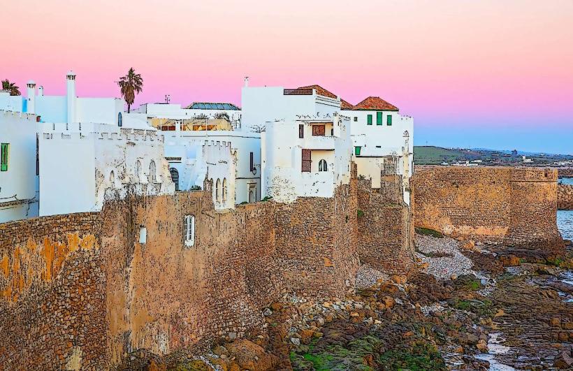
City: Asilah
Country: Morocco
Continent: Africa
Krikia Beach, Asilah, Morocco, Africa
Krikia Beach is a coastal area situated south of the historic medina in Asilah, Morocco.
This stretch of coastline serves as a public access point to the Atlantic Ocean.
Visual Characteristics
The beach consists of fine, light-colored sand. The water color is typically a deep blue, influenced by the Atlantic Ocean. The shoreline is generally flat, with a gradual slope into the sea. Coastal vegetation is sparse, consisting mainly of low-lying grasses and shrubs.
Location & Access Logistics
Krikia Beach is located approximately 2 kilometers south of Asilah's medina. Access is via the N1 national road. Turn west onto a paved local road directly opposite the Hotel Al Alba. Parking is available along the unpaved track leading to the beach, with capacity for approximately 50 vehicles. Public transport options are limited; local taxis from Asilah's center are the most direct method of arrival.
Historical & Ecological Origin
Krikia Beach is a natural formation, part of the Atlantic coastline of Morocco. Its geological origin is sedimentary, formed by the deposition of sand and silt over millennia. Ecologically, it is a coastal zone supporting a limited range of salt-tolerant plant species and marine life typical of the North Atlantic.
Key Highlights & Activities
Swimming is permitted when sea conditions are calm. Sunbathing on the sand is a primary activity. Walking along the shoreline is possible. Fishing from the shore occurs during specific seasons.
Infrastructure & Amenities
There are no permanent restroom facilities or shade structures directly on Krikia Beach. Informal food vendors may be present during peak tourist seasons, but their availability is not guaranteed. Cell phone signal (4G) is generally available.
Best Time to Visit
For photography, the late afternoon (approximately 16:00 to 18:00) offers softer light. The months of June through September provide the warmest air and sea temperatures. High tide can reduce the available sand area.
Facts & Legends
Local fishermen sometimes refer to specific areas of the beach as "the fisherman's steps" due to submerged rock formations that are visible at low tide and are known to attract certain fish species.
Nearby Landmarks
- Asilah Medina (1.5km North)
- Cape Spartel Lighthouse (25km Northeast)
- Tangier (40km Northeast)
- Lixus Archaeological Site (45km South)