Information
Landmark: Lagoa de ÓbidosCity: Obidos
Country: Portugal
Continent: Europe
Lagoa de Óbidos, Obidos, Portugal, Europe
The Lagoa de Óbidos is the most extensive coastal lagoon system in Portugal, stretching between the municipalities of Óbidos and Caldas da Rainha. It is a shallow saltwater body connected to the Atlantic Ocean through a narrow, shifting opening known as the Aberto.
Visual Characteristics
The lagoon covers approximately 6.9 square kilometers, characterized by calm, shallow turquoise waters and a mix of sandy banks and muddy bottom sediments. The perimeter is lined with salt marshes, reed beds, and pine forests. The water depth varies significantly with the tides, reaching a maximum of 5 meters in the main channels, while large sections of the sand become exposed at low tide.
Location & Access Logistics
The lagoon is located 15 kilometers west of the Óbidos town center. Access from Lisbon is via the A8 highway, exiting toward Foz do Arelho (northern shore) or Praia do Bom Sucesso (southern shore). Public transport is limited to local buses from Caldas da Rainha to Foz do Arelho. Large, free parking areas are situated at both the Foz do Arelho and Bom Sucesso beachheads.
Historical & Ecological Origin
Geologically, the lagoon is a remnant of a much larger marine gulf that reached the base of the Óbidos Castle hill in the Middle Ages. Over centuries, siltation and the formation of coastal dunes restricted its connection to the sea. Ecologically, it is a vital wetland habitat for migratory birds, including flamingos, grey herons, and various species of ducks, and serves as a nursery for fish and shellfish.
Key Highlights & Activities
Water sports such as windsurfing, kitesurfing, and sailing are concentrated on the northern shore due to consistent wind conditions and flat water. Stand-up paddleboarding and kayaking are common in the calmer interior sections. The lagoon is also a primary site for traditional shellfishing; visitors can observe locals harvesting clams and cockles using traditional hand tools during low tide.
Infrastructure & Amenities
The northern shore (Foz do Arelho) features a wooden boardwalk, public restrooms, and numerous restaurants. The southern shore (Bom Sucesso) is less developed but offers basic café facilities and shaded picnic spots near the pine groves. 5G cellular coverage is available across most of the lagoon's perimeter. There are several sailing schools and equipment rental shops located on the northern bank.
Best Time to Visit
Low tide is the best time for birdwatching and exploring the exposed sandbars. For photography, sunset offers high-contrast views of the water reflecting the sky against the Atlantic dunes. The months of May through September provide the most reliable weather for water activities, while winter months are preferable for observing migratory bird populations.
Facts & Legends
The lagoon's opening to the sea is not fixed; it must be periodically dredged or manually "opened" to ensure water oxygenation and the survival of local species. A local tradition dictates that the lagoon must be "married" to the sea every year to guarantee a bountiful harvest of fish and shellfish for the local community.
Nearby Landmarks
Foz do Arelho Beach - 0.1km North (at the lagoon mouth)
Bom Sucesso Beach - 0.2km South (at the lagoon mouth)
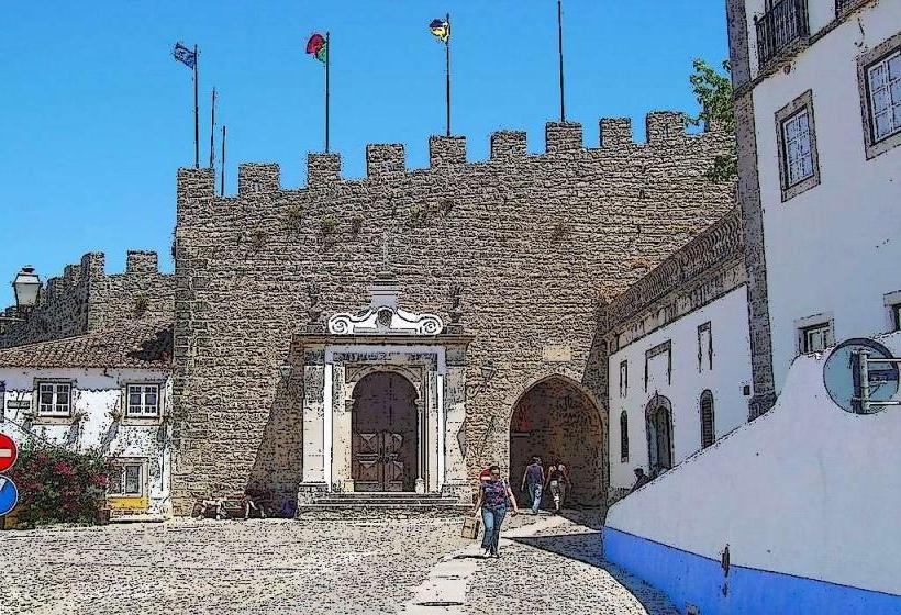
Óbidos Castle - 15.0km East
Santuário do Senhor Jesus da Pedra - 14.5km East
Caldas da Rainha Thermal Hospital - 12.0km East