Information
Landmark: Los Gigantes CliffsCity: Tenerife
Country: Canary Islands
Continent: Europe
Los Gigantes Cliffs, Tenerife, Canary Islands, Europe
Visual Characteristics
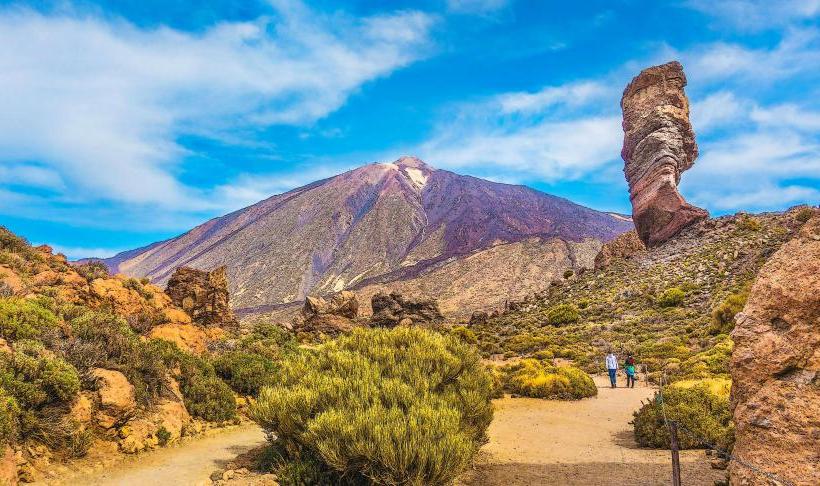
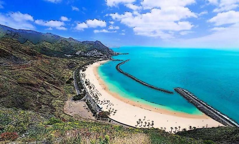
The cliffs are composed primarily of dark volcanic basalt rock, exhibiting a deep grey to black coloration. They reach heights of up to 600 meters (approximately 1,970 feet) above sea level, plunging vertically into the Atlantic Ocean. The sheer rock faces are largely devoid of significant vegetation, presenting a stark, imposing profile.
Location & Access Logistics
The cliffs are situated on the western side of Tenerife, approximately 30 kilometers west of Adeje and 48 kilometers west of Tenerife South Airport (TFS). Access is primarily via the TF-47 coastal road, which runs through the town of Los Gigantes. Limited street parking is available within the town, with several paid parking lots also present. Public transport includes Titsa bus lines, such as line 473 connecting Los Cristianos to Los Gigantes, and line 477 from Costa Adeje.
Historical & Ecological Origin
The Los Gigantes Cliffs are a result of ancient volcanic activity, formed by successive lava flows and subsequent erosion. Geologically, they are part of the older basaltic formations of Tenerife, predating the central Teide volcano complex. The cliffs represent a dramatic example of coastal erosion on a volcanic island.
Key Highlights & Activities
Boat excursions depart from Puerto de Santiago and Los Gigantes Marina for viewing the cliffs from the sea. Whale and dolphin watching tours often pass by the cliff base. Kayaking and stand-up paddleboarding are possible along the coastline, offering close-up views of the rock faces. Swimming is permitted at nearby beaches like Playa de los Gigantes.
Infrastructure & Amenities
Restrooms are available in the town of Los Gigantes and at the marina. Limited natural shade is present along the coastline, primarily from the cliffs themselves in the late afternoon. Cell phone signal (4G/5G) is generally strong in the town and along the coastal viewing areas. Numerous restaurants, cafes, and shops are located in the adjacent town of Los Gigantes.
Best Time to Visit
The best time for photography is late afternoon, when the setting sun illuminates the cliff faces, enhancing their dark coloration. The months from April to October offer the most stable weather conditions with less rainfall. Viewing from the sea is less affected by tides, but calm sea conditions are preferable for boat excursions.
Facts & Legends
The indigenous Guanches referred to the cliffs as the "Wall of Hell" (Muralla del Infierno) due to their imposing scale and the perceived end of the world beyond them. A local belief suggests that the cliffs hold ancient energy, attracting those seeking spiritual connection.
Nearby Landmarks
- Puerto de Santiago: 1.5km South
- Playa de la Arena: 2km South
- Charco del Tancón: 0.8km North
- Masca Valley: 10km Northeast
- Punta de Teno Lighthouse: 15km North