Landmark: Mangareva Island
City: Gambier Islands
Country: French Polynesia
Continent: Australia
Mangareva Island, Gambier Islands, French Polynesia, Australia
Mangareva Island is the largest island in the Gambier Islands archipelago, located in French Polynesia.
It is characterized by its volcanic origins and surrounding coral reefs.
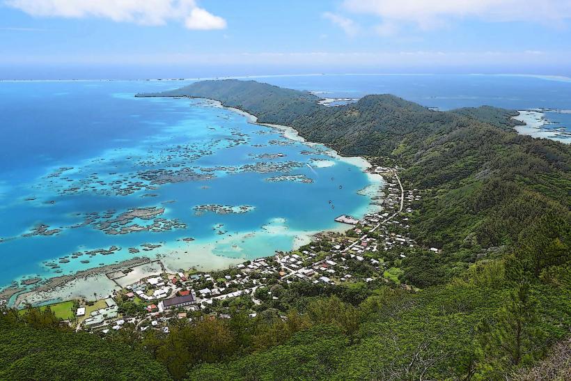
Visual Characteristics
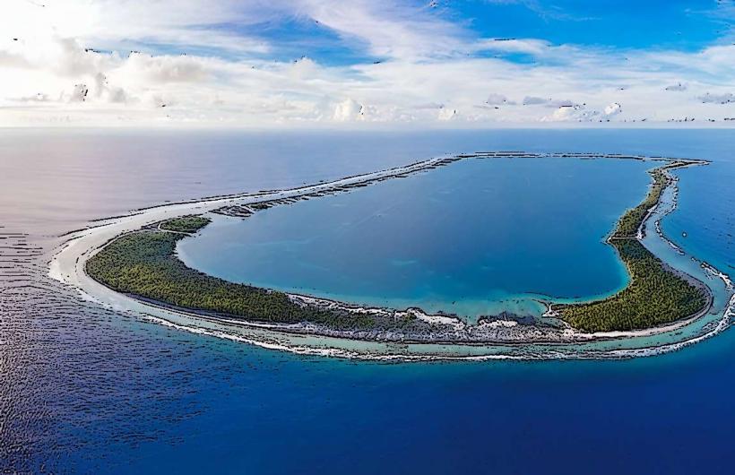
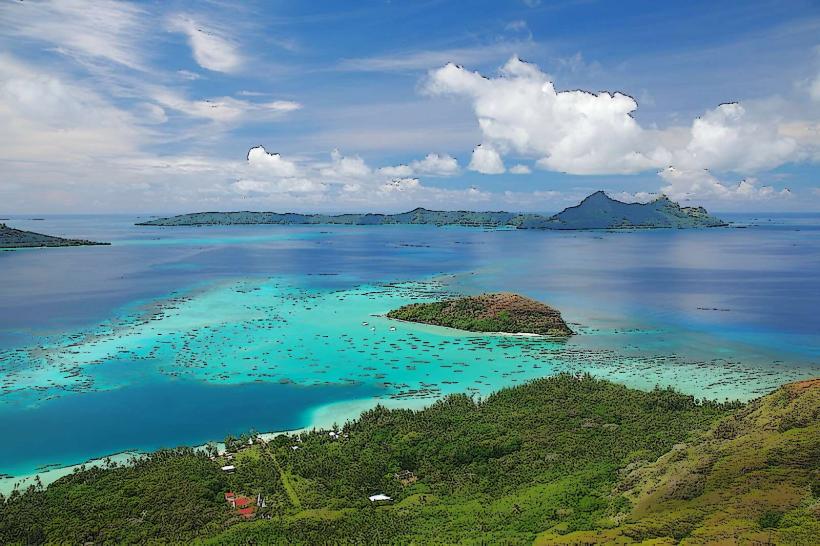
Mangareva Island features a mountainous interior with peaks reaching over 1,400 feet. The coastline is irregular, with numerous bays and inlets. The island is covered in dense tropical vegetation, primarily coconut palms and breadfruit trees. The surrounding lagoon is a deep blue, enclosed by a barrier reef dotted with smaller motus (islets).
Location & Access Logistics
Mangareva Island is situated approximately 1,600 kilometers east of Tahiti. Access is primarily via air to the Totegegie Airport (GMR), which serves the Gambier Islands. Inter-island transport to Mangareva from Totegegie is typically by boat, a journey of approximately 15 kilometers. There are no direct road connections from major international hubs; travel requires multiple flight segments.
Historical & Ecological Origin
Mangareva is a volcanic island formed by ancient lava flows. Its formation dates back millions of years. The island's current topography is a result of erosion and volcanic activity. The surrounding lagoon is a classic example of a coral atoll formation, developed on the submerged rim of the ancient volcano.
Key Highlights & Activities
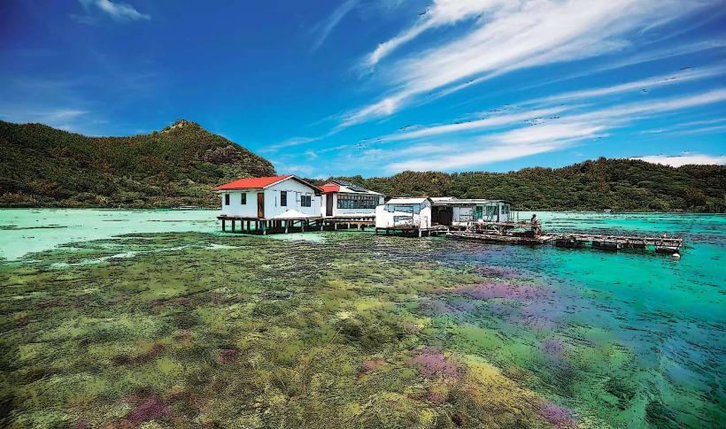
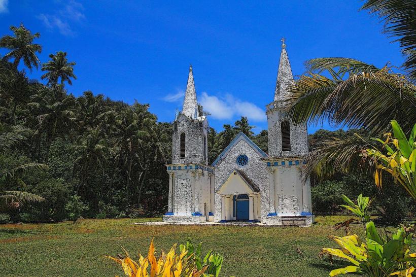
Activities include pearl farming tours, where visitors can learn about the cultivation of black pearls. Snorkeling and diving are possible within the lagoon, with opportunities to observe marine life. Hiking trails lead to viewpoints offering panoramic vistas of the island and lagoon. Visits to the historic Saint-Michel Cathedral in Rikitea are also a primary activity.
Infrastructure & Amenities
Rikitea, the main village, has a small number of guesthouses and a few local food vendors. Restrooms are available at some public areas and accommodations. Cell phone signal is generally available in Rikitea but can be intermittent elsewhere on the island. Shade is provided by natural vegetation and some structures in the village.
Best Time to Visit
The dry season, from May to October, offers the most favorable weather conditions with lower humidity and less rainfall. The best time of day for photography is generally in the morning or late afternoon when the sunlight is less direct. High tide is not a critical factor for most activities, but can affect access to certain motus.
Facts & Legends
Mangareva was once the center of a Polynesian kingdom. A unique local practice involves the cultivation of the prized black pearl, a significant economic driver for the island. The Saint-Michel Cathedral, built in the 19th century, is constructed from coral stone and is a prominent landmark.
Nearby Landmarks
- Saint-Michel Cathedral (0.2km North)
- Totegegie Airport (15km West)
- Mount Duff (1.5km Northwest)
- Motu Teiku (3km East)
- Motu Taravai (4km Southwest)