Landmark: Mines of Spain Recreation Area
City: Dubuque
Country: USA Iowa
Continent: North America
Mines of Spain Recreation Area, Dubuque, USA Iowa, North America
The Mines of Spain Recreation Area is a 1,400-acre state park located in Dubuque, Iowa, along the Mississippi River. It preserves natural landscapes and historical sites related to early European settlement and lead mining.
Visual Characteristics
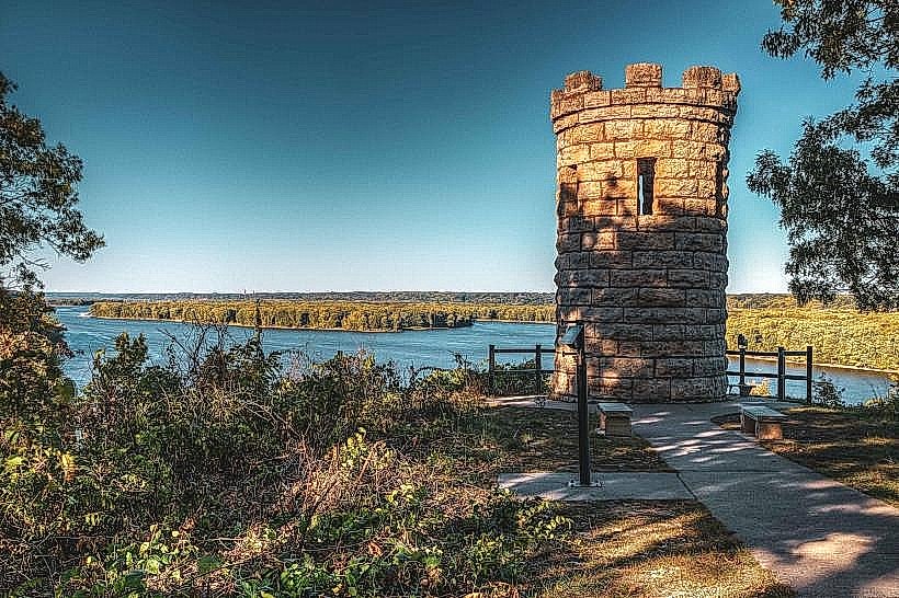
The area features a varied topography including limestone bluffs, wooded ravines, and prairie remnants. The Mississippi River forms the eastern boundary, with the Julien Dubuque Monument situated atop a prominent bluff overlooking the water. Vegetation includes deciduous forests, primarily oak and hickory, interspersed with open grasslands.
Location & Access Logistics
The park is accessible via John Deere Road (County Road D-26) from Dubuque. It is approximately 5 kilometers south of the Dubuque city center. Parking is available at multiple designated lots throughout the park, including near the E.B. Lyons Interpretive Center and the Julien Dubuque Monument. Public transport options are limited; the nearest bus routes do not directly service the park entrance.
Historical & Ecological Origin
This area was historically significant for lead mining by Julien Dubuque starting in 1788. The land was later acquired and designated as a state recreation area to protect its natural and historical resources. Ecologically, it represents a transition zone between the Mississippi River floodplain and the upland driftless area, supporting diverse flora and fauna.
Key Highlights & Activities
Activities include hiking on over 20 kilometers of trails, birdwatching, fishing in designated areas, and visiting the E.B. Lyons Interpretive Center. The Julien Dubuque Monument offers panoramic views. Educational programs are offered at the interpretive center. Kayaking and canoeing are possible on the Mississippi River, with access points available.
Infrastructure & Amenities
Restrooms are available at the E.B. Lyons Interpretive Center and at some trailheads. Shaded areas are present within the wooded sections of the park. Cell phone signal (4G/5G) is generally available but can be intermittent in deeper ravines. No food vendors are located within the park; visitors should bring their own provisions.
Best Time to Visit
For photography, early morning and late afternoon offer optimal lighting conditions, particularly for bluff views. The best months for weather are typically May through October. Spring and fall provide cooler temperatures for hiking. River access for water activities is dependent on seasonal water levels and ice conditions.
Facts & Legends
A local legend suggests that Julien Dubuque's spirit still guards the lead mines. A verified historical fact is that the lead extracted here was crucial for early American expansion and industry. A specific tip for visitors is to check the interpretive center for current trail conditions, as some can become muddy after rain.
Nearby Landmarks
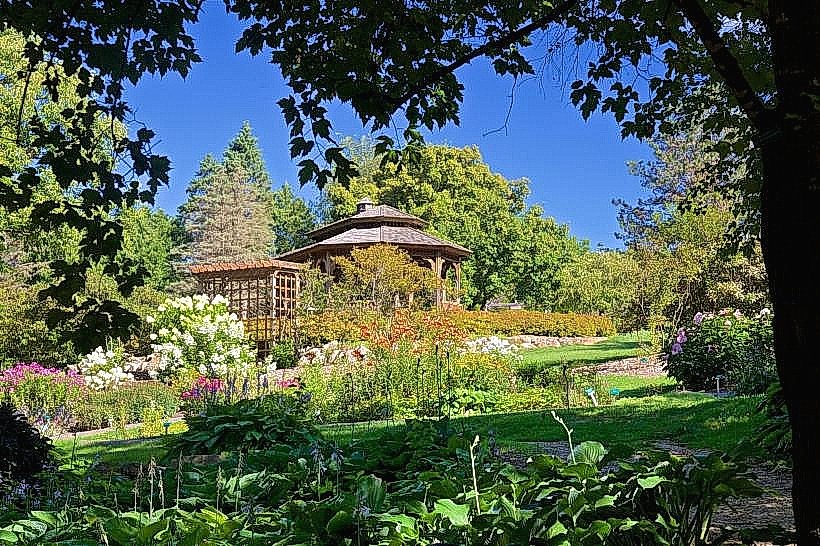
- Dubuque Arboretum & Botanical Gardens (2.5km North)
- Mississippi River Museum & Aquarium (4.0km North)
- Fenelon Place Elevator (4.5km North)
- Crystal Lake Cave (6.0km West)