Landmark: Mount Faron
City: Toulon
Country: France
Continent: Europe
Mount Faron, Toulon, France, Europe
Mount Faron is a limestone peak overlooking the city of Toulon and the Mediterranean Sea in the Var department of France. Reaching an elevation of 584 meters, it serves as a strategic military site and a significant recreational area for the Provence-Alpes-Côte d'Azur region.
Visual Characteristics
The mountain is composed of white Urgonian limestone, featuring steep vertical cliffs on its southern face and a more gradual, forested slope to the north. Vegetation consists of dense Mediterranean maquis, including Aleppo pines, holm oaks, and wild herbs. The summit is plateau-like, hosting several stone fortifications, telecommunication towers, and a memorial building constructed of reinforced concrete.
Location & Access Logistics
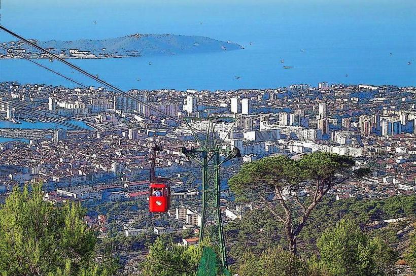
The base of the mountain is located approximately 2 kilometers north of the Toulon city center. Access to the summit is via a single-track, one-way ring road (D46) with steep gradients and hairpins; the ascent is via the west side and the descent via the east. The Téléphérique du Faron (cable car) provides the primary public transport link from the base station on Boulevard de l'Amiral Vence to the summit plateau. Bus line 40 connects the Toulon Train Station to the cable car base.
Historical & Ecological Origin
The mountain has been a strategic defensive point since antiquity, with most current fortifications dating to the 18th and 19th centuries to protect the Toulon Arsenal. Geologically, it is part of the Provençal limestone ranges formed during the Mesozoic era. The Memorial of the Landings in Provence was inaugurated in 1964 by Charles de Gaulle to commemorate the Allied invasion of August 1944.
Key Highlights & Activities
Visitors can tour the Memorial of the Landings in Provence, which features dioramas and military equipment. The Faron Cats Breeding Centre (Fauverie du Faron) is a specialized zoo located on the summit plateau focusing on the conservation of large felids. There are over 40 kilometers of marked hiking and mountain biking trails, as well as several designated rock-climbing sectors on the limestone cliffs.
Infrastructure & Amenities
The summit area includes several restaurants and snack bars, such as Le Panoramique. Public restrooms are available at the cable car top station and the Memorial. Shade is intermittent, provided primarily by pine groves along the trails. 5G and 4G cellular signals are exceptionally strong due to the presence of major broadcast towers on the peak.
Best Time to Visit
The best time for photography is during the late afternoon "golden hour" to capture the harbor of Toulon and the Saint-Mandrier peninsula. Visibility is highest in the morning or on days with a northern Mistral wind, which clears atmospheric haze. The cable car operates year-round but closes during high winds (above 60 km/h).
Facts & Legends
A verified historical oddity is that the mountain was once used as a giant optical telegraph station, allowing rapid communication between the French fleet and the inland command. Local tradition suggests that the "Trou de la Mort" (Hole of Death), a deep natural limestone shaft on the plateau, was used in ancient times for ritual purposes, though it is now a fenced-off geological curiosity.
Nearby Landmarks
Memorial of the Landings in Provence: 0.1km North (at summit)
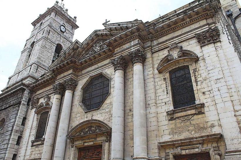
Toulon Opera House: 2.5km South
National Museum of the Marine: 2.8km South
Fort Saint-Louis: 3.5km Southeast
Mont Caume: 5.5km Northwest