Landmark: Pha Taem National Park
City: Isaan
Country: Thailand
Continent: Asia
Pha Taem National Park, Isaan, Thailand, Asia
Pha Taem National Park is a protected area situated in the Ubon Ratchathani Province of Thailand's Isaan region. It is known for its extensive prehistoric rock art and dramatic cliffside viewpoints overlooking the Mekong River.
Visual Characteristics
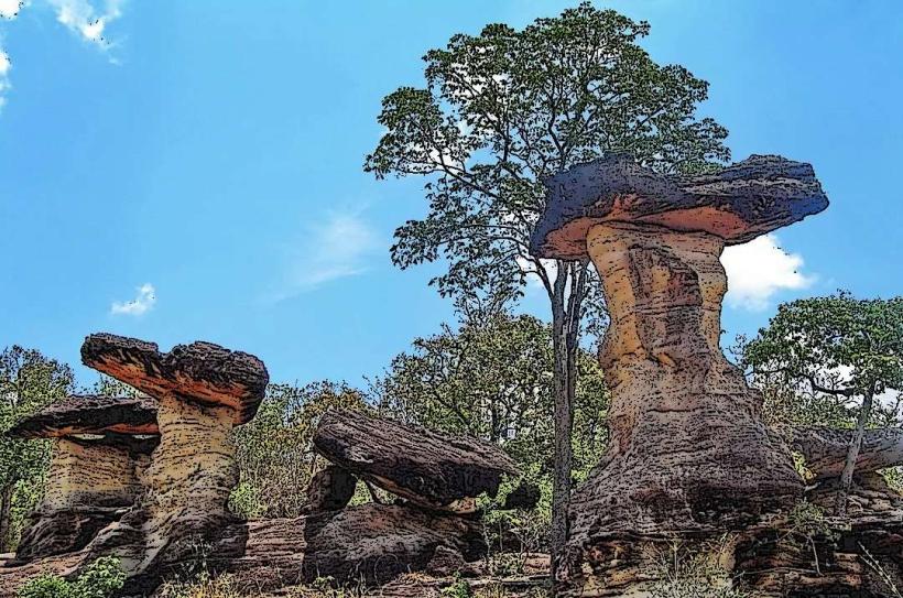
The park features sandstone cliffs that rise approximately 100 meters above the Mekong River. The rock formations exhibit various erosion patterns. Vegetation is primarily dry evergreen forest and mixed deciduous forest, with scattered bamboo groves. The Mekong River forms a natural border, appearing brown or muddy depending on the season and rainfall.
Location & Access Logistics
Pha Taem National Park is located approximately 90 kilometers east of Ubon Ratchathani city. Access is via Highway 2112, which leads directly to the park entrance. The drive from Ubon Ratchathani takes roughly 1.5 to 2 hours. Parking is available at designated areas near the visitor center and key viewpoints. Public transport options are limited; hiring a taxi or private car from Ubon Ratchathani is the most practical method of access.
Historical & Ecological Origin
The park's primary geological feature is its sandstone bedrock, formed during the Mesozoic era. The most significant aspect is the presence of prehistoric cave paintings, estimated to be between 3,000 and 5,000 years old. These paintings depict human figures, animals, and daily life activities, providing insight into early human settlements in the region. The area is part of the Mekong River basin's ecological system.
Key Highlights & Activities
Visitors can observe the prehistoric rock art panels at Pha Taem Cliff, which are accessible via a marked trail. The "Three Whales Rock" formation is a notable natural landmark. Hiking trails are available, including routes to various viewpoints. Observation decks offer panoramic views of the Mekong River and Laos on the opposite bank. Sunrise viewing is a popular activity from the eastern-facing cliffs.
Infrastructure & Amenities
Restrooms are available at the visitor center and near major viewpoints. Shaded areas are provided by natural tree cover and some constructed shelters. Cell phone signal (4G) is generally available within the vicinity of the visitor center and main access points. Food vendors are typically located near the park entrance and visitor center, offering local snacks and beverages.
Best Time to Visit
The best time of day for photography, particularly for the rock art, is during the morning hours (approximately 7:00 AM to 9:00 AM) when the light is softer and less direct. The dry season, from November to April, offers the most pleasant weather with lower humidity and minimal rainfall. The Mekong River's water level fluctuates significantly between the wet and dry seasons, affecting the visible riverbanks.
Facts & Legends
One of the most striking features of the rock art is the depiction of what appear to be large fish, possibly Mekong giant catfish, a species still found in the river. Local folklore sometimes associates the cliff formations with ancient spirits or guardians of the river.
Nearby Landmarks
- Wat Sirindhorn Phu Prao (Temple of Light) - 15km Southwest
- Phu Sing National Park - 20km West
- Kaeng Tana National Park - 45km South
- Ubon Ratchathani City - 90km West