
Landmark: Platja de Llevant
City: Formentera
Country: Balearic Islands
Continent: Europe
Platja de Llevant, Formentera, Balearic Islands, Europe
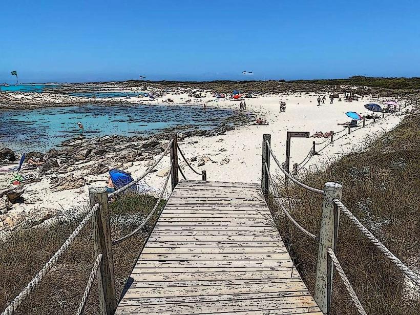
Platja de Llevant is a beach located on the eastern coast of Formentera, one of the Balearic Islands.
This coastal area is characterized by its sandy expanse and proximity to the Ses Illetes Natural Park.
Visual Characteristics
Platja de Llevant features fine, white sand. The water exhibits a clear, turquoise coloration, transitioning to deeper blues further from shore. The beach is approximately 1.5 kilometers long and up to 100 meters wide in some sections. It is backed by low dunes and sparse Mediterranean vegetation, including sea daffodils and junipers.
Location & Access Logistics
The beach is situated on the eastern side of Formentera, accessible via the PM-820 road. From the main town of Sant Francesc Xavier, it is approximately 7 kilometers east. Parking is available at designated areas along the road leading to the beach, with capacity varying by season. Public transport options are limited; a seasonal bus service may operate, but private vehicle or bicycle is the most common access method.
Historical & Ecological Origin
Platja de Llevant is a natural coastal formation, part of the larger geological landscape of the Balearic Islands. Its sandy composition is a result of marine erosion and sediment deposition over millennia. The area is ecologically significant as it borders the Ses Salines Natural Park, a protected zone supporting diverse marine and terrestrial ecosystems.
Key Highlights & Activities
Swimming and sunbathing are primary activities. The shallow, clear waters are suitable for wading. Walking along the length of the beach provides an opportunity to observe the dune system. Kayaking and paddleboarding are possible, particularly during calmer sea conditions.
Infrastructure & Amenities
Limited infrastructure is present directly on Platja de Llevant. Seasonal beach bars or chiringuitos may operate, offering refreshments and basic food. Public restrooms are not consistently available. Shade is primarily provided by natural vegetation or personal umbrellas. Cell phone signal (4G/5G) is generally available.
Best Time to Visit
For optimal lighting for photography, early morning or late afternoon offers softer sunlight. The best months for weather are typically May through October, with July and August being the warmest. High tide can reduce the visible beach width. Low tide exposes more of the sandy expanse.
Facts & Legends
A specific local legend associated with Platja de Llevant is its historical use as a landing point for small fishing vessels before the development of more formal port facilities. The beach is less developed than its western counterpart, Ses Illetes, offering a more expansive and less crowded experience during peak season.
Nearby Landmarks
- Ses Illetes Beach (1.5km West)
- La Savina Port (6km West)
- Cap de Barbaria Lighthouse (12km Southwest)
- Es Pujols (4km West)
- Salinas de Formentera (3km Northwest)


