Information
Landmark: Playa MajagualCity: San Juan del Sur
Country: Nicaragua
Continent: North America
Playa Majagual, San Juan del Sur, Nicaragua, North America
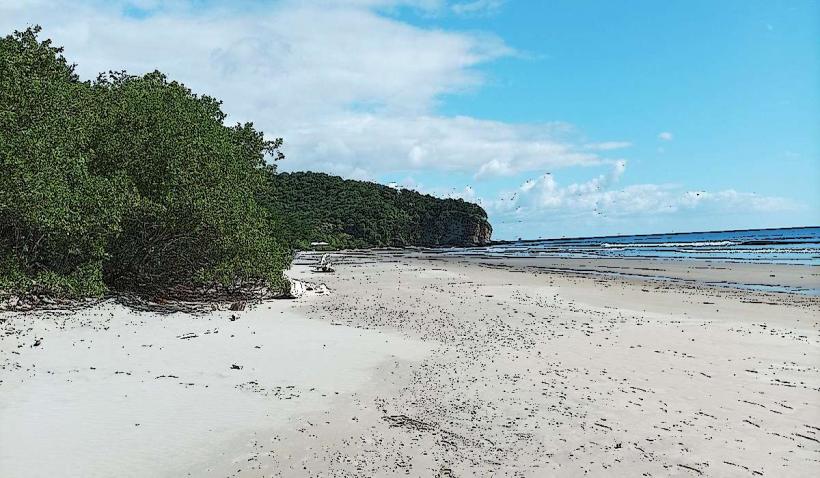
Playa Majagual is a beach located south of San Juan del Sur, Nicaragua.
This coastal area is characterized by its expansive sandy shores and surrounding tropical dry forest vegetation.
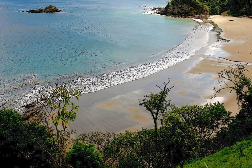
Visual Characteristics
The beach features a wide expanse of light brown sand. The water color varies from turquoise to deep blue depending on the angle of the sun and wave conditions. The shoreline is approximately 1.5 kilometers long. The area is bordered by moderate hills covered in dense green foliage, primarily consisting of deciduous trees and shrubs.
Location & Access Logistics
Playa Majagual is situated approximately 15 kilometers south of the central town of San Juan del Sur. Access is primarily via the unpaved Carretera a Las Salinas road. The final 3 kilometers to the beach are a rough dirt track, often requiring a 4x4 vehicle, especially during the rainy season (May to October). Public transport options are limited; shared taxis or private car hire from San Juan del Sur are the most common methods. There is a small, informal parking area near the beach entrance.
Historical & Ecological Origin
Playa Majagual is a natural formation, part of the Pacific coastline of Nicaragua. Its geological origin is attributed to coastal erosion and sediment deposition over millennia. Ecologically, it is situated within a tropical dry forest ecosystem, supporting a variety of plant and animal life adapted to seasonal rainfall.
Key Highlights & Activities
Swimming is possible, though conditions can be rough due to Pacific swells. Surfing is a primary activity, with consistent waves suitable for intermediate surfers. Beachcombing along the extensive shoreline is also common. Hiking trails are present in the surrounding hills, offering elevated views of the coastline.
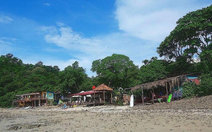
Infrastructure & Amenities
Basic amenities are available. There are a few small, open-air food stalls and bars located near the main access point, offering local food and drinks. Shade is provided by palm trees and the structures of the food vendors. Restrooms are typically available at these establishments. Cell phone signal (4G) is generally present but can be intermittent.
Best Time to Visit
The best time for dry weather and calmer seas is during the dry season, from December to April. For surfing, conditions are often more consistent from May to November. The late afternoon, approximately 2-3 hours before sunset, offers favorable lighting for photography due to the angle of the sun.
Facts & Legends
Local lore suggests that the name "Majagual" derives from the abundance of majagua trees (Hibiscus tiliaceus) that historically grew in the area, known for their fibrous bark used for rope and textiles.
Nearby Landmarks
- Playa Hermosa (1.2km South)
- Playa Yankee (3.5km South)
- Playa La Flor Wildlife Refuge (7.0km South)
- San Juan del Sur town center (15.0km North)