Information
Landmark: Playa TrocaderoCity: Antofagasta
Country: Chile
Continent: South America
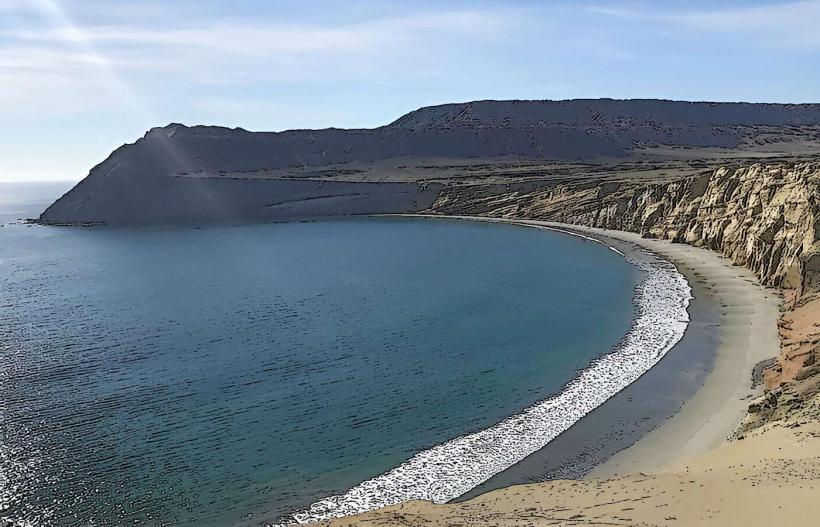
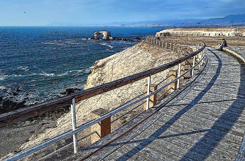
Playa Trocadero, Antofagasta, Chile, South America
Playa Trocadero is a coastal area situated in Antofagasta, Chile.
This location serves as a public beach and recreational space along the Pacific coastline.
Visual Characteristics
The beach consists of coarse, dark gray sand. The water color is typically a muted blue-green, influenced by oceanic currents. Rocky outcrops are present at the northern and southern extremities of the main beach area. Vegetation is sparse, primarily consisting of drought-resistant coastal shrubs and grasses on the higher ground behind the beach.
Location & Access Logistics
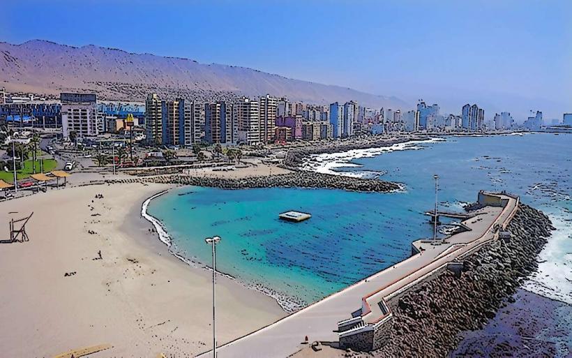
Playa Trocadero is located approximately 5 kilometers north of Antofagasta's city center. Access is via Avenida Costanera Norte, which runs parallel to the coastline. Ample parking is available in designated lots adjacent to the beach. Public transport options include the Red Bus Line 107, which stops directly at the beach entrance.
Historical & Ecological Origin
The area's geological formation is part of the Atacama Desert's coastal plain, characterized by ancient marine sedimentary rocks and volcanic intrusions. Historically, it has been a point of access to the sea for the city, with early development focused on its potential for recreation and fishing.
Key Highlights & Activities
Swimming is permitted in designated areas. Beach volleyball courts are available for public use. Walking paths along the coastline offer opportunities for observation. Fishing from the shore is a common activity, particularly during dawn and dusk.
Infrastructure & Amenities
Restrooms are located near the main parking area. Limited shade is provided by natural rock formations and a few strategically placed pergolas. Cell phone signal (4G) is generally reliable. No permanent food vendors are present on-site; however, mobile food carts occasionally operate during peak seasons.
Best Time to Visit
For photography, the hours around sunrise and sunset provide optimal lighting conditions. The months of December through March offer the warmest weather, with average daytime temperatures around 22°C. Ocean currents can be strong, and swimming advisories are posted when conditions are unfavorable.
Facts & Legends
A local anecdote suggests that during exceptionally low tides, remnants of an old Spanish galleon are sometimes visible just offshore, though this remains unverified.
Nearby Landmarks
- Parque Jorge Silva (0.8km South)
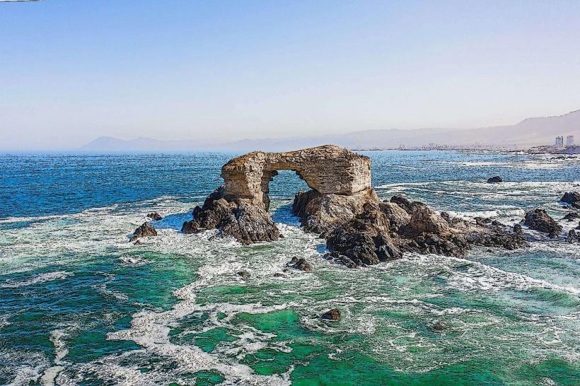
- Monumento Natural La Portada (4.5km North)
- Museo Regional de Antofagasta (5.2km South)
- Estadio Regional de Antofagasta (3.1km South)