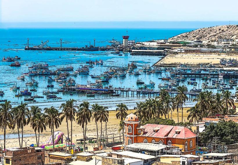
Landmark: Punta Sal Beach
City: Piura
Country: Peru
Continent: South America
Punta Sal Beach, Piura, Peru, South America
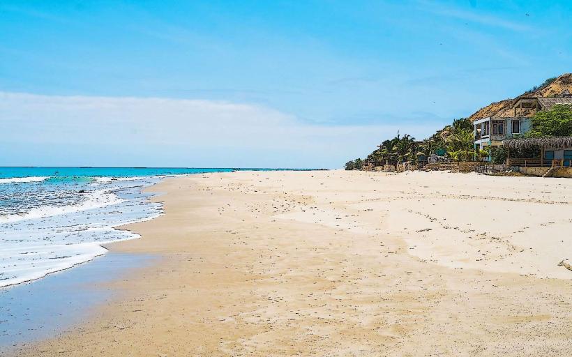
Punta Sal Beach is a coastal area located in the Tumbes Region of Peru, north of the city of Piura.
Visual Characteristics
The beach features fine, light-colored sand. The ocean water is typically clear with varying shades of blue and green. Coastal vegetation consists of low-lying shrubs and some scattered palm trees.
Location & Access Logistics
Punta Sal Beach is situated approximately 100 kilometers north of Piura city center, accessible via the Pan-American Highway (Carretera Panamericana Norte). Travel time from Piura is roughly 1.5 to 2 hours by car. Parking is available along the main road and in designated areas near accommodations. Public transport options include intercity buses that stop at Punta Sal, with onward local transport (taxis or mototaxis) to the beach itself.
Historical & Ecological Origin
Punta Sal's geological formation is part of the coastal plain of northwestern Peru, influenced by marine erosion and sediment deposition over millennia. Ecologically, it is part of the dry forest ecoregion, adapted to arid conditions.
Key Highlights & Activities
Activities include swimming, sunbathing, and beachcombing. Boat tours for dolphin watching are available. Fishing from the shore or by boat is a common pursuit. Snorkeling and diving are possible in calmer sections of the bay.
Infrastructure & Amenities
Restrooms are available at restaurants and hotels along the beachfront. Shade is provided by natural vegetation and constructed palapas. Cell phone signal (4G) is generally available. Food vendors and restaurants are present along the main beach area.
Best Time to Visit
The best time for clear skies and calm seas is from May to October. For photography, early morning and late afternoon offer optimal lighting conditions. High tide is generally suitable for swimming, with low tide exposing more of the sand.
Facts & Legends
Punta Sal is known for its consistent warm water temperatures year-round, a characteristic attributed to the Humboldt Current's influence being moderated by local oceanic conditions. Local folklore sometimes speaks of ancient mariners using the distinctive rock formations as navigational points.
Nearby Landmarks
- Máncora Beach (5km North)
- Los Órganos (15km North)
- Cabo Blanco (20km South)
- El Ñuro (10km North)