Landmark: Punta Sal National Park
City: Tela
Country: Honduras
Continent: North America
Punta Sal National Park, Tela, Honduras, North America
Punta Sal National Park is a protected coastal area located on the Caribbean coast of Honduras, near the city of Tela.
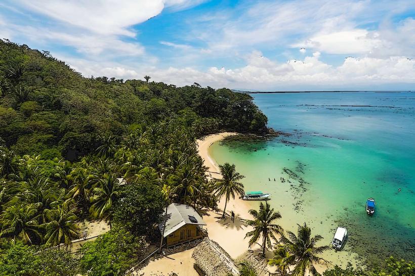
This park encompasses a peninsula with diverse ecosystems, including tropical rainforest, mangrove swamps, and coral reefs.
Visual Characteristics
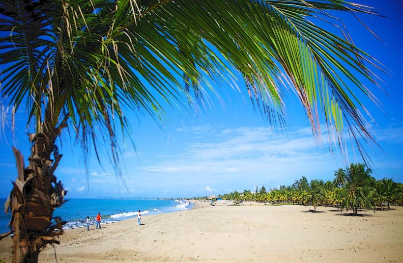
The peninsula features a coastline with sandy beaches and rocky outcrops. Inland, the terrain is characterized by dense tropical vegetation, with a canopy reaching approximately 20-30 meters in height. The waters surrounding the park are clear, with visible coral formations in shallower areas. The park's highest point is approximately 150 meters above sea level.
Location & Access Logistics
Punta Sal National Park is situated approximately 10 kilometers west of Tela. Access is primarily via boat from the Tela municipal dock. Boat transfers typically take 20-30 minutes. Limited road access exists to the park's periphery, but this is not the primary entry point for visitors. Parking is available at the Tela municipal dock.
Historical & Ecological Origin
Punta Sal was designated a national park in 1978 to protect its significant biodiversity and ecological importance. Ecologically, it is classified as a coastal marine and terrestrial protected area, supporting a variety of endemic and migratory species. The peninsula's geological formation is primarily sedimentary rock, shaped by coastal erosion and marine processes.
Key Highlights & Activities
Activities include snorkeling and diving in the coral reefs, particularly in the designated marine reserve areas. Hiking is possible on marked trails, such as the trail leading to the park's highest viewpoint. Wildlife observation, including birdwatching and primate spotting, is a primary activity. Boat tours around the peninsula are also available.
Infrastructure & Amenities
Basic facilities are available within the park, including designated picnic areas and some covered shelters. Restroom facilities are present at the main visitor access point. Cell phone signal (primarily 2G/3G) is intermittent within the park. Food vendors are typically located near the Tela municipal dock; limited options may be available at the park's main entry point.
Best Time to Visit
The dry season, from December to April, offers the most favorable weather conditions with reduced rainfall. The best time of day for photography is generally in the morning (08:00-10:00) or late afternoon (15:00-17:00) due to softer light. Snorkeling and diving conditions are optimal during calm seas, which are more frequent during the dry season.
Facts & Legends
Punta Sal is known for its population of white-faced capuchin monkeys and howler monkeys. A specific tip for visitors is to carry insect repellent, as mosquitoes can be prevalent, especially in the denser forest areas during humid periods.
Nearby Landmarks
- 0.5km East: Tela Municipal Dock
- 2.0km East: Tela City Center
- 4.0km Southeast: Lancetilla Botanical Garden
- 5.0km East: San Juan Pueblo