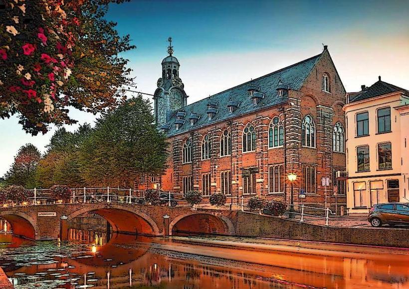
Landmark: Rijngracht
City: Leiden
Country: Netherlands
Continent: Europe
Rijngracht, Leiden, Netherlands, Europe
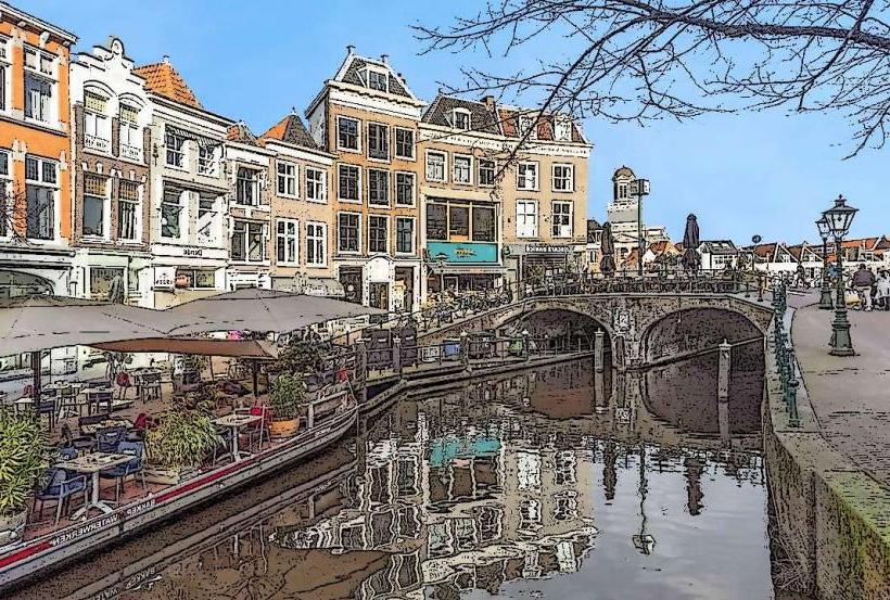
The Rijngracht (Rhine Canal) is a significant historical waterway in Leiden, forming part of the city's complex network of canals derived from the Old Rhine (Oude Rijn). It serves as a primary transit and residential corridor in the eastern section of the historic center.
Visual Characteristics
The canal is characterized by its wide, dark waters and high brick quay walls. It is lined with traditional Dutch canal houses featuring varied gables (neck, bell, and step gables). Rows of mature elm and linden trees provide a green canopy along the cobblestone embankments. It is frequently populated by classic wooden sloops and modern electric pleasure boats.
Location & Access Logistics
Position: Located in the eastern quadrant of Leiden's city center, connecting the Oude Rijn to the Herengracht.
Access: 1.2km southeast of Leiden Centraal station. Accessible via a 15-minute walk through the Haarlemmerstraat shopping district.
Navigation: Part of the standing mast route for regional shipping, though primarily used for local recreational boating.
Historical & Ecological Origin
The Rijngracht was formalized during the major city expansions of the 17th century (the Dutch Golden Age) to facilitate the transport of goods, particularly textiles and building materials. It follows the natural path of an ancient Rhine distributary. Geologically, the area consists of river clay and peat, requiring the historic houses to be supported by thousands of wooden piles driven into the stable sand layers deep beneath the surface.
Key Highlights & Activities
Boating: A major artery for canal tours and private boat rentals.
Architecture: Observation of the "Herenhuizen" (patrician houses), many of which have been converted into student housing or upscale apartments.
Bridges: Features several historic fixed stone bridges that offer panoramic views of the Leiden skyline, including the nearby Hooglandse Kerk.
Infrastructure & Amenities
The canal banks are primarily residential and professional office spaces. Mooring spots are strictly regulated by municipal permits. While there are no public restrooms on the canal itself, the nearby Haven and Nieuwe Rijn areas provide high densities of cafes and public facilities. 5G signals are excellent along the entire length.
Best Time to Visit
The canal is most picturesque at sunset when the light reflects off the water and illuminates the brick facades. During the 3rd of October (Leiden's Relief festival), the canal and its surrounding quays become a central site for city-wide celebrations.
Facts & Legends
A verified historical detail is that the water level in the Rijngracht is meticulously managed by the Rijnland District Water Control Board to prevent the surrounding historic basements from flooding. A local legend suggests that hidden underwater "spikes" were once placed near certain quays to prevent unauthorized cargo offloading during the height of the 17th-century excise tax era.
Nearby Landmarks
Hooglandse Kerk (0.3km West)
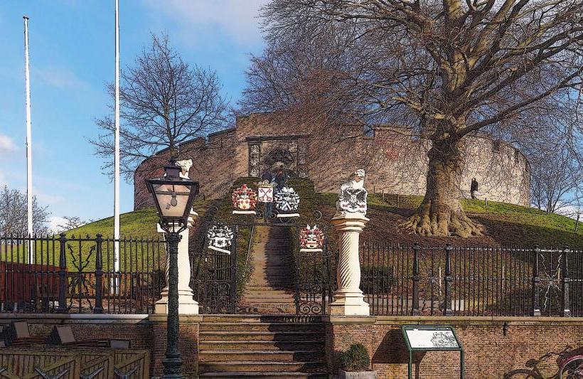
Burcht van Leiden (0.4km West)
Plantsoen Park (0.5km South)
De Haven (The Harbor) (0.2km North)
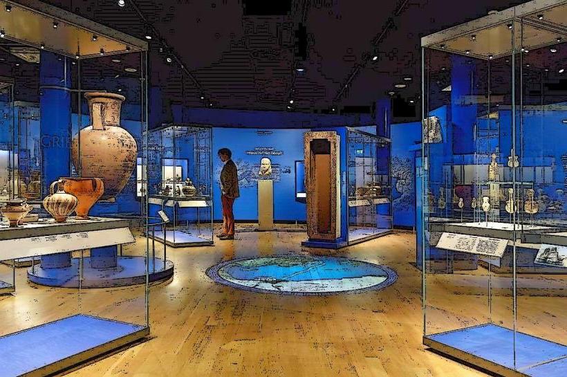
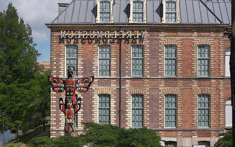
National Museum of Ethnology (1.4km Northwest)