Landmark: Ropotamo River
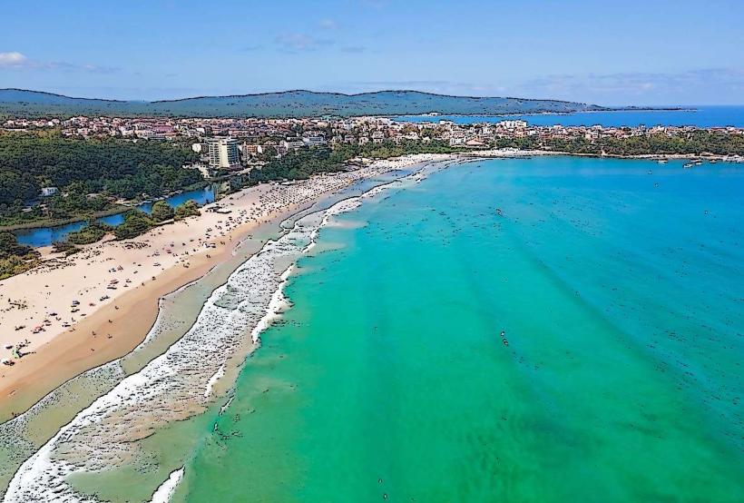
City: Primorsko
Country: Bulgaria
Continent: Europe
Ropotamo River, Primorsko, Bulgaria, Europe
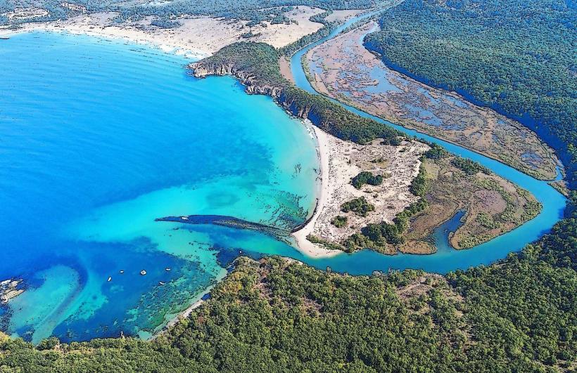
The Ropotamo River is a protected river located in the Burgas Province of Bulgaria, flowing into the Black Sea near the town of Primorsko.
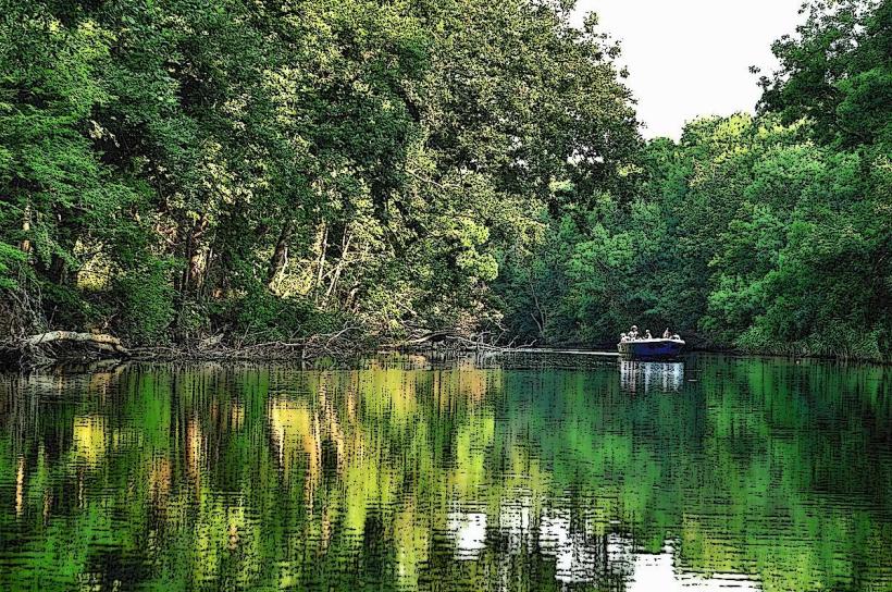
It is characterized by its slow-moving waters, dense riparian vegetation, and a unique delta system.
Visual Characteristics
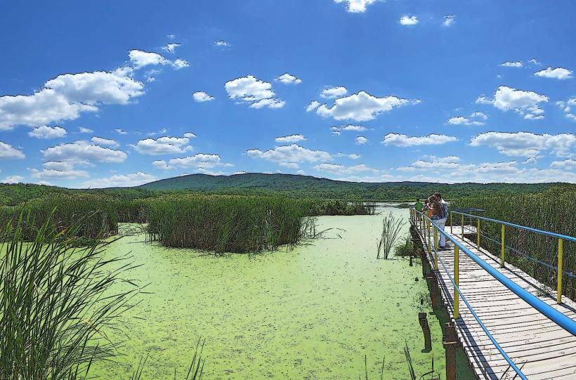
The river itself exhibits a dark, slow-moving water flow, often appearing brown due to sediment. The banks are densely covered with a mix of deciduous trees, including oak and hornbeam, and a significant presence of water lilies and other aquatic plants in calmer sections. The river widens considerably as it approaches its mouth, forming a marshy delta with reed beds.
Location & Access Logistics
The Ropotamo River is situated approximately 5 kilometers south of Primorsko. Access is primarily via the main road E87 (Republic Road I-9), with a clearly marked turn-off for the Ropotamo River Nature Reserve. Parking is available at designated areas near the river mouth and at the starting point for boat tours. Public transport options are limited; bus services to Primorsko are frequent from Burgas, from where local taxis or pre-arranged transport are required.
Historical & Ecological Origin
The Ropotamo River is a natural watercourse, with its current form shaped by geological processes over millennia. Ecologically, it is classified as a riverine and deltaic ecosystem, supporting a diverse range of flora and fauna adapted to freshwater and brackish environments. The area was declared a protected nature reserve in 1962 to preserve its unique biodiversity and landscape.
Key Highlights & Activities
Boat tours along the river are the primary activity, offering views of the riparian forest and wildlife. Kayaking and canoeing are permitted in designated areas. Birdwatching is a significant activity due to the variety of avian species present. Fishing is restricted within the protected reserve boundaries.
Infrastructure & Amenities
Basic amenities are available at the river mouth, including a small number of food vendors and cafes. Restrooms are located near the boat tour departure points. Shade is provided by the dense tree canopy along the riverbanks. Cell phone signal (4G) is generally available in the vicinity of the main access points.
Best Time to Visit
The best time for visiting is from April to October. For photography, early morning and late afternoon offer softer light. The river's water level is generally consistent, but boat tours may be affected by extreme weather conditions. High tide is not a significant factor for river access.
Facts & Legends
Local folklore suggests that the river's waters possess healing properties. A specific point of interest is the "Lion's Head" rock formation, a natural erosion feature visible from the river, which is a common subject for boat tours.
Nearby Landmarks
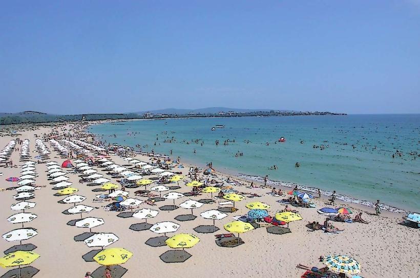
- Perla Beach (1.5km North)
- Primorsko (5km North)
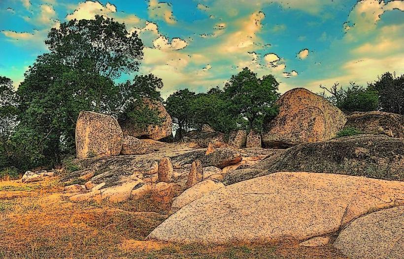
- Beglik Tash Thracian Sanctuary (6km West)
- Sozopol (25km North)