Information
Landmark: Rugova CanyonCity: Pec
Country: Kosovo
Continent: Europe
Rugova Canyon, Pec, Kosovo, Europe
Rugova Canyon is an 827-meter-deep river canyon located in the Accursed Mountains (Prokletije) of western Kosovo. The site begins approximately 3 kilometers west of the city center of Peja (Pec) and extends 25 kilometers toward the Montenegro border.
Visual Characteristics
The canyon features vertical limestone walls rising up to several hundred meters, punctuated by numerous caves and rock arches. The Lumbardhi i Pejës river flows along the canyon floor, characterized by turquoise water and white limestone boulders. Dense vegetation, primarily deciduous and coniferous forest, clings to the steep cliffs, while the upper sections expose grey, jagged rock formations.
Location & Access Logistics
Access is via the M9 motorway, which runs directly through the canyon floor. The entrance is located 3km west of Peja city center; follow signs toward the Rugova valley and Bogë. There is no dedicated public bus line through the entire canyon, though local minibuses to the village of Bogë pass through daily. Parking is limited to small gravel pull-offs along the M9 road.
Historical & Ecological Origin
The canyon was formed through water erosion by the Lumbardhi i Pejës river following the retreat of the Peja Glacier during the Pleistocene epoch. It is a protected National Park (Bjeshkët e Nemuna) and was historically used as a strategic passage for trade caravans between the Adriatic coast and the interior of the Balkan Peninsula.
Key Highlights & Activities
Via Ferrata climbing is available on several routes, including Ari and Mat. High-altitude hiking trails connect the canyon floor to the villages of Rugova. A 640-meter-long zipline operates near the canyon entrance. Caving is possible in the Great Canyon Cave (Gryka e Madhe), though professional equipment is required for entry.
Infrastructure & Amenities
Restrooms are available only at private restaurants and guesthouses located at intervals along the M9 road. Shade is intermittent depending on cliff orientation and tree cover. Cell phone signal (4G) is inconsistent and often drops out in the narrower sections of the gorge. Potable water can be found at specific roadside mountain springs.
Best Time to Visit
The best months for visiting are May through September to avoid snow-related road closures. Morning light (08:00 - 10:00) provides the best conditions for photography within the deep gorge sections. Winter visits are possible but restricted by ice falls and potential avalanches on the higher slopes.
Facts & Legends
The canyon contains the "Bridge of the Monk," a site associated with local folklore regarding a hermit who inhabited the nearby caves. A specific geological feature known as the "Stone of the Queen" (Guri i Mbretëreshës) is a prominent rock formation that served as a landmark for medieval travelers.
Nearby Landmarks
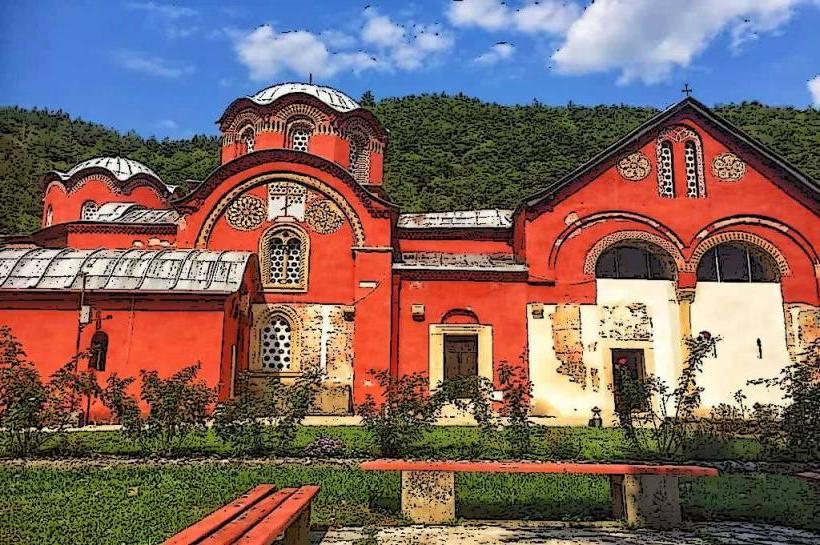
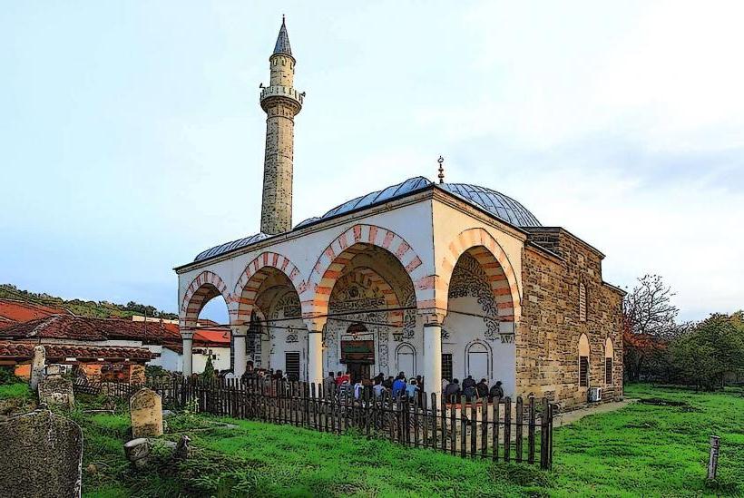
Patriarchate of Peć Monastery – 2.0km East
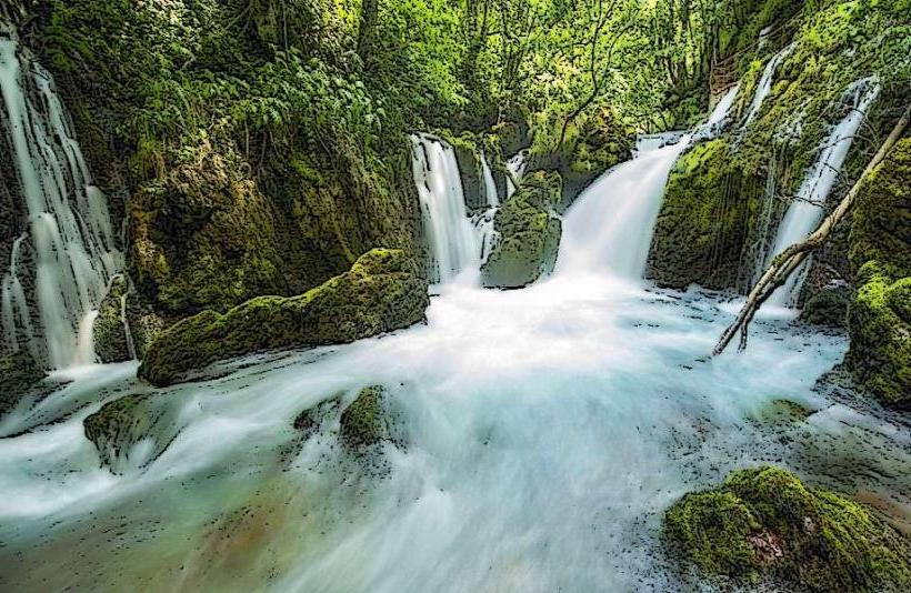
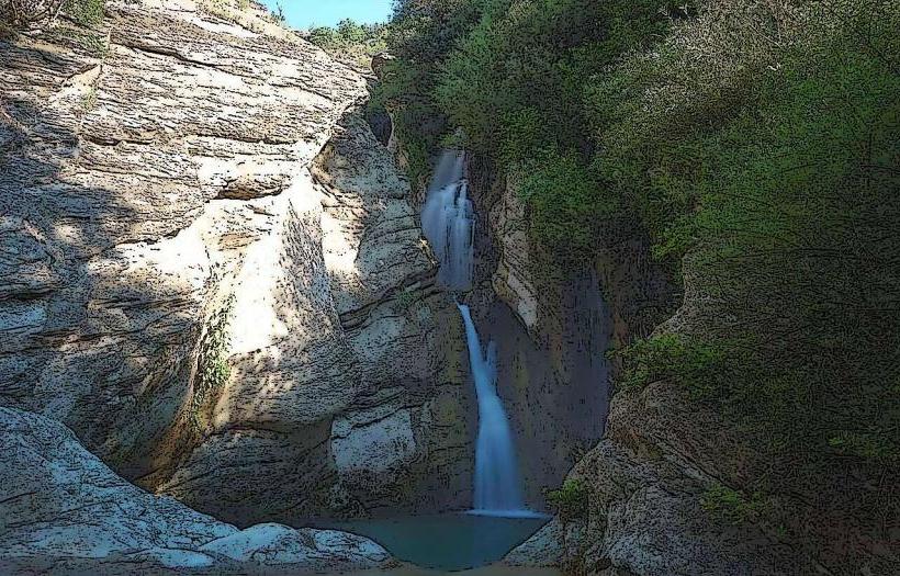
White Drin Waterfall – 12.0km Northeast
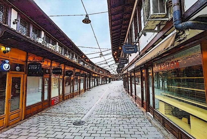
Old Bazaar of Peja – 4.5km East
Peaks of the Balkans Trail (Entrance) – 1.5km West