Landmark: Saint John Parish
City: West Coast
Country: Dominica
Continent: North America
Saint John Parish, West Coast, Dominica, North America
Saint John Parish is a administrative division located on the West Coast of Dominica. It encompasses a significant portion of the island's western shoreline.
Visual Characteristics
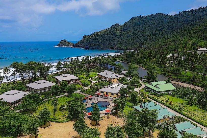
The coastline in Saint John Parish is characterized by a mix of volcanic black sand beaches and rocky outcrops. The water color ranges from deep blue offshore to turquoise closer to the coast. Inland, the terrain is mountainous and covered in dense tropical rainforest, with elevations reaching over 1,000 meters.
Location & Access Logistics
The parish is situated approximately 20 kilometers north of the capital city, Roseau. Access is primarily via the primary West Coast Road (Highway 1). Parking is available at designated points along the coast, particularly near populated areas and beaches. Public transport includes local bus routes that run regularly along Highway 1, connecting to Roseau and other coastal towns.
Historical & Ecological Origin
Saint John Parish was historically an area of settlement for the indigenous Kalinago people before European colonization. Ecologically, the area is part of Dominica's volcanic mountain range, with a rich biodiversity supported by the tropical rainforest ecosystem. The coastline is a result of volcanic activity and erosion.
Key Highlights & Activities
Activities include swimming and sunbathing at beaches such as Mero Beach. Snorkeling and diving are possible in clear water conditions, particularly around rocky areas. Hiking trails exist within the inland rainforest, offering opportunities to observe local flora and fauna. Fishing is a common local activity.
Infrastructure & Amenities
Restrooms are available at Mero Beach and in some smaller villages. Shade is provided by natural tree cover in forested areas and by umbrellas at developed beaches. Cell phone signal (4G) is generally available in coastal settlements and along the main road. Food vendors and small restaurants are present in Mero and other coastal villages.
Best Time to Visit
The best time for beach activities is during the dry season, from December to May. For hiking, the dry season offers more predictable weather. Mid-morning to late afternoon provides optimal natural light for photography of the coastline and rainforest.
Facts & Legends
A local legend speaks of a submerged Kalinago village off the coast, visible only during exceptionally low tides, though this remains unverified. The parish is also known for its historical role as a trading post during the colonial era.
Nearby Landmarks
- Mero Beach (0.2km South)
- Morne Diablotins National Park (5km East)
- Portsmouth (15km North)
- Indian River (10km North)
- Fort Shirley (18km North)