Information
Landmark: Sammamish River TrailCity: Redmond
Country: USA Washington
Continent: North America
Sammamish River Trail, Redmond, USA Washington, North America
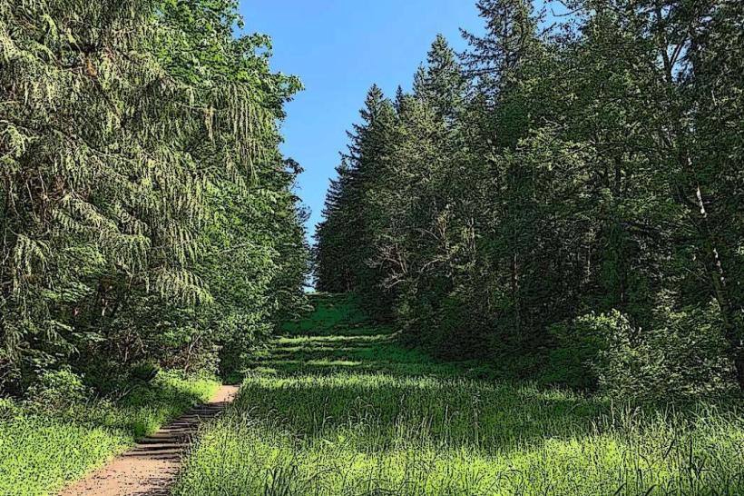
The Sammamish River Trail is a paved, multi-use recreational path located in Redmond, Washington, USA. It follows the Sammamish River for a significant portion of its length.
Visual Characteristics
The trail is predominantly flat and paved with asphalt, measuring approximately 10-12 feet in width. It is bordered by riparian vegetation, including deciduous trees and grasses, with the Sammamish River visible to the south for much of its course. Open fields and park areas are also adjacent to sections of the trail.
Location & Access Logistics
The trail begins near Marymoor Park in Redmond, accessible via NE 52nd Street. From downtown Redmond, head east on NE Redmond Way, turn right onto Highland Drive, and then left onto NE 52nd Street. Parking is available at Marymoor Park, which has multiple lots. Public transport options include King County Metro bus routes that serve the Redmond Transit Center, with connections to routes that stop near the park entrances.
Historical & Ecological Origin
The Sammamish River Trail is part of the larger East Lake Sammamish Trail system, developed on a former railroad corridor. The corridor was originally used by the Seattle, Lake Shore and Eastern Railway, established in the late 19th century. The river itself is a natural waterway flowing from Lake Sammamish to Lake Washington, supporting a temperate riparian ecosystem.
Key Highlights & Activities
Activities include cycling, running, walking, and inline skating. Birdwatching is possible along the riverbanks. The trail connects to other trail systems, allowing for longer excursions. Fishing is permitted in designated areas along the river.
Infrastructure & Amenities
Restrooms are available at Marymoor Park and at intervals along the trail, particularly at park access points. Shade is provided by trees in many sections. Cell phone signal (4G/5G) is generally consistent along the trail. Food vendors are present within Marymoor Park and in commercial areas near trail access points.
Best Time to Visit
For optimal lighting for photography, early morning or late afternoon provides softer light. The months of May through September offer the most favorable weather conditions with lower precipitation. The trail is accessible year-round, but winter months can be wet.
Facts & Legends
The Sammamish River was historically known as the "Dog River" by the indigenous Sammamish people, though the exact origin of this name is debated, with some attributing it to the sound of the water and others to local wildlife.
Nearby Landmarks
- Marymoor Park (0.1km West)
- Redmond Town Center (2.5km Northwest)
- Microsoft Visitor Center (3.0km West)
- Big Picture Theater & Cafe (2.8km Northwest)
- Sammamish Landing Park (4.5km Southeast)