Landmark: Slide Mountain
City: Catskills
Country: USA New York
Continent: North America
Slide Mountain, Catskills, USA New York, North America
Slide Mountain is the highest peak in the Catskill Mountains, located in Ulster County, New York.
It is a prominent summit within the Catskill Park, offering extensive views and recreational opportunities.
Visual Characteristics
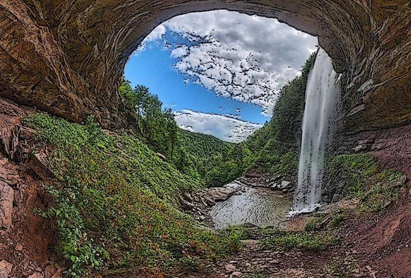
Slide Mountain is characterized by its broad, rounded summit, a result of glacial erosion. The upper slopes are primarily covered in mixed hardwood forest, with deciduous trees like beech, maple, and birch dominating. Coniferous species such as spruce and fir are present at higher elevations. The summit itself is largely forested, with limited open areas. Rock outcroppings are visible on steeper sections of the trails.
Location & Access Logistics
Slide Mountain is situated approximately 15 miles west of Kingston, New York. Access is via County Route 42 (also known as Oliverea Road) from the east or County Route 28 from the west. The primary trailhead is located off County Route 42, approximately 3 miles north of the hamlet of Oliverea. Parking is available at the designated Slide Mountain Trailhead parking area, which can accommodate approximately 30 vehicles. There are no direct public transport routes to the trailhead; visitors typically require private vehicles.
Historical & Ecological Origin
The Catskill Mountains, including Slide Mountain, are composed of Devonian sedimentary rocks, primarily sandstones and shales, formed from ancient marine environments. The current topography is a result of extensive glaciation during the Pleistocene epoch, which carved out valleys and shaped the mountain peaks. The area is part of the larger Appalachian Mountain system. Historically, the region was utilized by indigenous peoples and later by loggers and farmers.
Key Highlights & Activities
Hiking is the primary activity. The most direct route to the summit is the yellow-blazed Slide Mountain Trail, which is approximately 2.5 miles one-way from the trailhead. The trail ascends steadily, with some steep sections. A viewing platform is located near the summit, providing panoramic views of the surrounding Catskill region. Other trails connect to adjacent peaks, allowing for longer traverses.
Infrastructure & Amenities
The Slide Mountain Trailhead parking area has a small information kiosk. There are no restrooms or potable water sources at the trailhead or on the trail. Cell phone signal is intermittent to non-existent on the trails and at the summit. No food vendors are located at or near the trailhead.
Best Time to Visit
For hiking, the best months are typically May through October, avoiding winter conditions. Fall foliage in September and October offers significant visual appeal. The best time of day for photography from the summit viewing platform is generally mid-morning or late afternoon, when the sun angle is lower, reducing harsh shadows. There are no tidal considerations for this inland mountain location.
Facts & Legends
Slide Mountain's name is derived from a large rockslide that occurred on its western flank in the 19th century. The summit elevation is officially recorded at 4,180 feet (1,274 meters). A unique geological feature is the presence of glacial erratics, large boulders transported and deposited by glaciers, found scattered on the mountain's slopes.
Nearby Landmarks
- 3.5km Southwest: Wittenberg Mountain
- 4.2km West: Cornell Mountain
- 4.8km Northeast: Shandaken Wild Forest