Landmark: Slieve League Cliffs
City: Donegal
Country: Ireland
Continent: Europe
Slieve League Cliffs, Donegal, Ireland, Europe
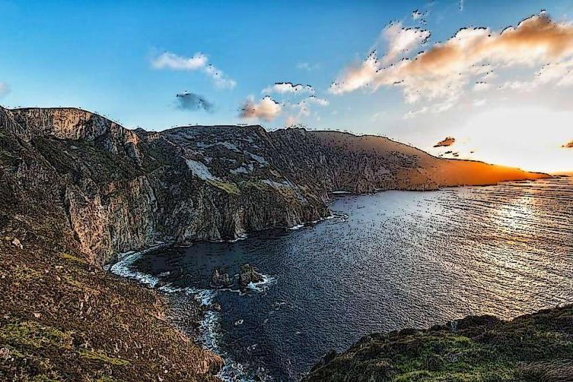
Slieve League (Sliabh Liag) is a mountain on the Atlantic coast of County Donegal. At $601$ meters ($1,972$ feet), its sea cliffs are among the highest in Europe, nearly three times the height of the Cliffs of Moher.
Visual Characteristics
The cliffs are a massive wall of Precambrian quartzite and schist. Unlike vertical limestone cliffs, Slieve League is a mountain that has been sheared by the sea, resulting in a steep, multi-colored rock face showing shades of ochre, white, and grey.
The Ridge: The mountain tapers to a narrow, jagged arête known as "One Man's Pass."
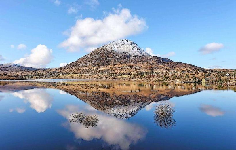
Ocean Views: Overlooks Donegal Bay and, on clear days, the mountains of Sligo and Mayo.
Location & Access Logistics
Address: Shanbally, Co. Donegal.
Position: Located on the southwest coast of Donegal, near the villages of Teelin and Carrick.
Transit: Private vehicle is the primary access method. Narrow, winding roads lead to the site.
Parking: * Lower Car Park: Located at the Visitor Centre/Gate.
Upper Car Park (Bunglass): Provides the most direct view. During peak season, a shuttle bus operates from the visitor center to this point, and private vehicle access to the upper lot may be restricted.
Accessibility: The Bunglass viewing platform is wheelchair accessible. The hiking trails beyond the platform consist of steep, rugged stone steps and loose scree.
Historical & Geological Origin
Geology: Formed from rocks over $600$ million years old. The current profile was shaped by heavy glaciation and subsequent marine erosion.
Monastic History: The mountain was a site of early Christian pilgrimage. The ruins of a 5th or 6th-century monastic settlement, associated with St. Assicus, are located near the summit.
WWII Markers: A large "EIRE" sign made of white stones is visible on the headland, originally placed to notify WWII pilots they were over neutral territory.
Key Highlights & Activities
The Pilgrim’s Path: A $4$km interior route that follows a traditional pilgrimage trail to the summit.
One Man's Pass: A narrow ridge walk at the summit for experienced hikers only; it requires traversing a path barely a meter wide with steep drops on both sides.
Boat Tours: Operate from Teelin Pier, allowing visitors to view the cliff face and sea caves from the water.
Infrastructure & Amenities
Sliabh Liag Visitor Centre: Located in Teelin; provides history, café services, and restrooms.
Sanitation: Public restrooms are available at the Visitor Centre, not at the cliff edge.
Connectivity: Extremely limited. Signal is often lost in the mountain shadows; GPS can be unreliable on the narrow approach roads.
Best Time to Visit
Hours: The cliffs are accessible 24/7, but the visitor center and shuttle bus operate roughly 10:00–18:00.
Weather: Subject to rapid changes. Thick sea mist often obscures the view entirely. Check local maritime forecasts before travel.
Photography: Sunset is the optimal time for photography, as the west-facing cliffs catch the evening light, highlighting the mineral colors in the rock.
Facts & Legends
A verified technical detail: Slieve League is the highest point of the International Appalachian Trail in Ireland. Local legend speaks of a "Spanish Gold" ship wrecked at the base of the cliffs, though no recovery has ever been documented due to the extreme depths and currents at the base.
Nearby Landmarks
Glencolmcille Folk Village – 15km West
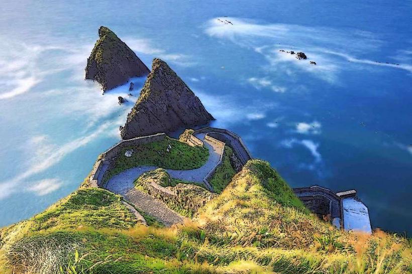
Silver Strand (Malin Beg) – 20km West
Assarancagh Waterfall – 30km North
Killybegs Fishing Port – 20km East