Landmark: Superstition Mountains
City: Payson
Country: USA Arizona
Continent: North America
Superstition Mountains, Payson, USA Arizona, North America
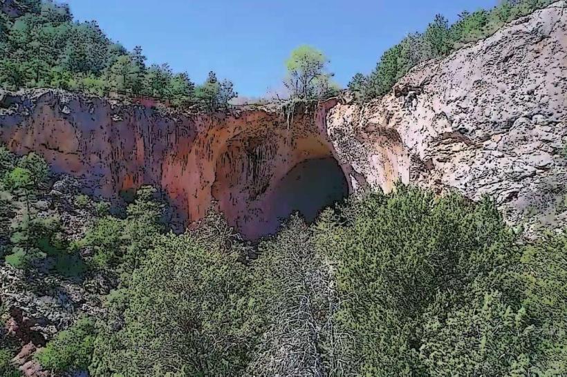
The Superstition Mountains are a mountain range located in central Arizona, east of Phoenix. They are characterized by rugged, eroded rock formations and desert vegetation.
Visual Characteristics
The mountains are composed primarily of volcanic rock, with prominent red and brown hues. Peaks reach elevations of over 5,000 feet. The terrain features steep canyons, sheer cliffs, and scattered saguaro cacti, palo verde trees, and creosote bushes. Erosion has sculpted the rock into distinct shapes.
Location & Access Logistics
The range is accessible via State Route 88 (Apache Trail) from Apache Junction, approximately 40 miles east of Phoenix. Paved sections of SR 88 lead to trailheads. Unpaved sections of the Apache Trail require high-clearance vehicles. Parking is available at designated trailheads such as Lost Dutchman State Park and Canyon Lake. No direct public transport serves the mountain range itself.
Historical & Ecological Origin
The Superstition Mountains are part of the Basin and Range Province, formed by tectonic activity and volcanic eruptions approximately 20-30 million years ago. The area is classified as Sonoran Desert, characterized by arid conditions and specialized plant and animal life adapted to extreme temperatures.
Key Highlights & Activities
Hiking is the primary activity. Specific trails include the Peralta Trail to Weaver's Needle, the Siphon Draw Trail to the "Ice Cream Cone," and the Treasure Loop Trail. Rock climbing is possible on designated routes. Photography opportunities exist at sunrise and sunset due to the rock coloration.
Infrastructure & Amenities
Restrooms are available at trailheads within Lost Dutchman State Park. Shade is limited to natural rock overhangs and sparse vegetation. Cell phone signal is intermittent and generally unavailable in deeper canyons. Food vendors are located in nearby towns like Apache Junction and Tortilla Flat.
Best Time to Visit
The best months for visiting are October through April, avoiding the extreme summer heat. Early morning or late afternoon provides optimal lighting for photography. No tide considerations apply.
Facts & Legends
The mountains are associated with the legend of the Lost Dutchman's Gold Mine, a supposed rich gold deposit whose location remains a subject of local folklore and numerous unsuccessful searches. A verified historical fact is the presence of ancient petroglyphs left by the Salado people.
Nearby Landmarks
- Lost Dutchman State Park (0.1km West)
- Canyon Lake (3km Southwest)
- Tortilla Flat (10km West)
- Goldfield Ghost Town (12km West)
- Usery Mountain Regional Park (25km West)