Landmark: Wahgi Valley
City: Mount Hagen
Country: Papua New Guinea
Continent: Australia
Wahgi Valley, Mount Hagen, Papua New Guinea, Australia
The Wahgi Valley is a significant geographical depression located in the Western Highlands Province of Papua New Guinea, near the city of Mount Hagen.
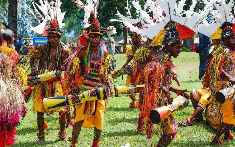
This extensive valley system is characterized by its fertile agricultural land and its role as a cultural hub for several indigenous groups.
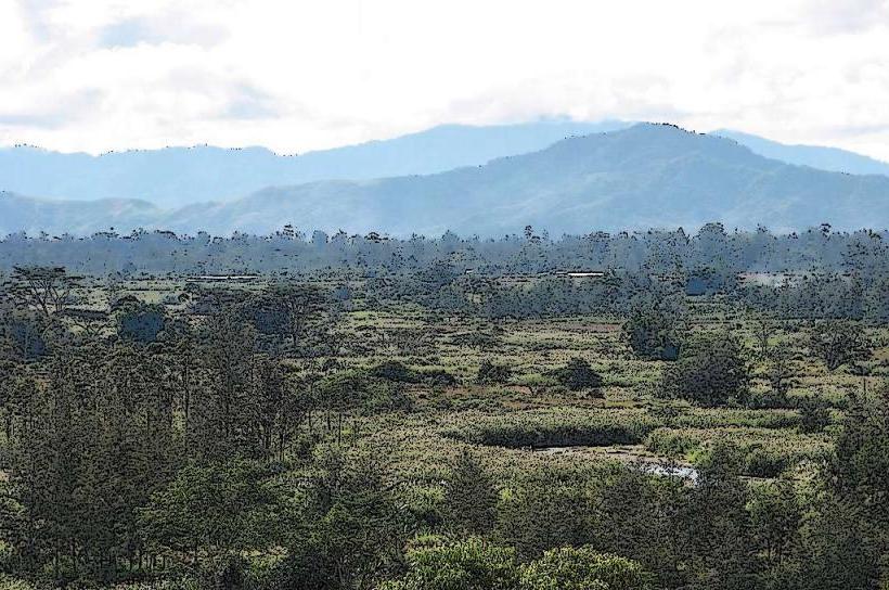
Visual Characteristics
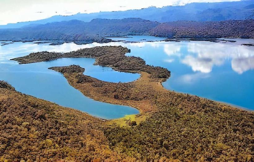
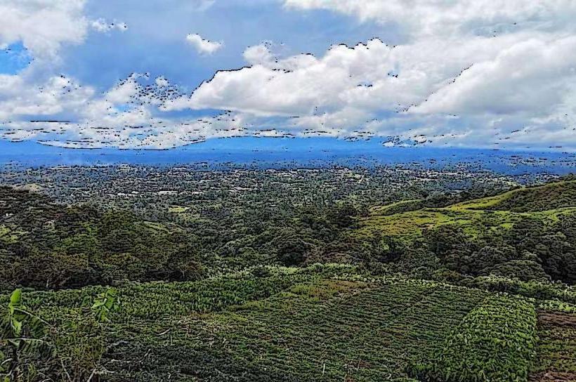
The valley floor is predominantly flat to gently undulating, covered in a mosaic of cultivated fields and grassland. Elevation ranges from approximately 1,500 to 1,800 meters above sea level. The surrounding topography consists of steep, densely forested mountain slopes. Rivers and streams, often carrying sediment, traverse the valley floor. Vegetation is a mix of agricultural crops (coffee, taro, sweet potato) and secondary growth forest.
Location & Access Logistics
The Wahgi Valley is situated approximately 10 kilometers west of Mount Hagen. Access is primarily via the Highlands Highway, a sealed road connecting major towns in the region. Mount Hagen has an airport (Hagen Airport, HGN) with domestic flights. From Mount Hagen, local transport options include taxis and hire cars. Public bus services operate along the Highlands Highway, stopping at villages within the valley. Parking is generally available in designated areas at villages or agricultural stations.
Historical & Ecological Origin
The Wahgi Valley is an erosional valley formed by the ancestral Wahgi River and its tributaries over geological time. It is part of the larger New Guinea Highlands, a region shaped by tectonic uplift and volcanic activity. The valley's fertile soils are derived from volcanic ash and alluvial deposits, making it historically significant for agriculture and human settlement. Archaeological evidence suggests human presence in the region dating back thousands of years.
Key Highlights & Activities
Agricultural tourism is a primary activity, with opportunities to observe coffee plantations and traditional farming practices. Cultural village visits can be arranged to learn about local customs and traditions. Hiking trails exist on the valley slopes, offering views of the valley floor. Birdwatching is possible in the forested areas surrounding the valley. Photography of the agricultural landscape and local life is common.
Infrastructure & Amenities
Basic infrastructure is present in villages and along the Highlands Highway, including small shops and guesthouses. Restrooms are typically available at larger villages or tourist facilities. Shade is provided by trees and agricultural structures. Cell phone signal (2G/3G) is generally available in populated areas, but can be intermittent. Food vendors are present in market towns and at roadside stops.
Best Time to Visit
The dry season, from May to September, offers the most favorable weather conditions with less rainfall. The best time of day for photography is generally in the morning or late afternoon when the light is softer and casts longer shadows across the landscape. There are no specific tide requirements as the valley is inland.
Facts & Legends
The Wahgi Valley is known for its complex system of traditional land ownership and inter-clan relationships, which have shaped its social and agricultural development for centuries. A local belief describes the valley as being protected by ancestral spirits residing in the surrounding mountains.
Nearby Landmarks
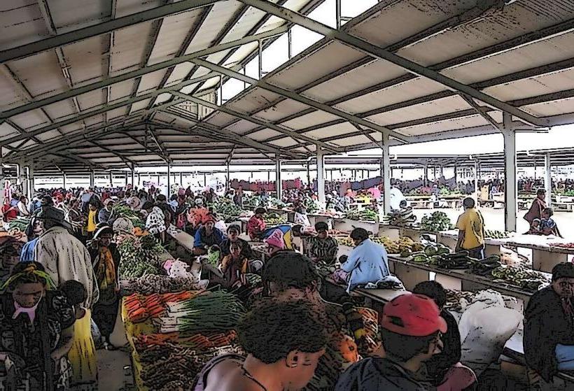
- Mount Hagen Market (2km East)
- Kuta Village (4km Southwest)
- Baisu Coffee Plantation (3km West)
- Baiyer River Sanctuary (15km North - outside 5km radius, but significant)