Landmark: West River Trail
City: Brattleboro
Country: USA Vermont
Continent: North America
West River Trail, Brattleboro, USA Vermont, North America
The West River Trail is a multi-use recreational path located in Brattleboro, Vermont. It follows the course of the West River through varied terrain.
Visual Characteristics
The trail surface consists of packed gravel and dirt, with sections of boardwalk over marshy areas. The path is generally 2-3 meters wide. It is bordered by deciduous forest, with the West River visible to the south for much of its length. The river's water color varies from brown to green depending on recent rainfall and sediment load. Rock outcroppings and exposed bedrock are present along the riverbanks.
Location & Access Logistics
The West River Trail begins at the intersection of Route 142 and the Brattleboro Recreation Path, approximately 1.5km west of Brattleboro's downtown center. Parking is available at the Brattleboro Recreation Path trailhead. Public transport options are limited; the nearest bus stop for the Brattleboro Green Line is at the intersection of Route 142 and Main Street, requiring a 1km walk to the trailhead.
Historical & Ecological Origin
The trail was developed on the former right-of-way of the West River Railroad, which operated from 1879 to 1942. The railroad was primarily used for transporting lumber and agricultural products. Ecologically, the area is part of the Connecticut River watershed, characterized by riparian forest and wetland habitats.
Key Highlights & Activities
Activities include walking, running, and cycling. Birdwatching is possible along the river and in adjacent wooded areas. Fishing is permitted in the West River, subject to Vermont state regulations. The trail offers access points for launching kayaks or canoes during periods of sufficient water flow.
Infrastructure & Amenities
Restrooms are available at the Brattleboro Recreation Path trailhead. There are no designated shade structures along the trail itself. Cell phone signal (4G/5G) is generally available, though it may be intermittent in more remote sections. No food vendors are located directly on the trail; options are available in downtown Brattleboro.
Best Time to Visit
For photography, early morning or late afternoon light provides optimal illumination of the river and forest. The months of May through October offer the most favorable weather conditions for outdoor activities. High tide is not a significant factor for trail access, but river levels can affect water-based activities.
Facts & Legends
A local anecdote suggests that during the railroad's operation, a particular section of the trail was known for frequent deer crossings, leading to occasional delays for trains. The trail's elevation gain is minimal, making it accessible for most fitness levels.
Nearby Landmarks
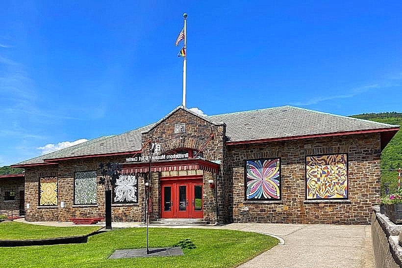
- Brattleboro Museum & Art Center (1.2km East)
- Fort Dummer State Park (3.5km South)
- Putney Mountain Observatory (4.8km North)
- Downtown Brattleboro (1.5km East)