Landmark: Wickford Village
City: North Kingstown
Country: USA Rhode Island
Continent: North America
Wickford Village, North Kingstown, USA Rhode Island, North America
Wickford Village is a historic village located in North Kingstown, Rhode Island, USA. It is recognized for its well-preserved colonial architecture and waterfront setting.
Visual Characteristics
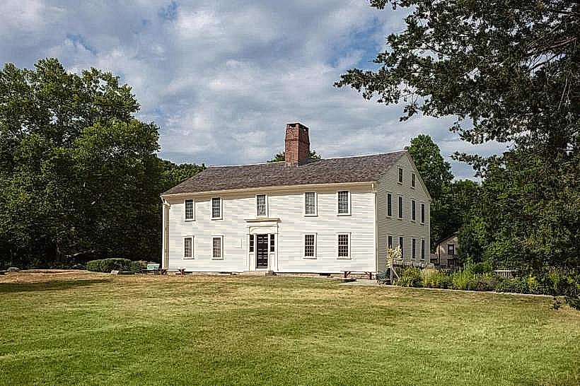
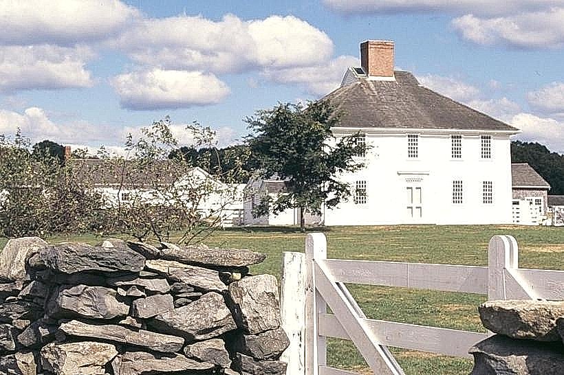
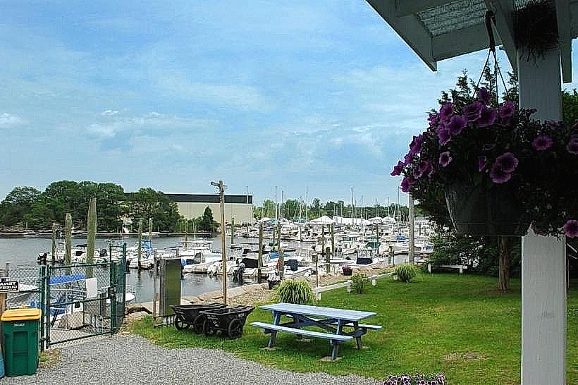
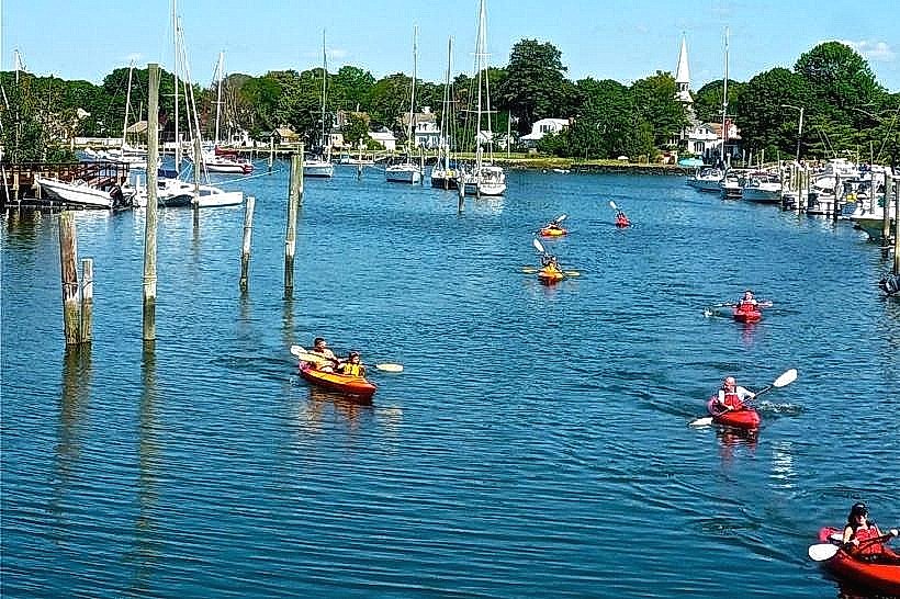
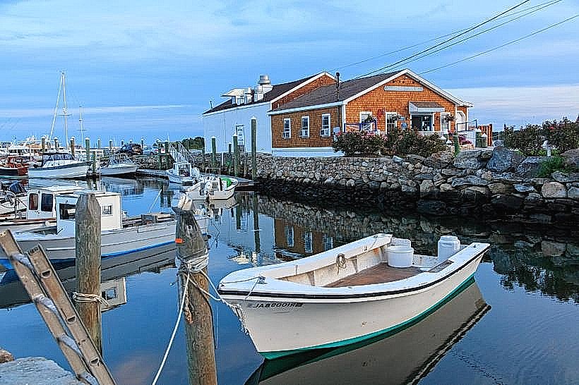
The village features numerous colonial-era structures constructed primarily from wood and stone. Buildings exhibit clapboard siding, often painted in muted historical colors such as white, grey, and light blue. Rooflines are typically gabled. The village is situated along the western shore of Narragansett Bay, with many properties offering views of the water. Streets are lined with mature trees, contributing to a shaded environment.
Location & Access Logistics
Wickford Village is situated approximately 15 miles south of Providence, Rhode Island. Access is primarily via Route 1A (Tower Hill Road). From I-95 South, take Exit 9 for Route 1 North, then follow signs for Route 1A South. Parking is available in designated public lots, including one near the Wickford Train Station and along the waterfront. The Wickford Junction MBTA Commuter Rail station provides direct service from Boston and Providence, with a short walk to the village center. Local bus routes, such as RIPTA Route 64, also serve the area.
Historical & Ecological Origin
Wickford was settled in 1637 by Roger Williams, who named it after Wickford in Essex, England. It served as a significant port and shipbuilding center in the colonial era. Many of the existing buildings date from the 18th and 19th centuries, representing a period of prosperity driven by maritime trade and agriculture. The village's location on Narragansett Bay is an estuary, influenced by tidal patterns and supporting marine life.
Key Highlights & Activities
Walking tours of the historic district are recommended to observe the architecture. Boat tours of Narragansett Bay depart from the Wickford Marina. Fishing and kayaking are possible from public access points along the waterfront. Browsing the shops and galleries located on Brown Street and West Main Street is a common activity.
Infrastructure & Amenities
Public restrooms are available in the vicinity of the town square and marina. Shade is provided by mature trees along streets and in public parks. Cell phone signal (4G/5G) is generally reliable within the village center. Several restaurants and cafes are located within walking distance of the main streets.
Best Time to Visit
For optimal lighting for photography of the colonial architecture, early morning or late afternoon is recommended. The months of May through October offer the most pleasant weather for outdoor exploration. High tide can enhance the visual appeal of the waterfront areas.
Facts & Legends
A notable historical oddity is the presence of the Smith's Castle, a 17th-century stone house located a short distance from the village center, which served as a colonial administrative building and was burned by the British during the Revolutionary War. A local legend speaks of a hidden tunnel connecting the waterfront to older buildings, though its existence is unverified.
Nearby Landmarks
- Smith's Castle (1.5km West)
- North Kingstown Free Library (0.8km Northwest)
- Fort Adams State Park (12km Southeast, across the bay)
- Beavertail State Park (15km Southeast, across the bay)
- Jamestown Windmill (10km Southeast, across the bay)