City: Barka
Country: Oman
Continent: Asia
Barka, Oman, Asia
Barka is a coastal administrative center in the Al Batinah South Governorate, located approximately 80 kilometers west of the capital. The city serves as a critical agricultural and fishing hub, positioned strategically between the Gulf of Oman and the fertile Batinah coastal plain with Muscat being the nearest major metropolitan center.
History & Culture
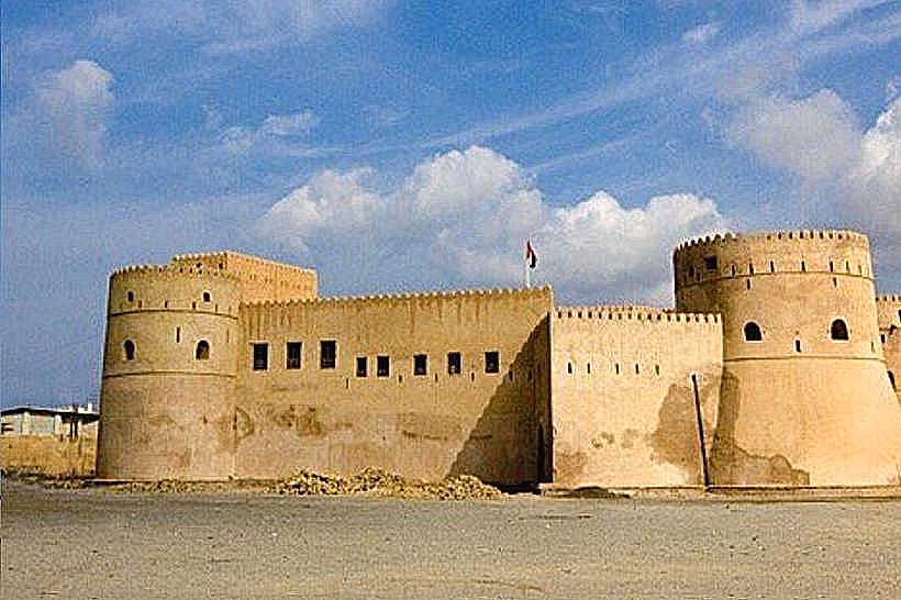
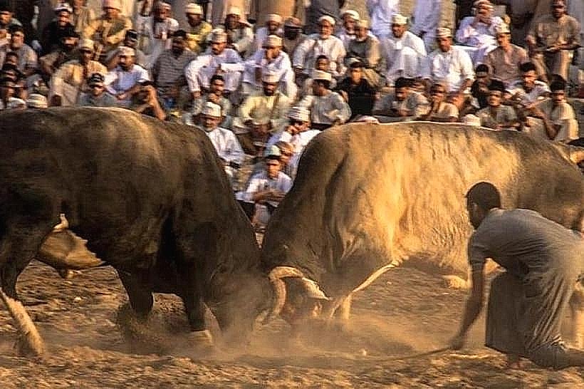
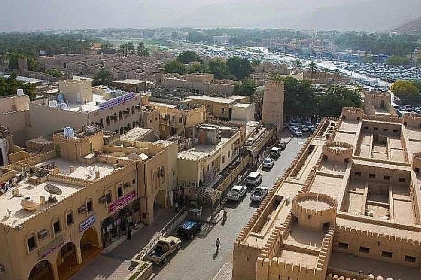
Barka transitioned into a significant administrative post during the Al Said dynasty in the 18th century, marked by the construction of the Barka Fort. The city’s culture is deeply rooted in maritime trade and camel racing, which remain central to local identity. Islam is the primary religious affiliation. The most significant social etiquette norm involves the traditional "Bull Butting" events (non-lethal wrestling), where spectators are expected to maintain a respectful distance and adhere to local dress codes.
Language & Communication
Arabic is the official language. English proficiency is medium, being functional in commercial retail and hospitality but limited among the fishing and farming labor force. The Batinah Arabic dialect is the dominant local variation.
Population & Economy
The population is approximately 150,000, with a mix of urban coastal settlements and rural farming interior. The top three export commodities are dates, fresh fish, and poultry. GDP per capita aligns with the national average of $25,000 USD. The labor market is driven by the Al Batinah logistics corridor and the large-scale desalination and power plants located in the industrial zone.
Visa & Entry Policy
Entry follows Omani national regulations. EU, US, and UK passport holders are eligible for 14-day visa-free entry. For longer durations, the E-Visa system is mandatory. There are no internal border controls between Barka and the capital, though valid residency or tourist documentation must be presented at hotels.
Currency & Payment Systems
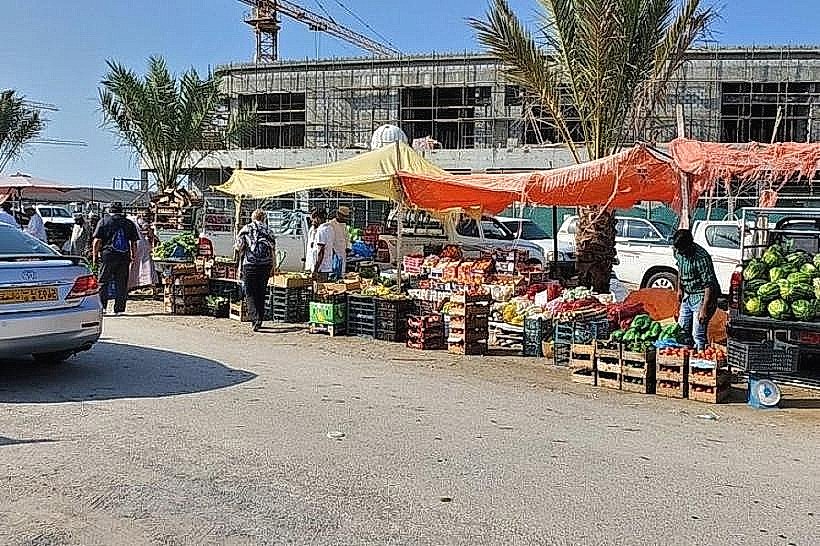
The currency is the Omani Rial (OMR). Card payments and tap-to-pay are standard at fuel stations and supermarkets, but cash is the primary medium at the Barka Fish Souq and traditional markets. ATMs are readily available along the main Sultan Qaboos Highway.
National Transport Grid
Barka is a major transit point on the Sultan Qaboos Highway (Route 1). Mwasalat intercity buses frequently stop in Barka on routes between Muscat and Sohar. There is no rail or domestic flight service; travelers rely on private vehicles or shared taxis operating from the Barka bridge interchange.
Digital Infrastructure
Omantel, Ooredoo, and Vodafone Oman are the primary providers. 5G coverage is stable in the town center and residential areas. 4G coverage is consistent along the coastal strip but can fluctuate in the agricultural farmlands (farms) further inland.
Climate & Seasonality
The climate is hot and humid. Summers (May to September) see temperatures exceeding 40°C with high humidity due to coastal proximity. The dry, cooler season from October to April is the primary period for tourism and outdoor events. Rainfall is sporadic and occurs mainly in January and February.
Health & Safety
No mandatory vaccines are required for entry. High humidity in summer poses a risk of heat-related illnesses. The emergency number for Police, Fire, and Ambulance is 9999.
Top Major Regions & Cities
Barka Fort & Old Souq: The historical and commercial hub located near the shoreline.
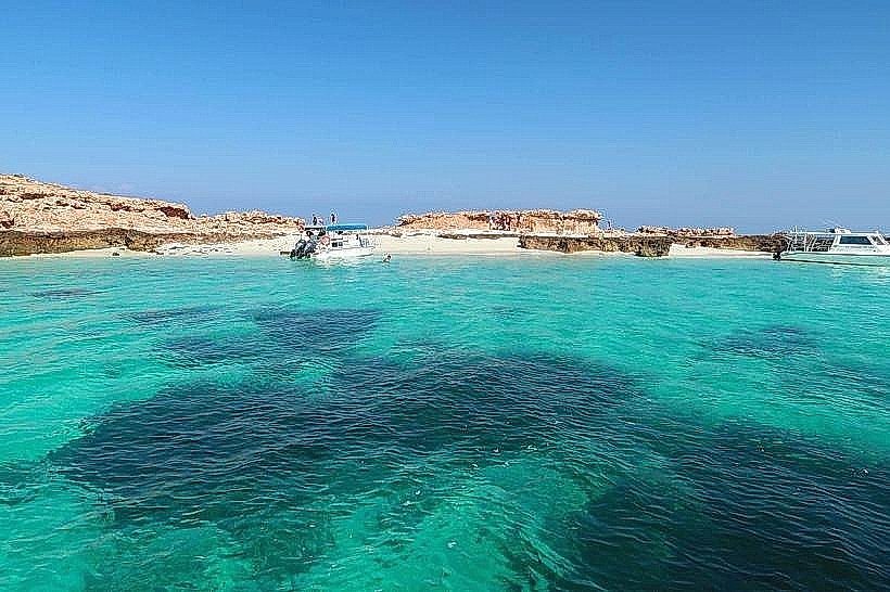
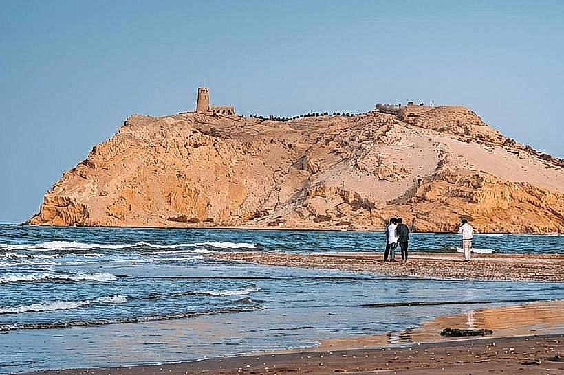
Al Sawadi Beach: A primary coastal region known for its proximity to the Damaniyat Islands.
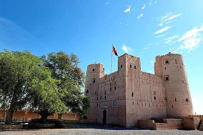
An Naman: A rural inland hub featuring the historic An Naman Castle.
Barka Industrial Area: The economic hub housing the region’s desalination and power infrastructure.
Local Cost Index
1L Water: 0.200 OMR ($0.52 USD)
1 Domestic Beer: 4.000 OMR ($10.40 USD) - Note: Available only in specific resort hotels.
1 Sim Card (10GB Data): 5.000 OMR ($13.00 USD)
Facts & Legends
Barka is the site of the Bait Na'aman, a 17th-century fortified house that served as a secret coastal retreat for the Imams. Local legend suggests that the fort was built with a hidden underground tunnel leading toward the sea to allow for a discrete escape during naval sieges by the Portuguese.