City: Gicumbi
Country: Rwanda
Continent: Africa
Gicumbi, Rwanda, Africa
Gicumbi serves as the primary gateway to Rwanda’s Northern Province and a strategic high-altitude agricultural hub. The city is situated on a rugged plateau at an elevation of 2,200 to 2,400 meters, overlooking the primary transit corridor between Kigali and the Ugandan border.
Historical Timeline
Gicumbi, historically known as Byumba, was established as a colonial administrative post by Belgian authorities in the 1920s to manage the northern highlands. The city underwent significant political and infrastructural shifts during the 1990s as a focal point of the liberation struggle. The primary event shaping its current urban form was the 2006 administrative reform, which designated the city as the capital of the Gicumbi District. Recent reconstruction has been defined by the "Green Gicumbi" initiative (2019–2022), a climate-resilience project that modernized the city’s drainage and terrace systems to combat high-altitude erosion.
Demographics & Population
The total population of the Gicumbi district is 448,824 (2022 Census), with the urban center housing approximately 28,131 residents. The demographic is 99.9% Rwandan, with a median age of approximately 19.8 years. The city has a high density of agricultural professionals and civil servants relative to its size.
Urban Layout & Key Districts
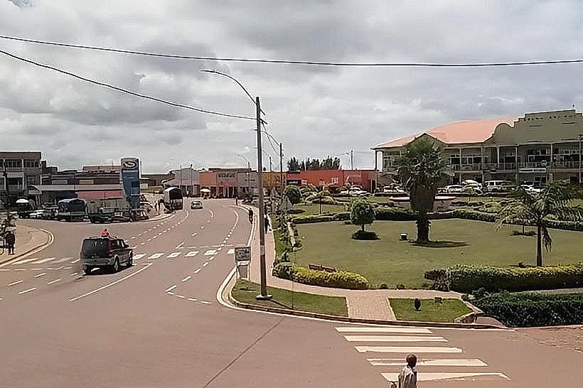
The city is organized along a narrow, winding ridge that follows the RN3 highway. The Administrative Core (Byumba) contains the district offices, the main cathedral, and the financial sector. The Market District is located on the northern slope, serving as the central trading post for northern tea and dairy. Kibali is a primary educational and residential sector located to the south, characterized by steep gradients and panoramic views of the Virunga Mountains.
Top City Landmarks
Byumba Cathedral: A prominent red-brick structure and one of the largest religious landmarks in northern Rwanda.
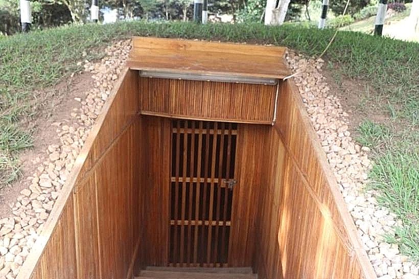
National Liberation Museum Park (Mulindi): Located nearby, this site preserves the bunkers used as headquarters during the 1990–1994 liberation war.
University of Technology and Arts of Byumba (UTAB): The city’s primary academic institution and a hub for regional research.
Green Gicumbi Terraces: A massive engineered landscape of radical terraces surrounding the city, showcasing climate-resilient agriculture.
Gisuna Parking & Transit Hub: A vital logistical node for heavy freight moving between Kigali and the Gatuna border.
Transportation Network
Movement within Gicumbi is conducted via Moto-taxis, with drivers wearing green or yellow vests. Due to the extreme verticality of the terrain, bicycle taxis are not operational. Public transit is serviced by Ritco and Stella Express, providing hourly bus links to Kigali (1.5 hours) and the Ugandan border at Gatuna. There is no metro or tram system. Official taxis are white with orange stripes. Traffic density is low, though the main highway is a major route for international fuel and cargo trucks.
Safety & "Red Zones"
Gicumbi is categorized as exceptionally safe. There are no designated "red zones." Pedestrian vigilance is required on the RN3 highway after dark due to heavy fog and truck traffic. Common scams are negligible, though "unofficial" guides may occasionally offer transit to historical sites at inflated prices.
Digital & Financial Infrastructure
Average internet speed is 15-25 Mbps, with 4G LTE coverage provided by MTN and Airtel. Card acceptance is low, limited to the main hotels and district administrative offices. Bank of Kigali and BPR Bank maintain the primary international ATMs in the Byumba commercial district.
Climate & Air Quality
The climate is cool and temperate (highland), with temperatures ranging from 10°C to 22°C. Gicumbi is one of the wettest and foggiest cities in Rwanda, with high rainfall from March to May. Air quality is pristine due to high altitude and the lack of heavy industry, though evening visibility is frequently compromised by dense mountain mist.
Culture & Social Norms
Tipping is not standard; 1,000 RWF is appreciated for market porters. Greetings are formal and usually begin with a handshake. Dress is conservative and functional; due to the cold climate, heavy knitwear and waterproof jackets are the local norm. Public smoking is rare and socially discouraged in communal gatherings.
Accommodation Zones
Stay in Byumba (Center) for immediate logistical access to transport, banks, and the main market.
Stay in the Lake Muhazi Periphery (Southern Gicumbi) for quiet eco-resorts and lakeside recreation.
Local Cost Index
1 Espresso: 1,800 RWF ($1.40 USD)
1 Standard Lunch: 3,500 RWF ($2.70 USD)
1 Bus Ticket (to Kigali): 1,800 RWF ($1.40 USD)
Nearby Day Trips
Gatuna Border: 25 km (40 mins) to view the international trade corridor with Uganda.
Mulindi Bunkers: 15 km (25 mins) for historical military tours.
Lake Burera: 45 km (1.5 hours) for volcanic lakeside views.
Kigali: 60 km (1.5 hours) for metropolitan services.
Facts & Legends
Gicumbi is the subject of a local "urban legend" regarding the Mulindi Bunkers, where it is claimed that an underground tunnel system once connected the bunkers directly to the Ugandan border, though no such tunnels have ever been verified by archaeologists. Historically, the city is known as the "Place of the Throne" (Gicumbi), a name referring to its traditional role as a high-altitude sanctuary where royal messengers would stop to rest before entering the central Rwandan kingdom.