City: Kedougou
Country: Senegal
Continent: Africa
Kedougou, Senegal, Africa
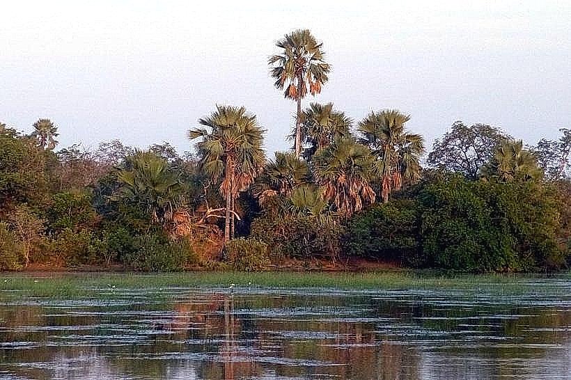
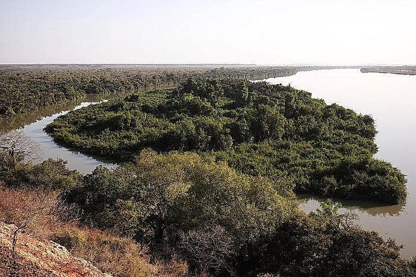
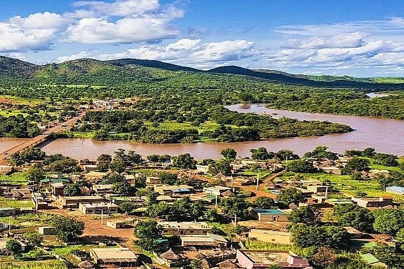
Kedougou serves as the administrative capital of the eponymous region in the extreme southeast of Senegal, functioning as a critical gateway to the Futa Jallon highlands and the mining and agricultural heartlands bordering Guinea and Mali. Its geographic position on the Gambia River makes it a vital hub for cross-border trade and the primary logistical base for the nation's gold mining industry.
Historical Timeline
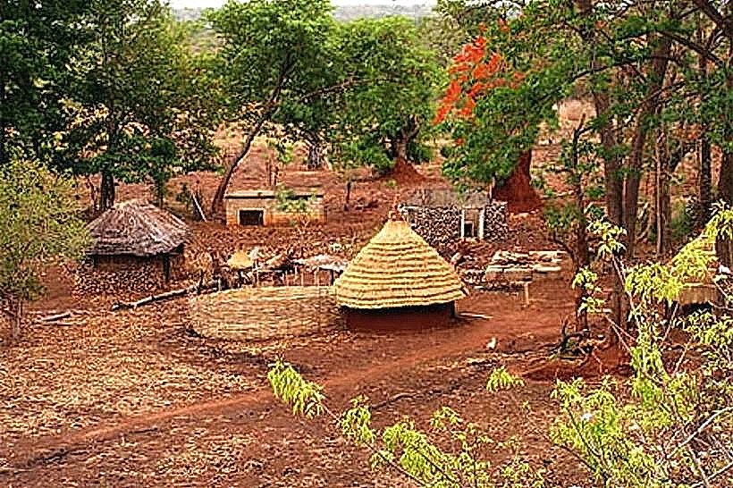
Founded originally as a small settlement within the pre-colonial Bedik and Bassari territories, Kedougou remained a remote outpost until the 19th century when it was integrated into the French colonial administrative structure. The primary eras of governance include the decentralized ethnic chieftaincies, the French colonial administration (1890s–1960), and the post-independence era marked by industrialization. The most significant architectural and infrastructure reconstruction began in the early 2000s, accelerated by the 2008 gold mining boom. The primary event shaping the current urban form is the 2008 elevation to Regional Capital status, which triggered a surge in administrative buildings and standardized road grids.
Demographics & Population
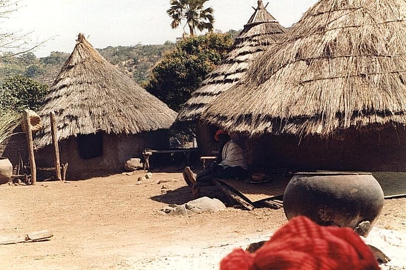
The total population within the city limits is approximately 40,000, while the regional population exceeds 150,000. The top three ethnic demographics are the Mandinka, Pulaar (Fula), and Bassari. The median age of the population is approximately 18.3 years.
Urban Layout & Key Districts
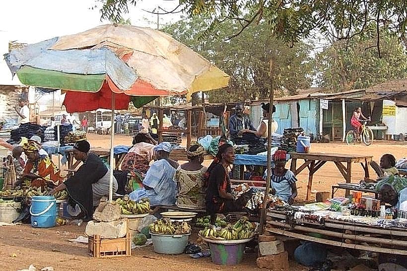
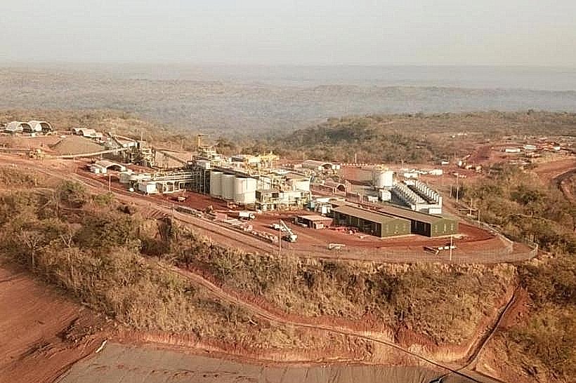
The city is organized along the N7 highway and the northern bank of the Gambia River. Centre-Ville (Central) contains the administrative offices, the regional hospital, and the main market; Quartier Mosquée (North) is the high-density residential and religious core; and the Industrial Zone (East) houses the logistical depots for the Sabodala-Goldfields operations.
Top City Landmarks
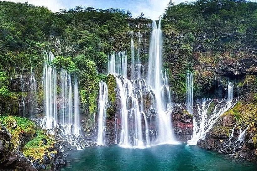
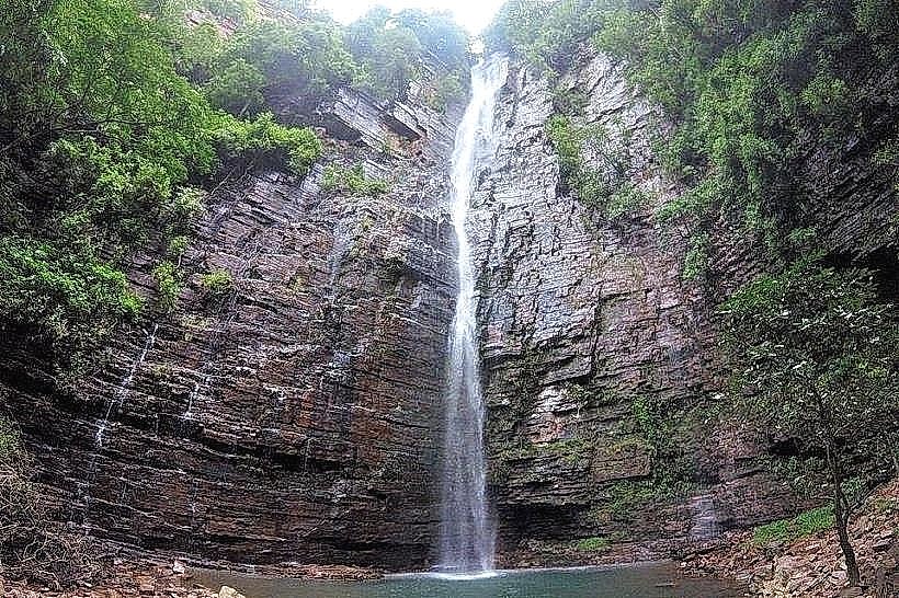
Dindefelo Falls (nearby)
Kedougou Central Mosque
The Gambia River Bridge
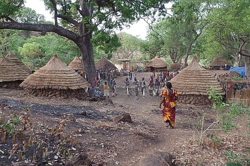
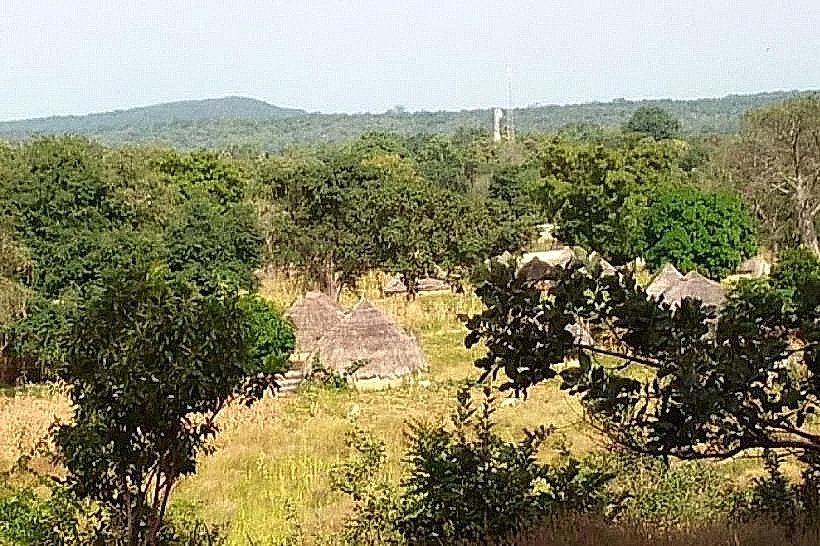
Bedik Cultural Village of Iwol (nearby)
Kedougou Marketplace
Transportation Network
Movement within the city is conducted via "Jakarta" motorbike taxis and yellow-and-black unmetered taxis. There are no metro, tram, or formal bus systems. Long-distance transit is managed via the "Garage Routier" using "sept-places" or larger buses connecting to Tamabacounda and Dakar. The N7 highway is the primary artery, though road quality degrades significantly during the rainy season. Traffic density is moderate, peaking during market days when mining transport trucks transit the city center.
Safety & "Red Zones"
The general safety level is moderate to high within the city. Visitors should avoid the artisanal mining sites (diouras) on the outskirts at night due to unregulated activity and potential for localized disputes. Common scams include "mineral dealers" attempting to sell fake gold or precious stones to foreign visitors in the central market.
Digital & Financial Infrastructure
Average fixed broadband speed is 10-25 Mbps. Main mobile carriers are Orange and Free, though coverage is intermittent outside the urban core. Card acceptance is extremely low; cash (XOF) is mandatory for almost all transactions. ATMs are limited, located primarily at CBAO and Ecobank branches in the city center.
Climate & Air Quality
Temperatures range from 18°C to 42°C. Kedougou is the wettest region in Senegal, experiencing a heavy monsoon season from June to October. Significant weather risks include seasonal flooding and extreme heat during April and May. Air quality is generally high, though dust levels rise during the Harmattan (December–February) and near the unpaved roads and mining transit routes.
Culture & Social Norms
Tipping is not mandatory but 500-1,000 XOF is appreciated for service. Handshakes are the standard greeting. Social norms are highly influenced by traditional Mandinka and Pulaar customs; modest dress is required, especially in residential and religious areas. Public displays of affection are discouraged.
Accommodation Zones
Quartier Escale: Stay here for proximity to administrative services, banks, and the most reliable electricity and water infrastructure.
Riverfront: Stay here for eco-lodges and guesthouses offering lower temperatures and proximity to natural sites.
Local Cost Index
1 Espresso: 1,500 XOF (2.50 USD) - restricted to high-end lodges.
1 Standard Lunch: 2,000 XOF (3.30 USD).
1 Metro/Bus Ticket: 200 XOF (0.35 USD) - local shared transport fare.
Nearby Day Trips
Dindefelo Falls: 35 km (1 hour via 4x4)
Iwol (Bedik Village): 25 km
Niokolo-Koba National Park: 90 km
Sabodala Gold Mine: 95 km
Facts & Legends
Local legend persists regarding the "Spirits of the Falls" at Dindefelo, where it is believed that the water's flow is governed by ancient protectors. Historically, Kedougou is noted for the "Gamon" festival, an annual traditional gathering of the Bassari people that involves elaborate masks and rituals to celebrate the harvest and initiate youth into adulthood, maintaining a cultural lineage distinct from the more Islamized northern regions of Senegal.