City: Kogi
Country: Nigeria
Continent: Africa
Kogi, Nigeria, Africa
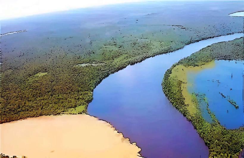
Kogi is a central Nigerian state serving as the principal transit gateway between the northern and southern regions of the country. It is geographically defined by the confluence of the Niger and Benue Rivers at its capital, Lokoja.
Historical Timeline
Lokoja was founded in 1857 by British explorer William Baikie at the site of a previous 1841 agricultural expedition. It served as the first administrative capital of the British Northern Nigeria Protectorate and was the military headquarters for the Royal Niger Company from 1886 to 1900. The primary event shaping its current urban form was the 1914 Amalgamation of Northern and Southern Nigeria, during which Sir Frederick Lugard governed from the city, followed by its designation as the capital of the newly created Kogi State in 1991.
Demographics & Population
The estimated metropolitan population of Lokoja for 2026 is 975,000, with the state population exceeding 5.2 million. The top three ethnic demographics are the Igala (45%), Ebira (27%), and Okun (Yoruba-related, 18%). The median age is 18.9 years.
Urban Layout & Key Districts
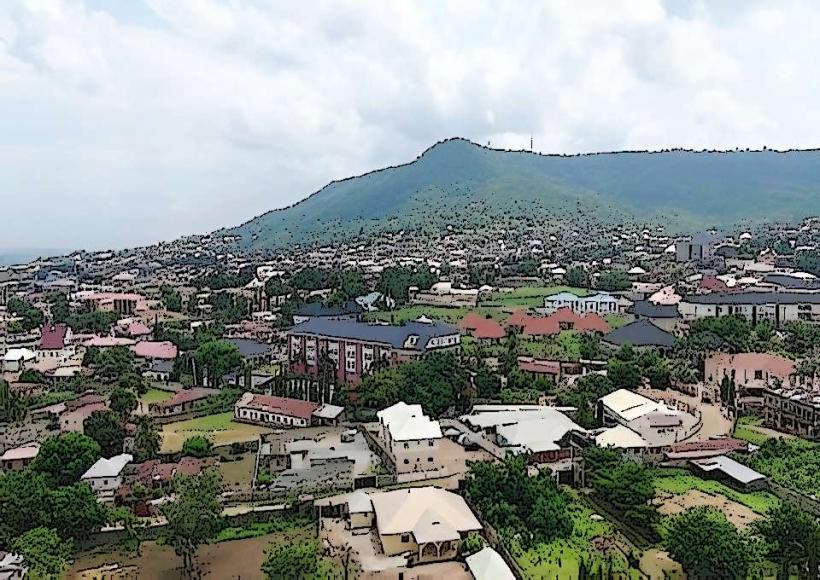
The city is organized along a north-south axis constrained by Mount Patti to the west and the Niger River to the east. Key districts include the Government Residential Area (GRA) in the central-west, the historic "Old City" near the palace, and the rapidly expanding Felele and Adankolo districts along the A2 highway.
Top City Landmarks
Mount Patti (1,349-foot plateau)
The Confluence Point (Niger and Benue Rivers)
Lord Lugard’s First Residence and Office
The European/Colonial Cemetery
Museum of Colonial History
Transportation Network
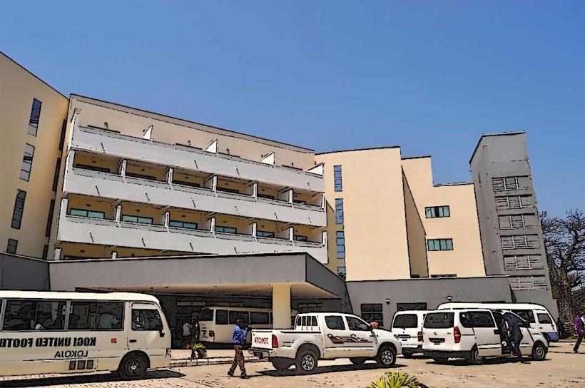
Intra-city movement is facilitated by "Keke Napep" (tricycles) and green-painted commercial taxis. There is no metro or tram network. Ride-sharing apps like Uber or Bolt have negligible presence; local transit is coordinated via the Lokoja Mega Terminal. Traffic density is high at the "Confluence Flyover" and along the Abuja-Okene road, a major national artery for haulage trucks.
Safety & "Red Zones"
The general safety level is moderate, though the state serves as a transit corridor for kidnapping-for-ransom operations. Specific neighborhoods to avoid at night include the peripheries of Felele and the dense alleys of the Old City. Travelers are advised against night transit on the Lokoja-Okene and Lokoja-Kabba highways due to banditry risks.
Digital & Financial Infrastructure
The average internet speed is 20-30 Mbps. Main mobile carriers are MTN, Airtel, and Globacom (Glo). Card acceptance is high in hotels and supermarkets within the GRA but non-existent in traditional markets. ATMs are concentrated in the "Bank Road" sector of the city center.
Climate & Air Quality
Temperatures range from 22°C in the rainy season to 41°C during the peak dry season (March–April). Air quality is frequently poor (AQI >100) due to Saharan dust during the Harmattan and industrial emissions from the nearby Obajana cement plant. Significant weather risks include severe seasonal flooding between August and October.
Culture & Social Norms
Tipping is not mandatory but ₦500–₦1,000 is customary for hotel and restaurant staff. The standard greeting is a handshake, often accompanied by a slight bow to elders. Dress codes are conservative; modest clothing is expected in public spaces and religious sites. Alcohol consumption is generally permitted but restricted to specific leisure zones and hotels.
Accommodation Zones
Lokoja GRA: Recommended for security, consistent power supply, and proximity to government offices.
Lokongoma Phase II: Recommended for a quiet residential atmosphere and modern apartment-style lodging.
Local Cost Index
1 Espresso (at a major hotel): ₦2,500 ($1.60 USD)
1 Standard Lunch (Rice/Plantain): ₦5,500 ($3.50 USD)
1 Keke Napep Drop: ₦300 ($0.19 USD)
Nearby Day Trips
Ajaokuta Steel City: 45 km
Idah (Historic Igala Kingdom Capital): 110 km
Abuja (National Capital): 214 km
Ososo Hill Resort (Edo State): 105 km
Facts & Legends
Local history records that the name "Nigeria" was coined by Flora Shaw (later Lady Lugard) in 1897 while she was looking out at the Niger River from the summit of Mount Patti. A persistent local legend claims that the "Iron of Liberty"-a monument in Lokoja-marks the exact spot where slaves were formally emancipated by British naval officers in the mid-19th century, with the iron rod symbolizing the breaking of physical chains.