
City: Nyagatare
Country: Rwanda
Continent: Africa
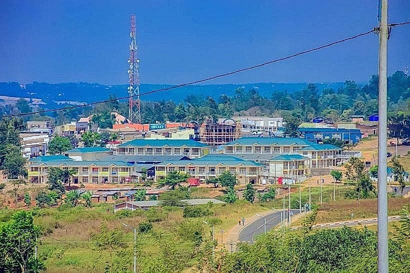
Nyagatare, Rwanda, Africa
Nyagatare serves as the preeminent cattle-ranching and agricultural hub of northeastern Rwanda, acting as the administrative capital of the country’s largest district. It is strategically positioned near the border tripoint of Rwanda, Uganda, and Tanzania, characterized by a low-lying savannah plateau.
Historical Timeline
Nyagatare’s modern urban identity emerged post-1994, transitioning from a sparsely populated grazing area into a primary resettlement zone for returning Rwandan refugees. It previously served as the capital of the now-defunct Umutara Province before the 2006 administrative restructuring. The most significant architectural expansion occurred after 2013 when the city was designated as one of Rwanda's six "Secondary Cities." The primary event shaping its current urban form was the massive post-conflict influx of population seeking land for large-scale livestock farming, leading to a rapid transition from rural village to an organized urban grid.
Demographics & Population
The Nyagatare district population is approximately 653,861 (2022 Census), making it the second most populous district in Rwanda. The urban core houses roughly 52,000 residents. The demographic is noted for its high percentage of returnees from neighboring East African countries, contributing to a linguistically diverse environment. The median age is 19.1 years.
Urban Layout & Key Districts
The city is organized around a central commercial spine along the main highway. The District HQ District serves as the administrative center in the town's northern sector. The University Zone (Mutara) is located to the east, anchored by the University of Rwanda campus. Ryabega, situated 9km south of the center, functions as a critical transport junction where the roads to Kigali and the Ugandan border diverge.
Top City Landmarks
University of Rwanda (Nyagatare Campus): A sprawling hilltop campus and the intellectual center of the Eastern Province.
Mantis EPIC Hotel & Suites: The city’s premier modern architectural landmark, featuring international-standard resort facilities.
Nyagatare Stadium: A central venue for regional sports and major national celebrations.
Umuvumba River Front: The primary hydrological feature of the city, providing a vital water source for the region's vast cattle herds.
The "Gate to the North": The Kagitumba border post infrastructure, representing the city’s role in international trade.
Transportation Network
Movement within the city is dominated by Moto-taxis, with drivers wearing green or yellow vests. Due to the flatter terrain compared to the rest of Rwanda, Bicycle-taxis are also a common and affordable transit option. There is no metro or tram system. Ritco and Stella Express provide consistent bus links to Kigali (approx. 3 hours). Traffic density is low within the city but high at the Ryabega junction. Official taxis are white with an orange stripe.
Safety & "Red Zones"
Nyagatare is categorized as highly safe. There are no specific "red zones" or neighborhoods to avoid. Visitors should exercise caution near the Umuvumba River during the rainy season due to hippopotamus activity. Common scams are rare and typically limited to minor overcharging for motorbike fares for non-residents.
Digital & Financial Infrastructure
Average internet speed is 20-30 Mbps, with reliable 4G LTE coverage from MTN and Airtel. Card acceptance is high at the EPIC Hotel but remains low in the general market area. Bank of Kigali and BPR Bank maintain the primary international ATMs in the central commercial district.
Climate & Air Quality
The climate is tropical semi-arid and is among the warmest in Rwanda, with temperatures ranging from 20°C to 30°C. The region is prone to seasonal droughts. Air quality is generally good, though "Very Unhealthy" PM2.5 levels can occur during the dry season (June–August) due to dust from the plains and agricultural burning.
Culture & Social Norms
Tipping is not standard; 500–1,000 RWF is appreciated for hotel staff. Handshakes are the standard greeting. The local culture is heavily influenced by "cattle culture," where livestock is a primary symbol of wealth and status. Dress is casual but conservative; academic and professional attire is expected in the University and District HQ zones.
Accommodation Zones
Stay in the Town Center (Nyarushanje) for immediate access to banks, transport links, and local dining.
Stay in the University/Resort Zone (East) for higher-end amenities and quieter surroundings.
Local Cost Index
1 Espresso: 2,200 RWF ($1.65 USD)
1 Standard Lunch: 4,000 RWF ($3.05 USD)
1 Moto-taxi (Short trip): 600 RWF ($0.45 USD)
Nearby Day Trips
Akagera National Park (North Gate): 30 km (45 mins) for safari exits and wildlife viewing.
Kagitumba Border: 35 km (45 mins) to view the Rwanda-Uganda trade corridor.
Mimuli Sector: 25 km (40 mins) for visiting traditional large-scale cattle ranches.
Gabiro: 45 km (1 hour) for historical and military landmarks.
Facts & Legends
Nyagatare is the subject of a modern "urban legend" regarding its rapid growth; locals claim the city "rose from the grass overnight," referring to its transformation from a wilderness area in 1994 to a secondary city in under two decades. It is also the only major city in Rwanda where you might see "traffic jams" caused by large herds of long-horned Inyambo cattle crossing the main tarmac roads, a sight that remains a verified historical oddity of the region's transition to urbanity.