City: Tambacounda
Country: Senegal
Continent: Africa
Tambacounda, Senegal, Africa
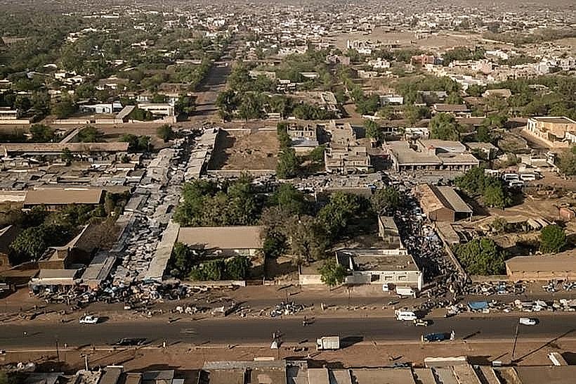
Tambacounda serves as the regional capital of eastern Senegal and the largest city in the country's interior. It functions as a critical logistical crossroads, linking the coastal capital of Dakar to the landlocked markets of Mali, Guinea, and Burkina Faso.
Historical Timeline
Founded in the early 20th century as a key station on the Dakar-Niger Railway, the city transitioned from a minor French colonial outpost to a strategic transport hub. Primary eras of governance include French colonial rule (1900s–1960) and the post-independence era, during which it became a regional administrative center. The most significant architectural reconstruction occurred in the mid-20th century with the expansion of the railway infrastructure. The primary event shaping the current urban form was the completion of the paved N1 and N7 highways, which shifted the city's economic center from the rail station toward the major road junctions.
Demographics & Population
The total population within the city and commune is approximately 149,071 (2023 census), while the surrounding department exceeds 427,000. The top three ethnic demographics are the Pulaar (Fula), Wolof, and Mandinka. The median age of the population is approximately 18.5 years.
Urban Layout & Key Districts
The city is organized in a radial pattern around the central railway station and the intersection of the N1 and N7 highways. Escale (Central) serves as the historic commercial and administrative core containing the main banks and colonial-era buildings; Liberté (North) is a high-density residential zone; and Quinzambougou (East) is a major residential and artisanal district.
Top City Landmarks
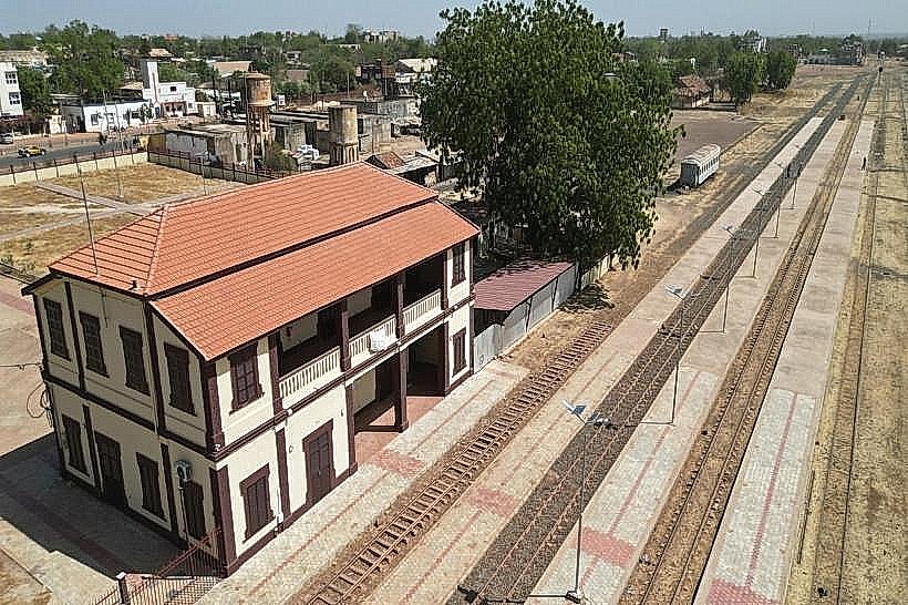
Tambacounda Railway Station (Gare de Tambacounda)
Grande Mosquée de Tambacounda
Regional Cultural Center (Centre Culturel Régional)
Cathédrale Marie Reine de l'Univers
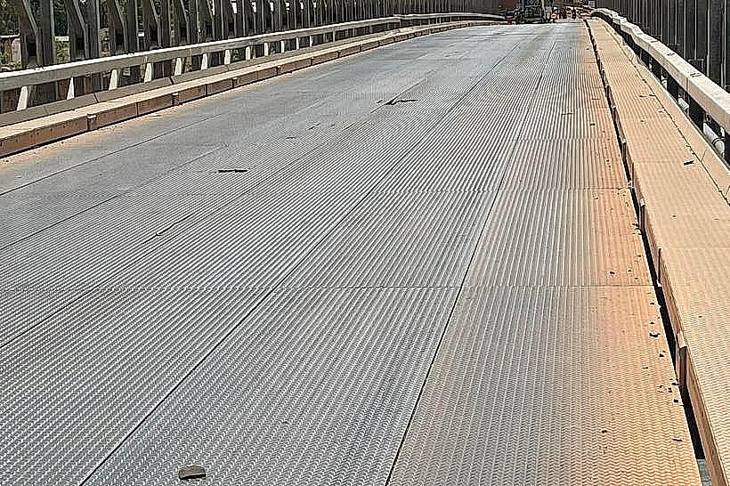
The Iron Bridge (Pont de Fer)
Transportation Network
Movement within the city is conducted via "Jakarta" motorbike taxis and yellow-and-black unmetered taxis. There are no Metro or Tram systems. Ride-sharing apps are not operational. Long-distance transit is managed via the "Gare Routière," utilizing "sept-places" (seven-seat taxis) and buses connecting to Dakar and Mali. The city is a major stop on the Dakar-Niger rail line, though passenger service is infrequent. Traffic density is moderate, peaking at the highway junctions.
Safety & "Red Zones"
The general safety level is high. There are no specific "red zones" or neighborhoods to avoid. Common scams involve "fixers" at the main bus station who attempt to overcharge for ticket reservations or luggage handling; visitors should always pay for tickets at the official desk or directly to the driver.
Digital & Financial Infrastructure
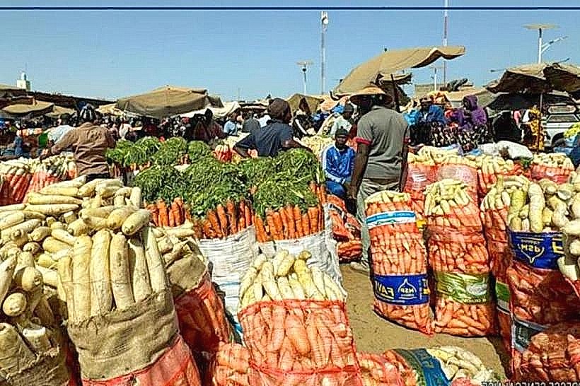
Average fixed broadband speed is 15-30 Mbps. Main mobile carriers are Orange, Free, and Expresso. Card acceptance is very low; cash is the primary medium for all local transactions. ATMs are located primarily in the Escale district near the main highway branches.
Climate & Air Quality
Temperatures are among the highest in Senegal, ranging from 18°C in winter nights to 42°C in summer days (April–May). The air quality is often "Unhealthy" during the dry season (November–May) due to PM 2.5 levels from Harmattan dust and localized biomass burning. Significant weather risks include extreme heat waves and seasonal flash flooding during the monsoon (July–September).
Culture & Social Norms
Tipping is not mandatory but 500-1,000 XOF is common in restaurants. Handshakes are the standard greeting. Social norms are conservative; modest dress is required in public. The city is a bastion of oral tradition and the "Ataaya" tea ceremony is a central social ritual. Public smoking and alcohol consumption are socially discouraged in many residential neighborhoods.
Accommodation Zones
Escale: Stay here for logistical proximity to the railway station, banks, and transport hubs.
Outskirts (N7 Road): Stay here for larger, air-conditioned hotels and guesthouses catering to transit travelers and mining personnel.
Local Cost Index
1 Espresso: 1,000 XOF (1.65 USD)
1 Standard Lunch: 2,000 XOF (3.30 USD)
1 Metro/Bus Ticket: 200 XOF (0.35 USD) - local shared taxi or minibus fare.
Nearby Day Trips
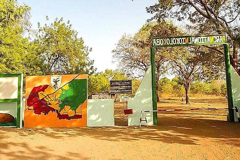
Niokolo-Koba National Park (Dar Salam Entrance): 90 km (1 hour 30 mins)
Wassadou (Gambia River views): 60 km (1 hour)
Gouloumbou Bridge: 35 km
Koumpentoum: 100 km
Facts & Legends
Tambacounda is known locally as "Tamba," and an enduring urban legend claims the city’s name originates from a Mandinka founder named "Tamba" and "Kounda" (house/place). Historically, it is regarded as the "Hottest Place on Earth" in Senegal; a local historical oddity is that during the colonial era, the heat was so intense that the railway tracks were reported to warp, requiring constant maintenance during the peak dry season months.