City: Warwick
Country: USA Rhode Island
Continent: North America
Warwick, USA Rhode Island, North America
Warwick serves as the primary transportation hub and retail center for the state of Rhode Island. It is located on the western shore of Narragansett Bay in the central part of the state, approximately 10 miles south of Providence.
Historical Timeline
Warwick was founded in 1642 by Samuel Gorton after he purchased the land from the Narragansett sachem Miantonomi. The town was significantly damaged during King Philip's War in 1676 and later transitioned from a series of agrarian villages into a major textile manufacturing center during the 19th century. The most significant architectural and logistical shift occurred in the mid-20th century with the expansion of Theodore Francis Green Airport and the construction of the Interstate 95 and I-295 interchange. The primary event shaping the current urban form was the 2010 flood of the Pawtuxet River, which forced a major redesign of the city's central commercial corridor and drainage infrastructure.
Demographics & Population
The population within city limits is approximately 83,000. The primary demographics are White (86.2%), Hispanic (5.4%), and Asian (3.2%). The median age is 44.4 years.
Urban Layout & Key Districts
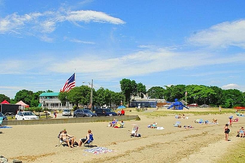
Warwick lacks a single dense core and is instead organized as a collection of 30 distinct villages. The most important districts for visitors are Apponaug (South), the seat of local government and a major traffic node; City Side/Hillsgrove (Central), containing the airport and transit hubs; and Oakland Beach (Southeast), the primary coastal recreation district.
Top City Landmarks
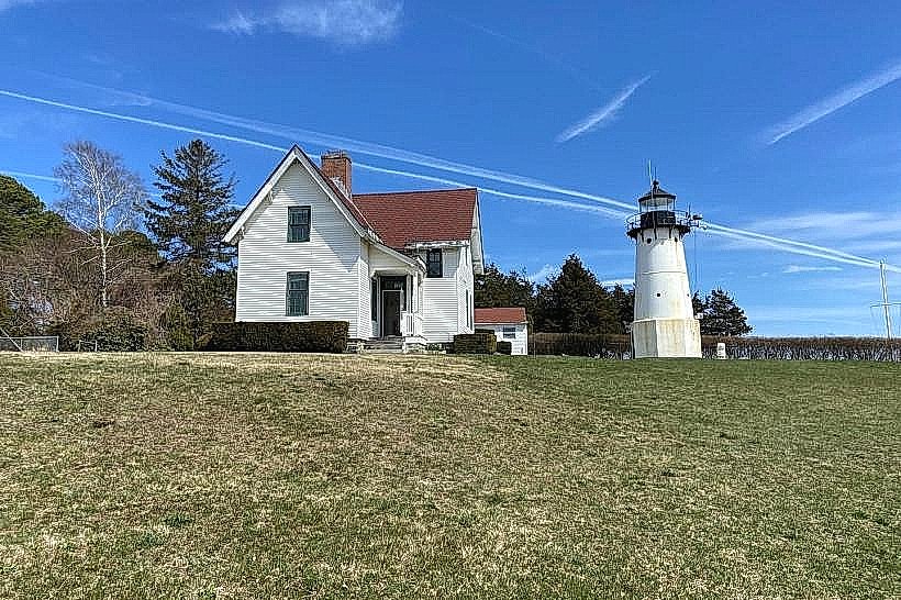
Warwick Light (Little North Point)
Clouds Hill Victorian Museum
Warwick City Hall (Apponaug)
Transportation Network
Warwick is the regional node for the Rhode Island Public Transit Authority (RIPTA) bus network. The InterLink facility connects T.F. Green International Airport to the MBTA Commuter Rail, providing service to Providence and Boston. Private vehicles are the dominant mode of transport, and the city contains the state's highest concentration of highway interchanges. Uber and Lyft are highly active. Official taxis are typically white or yellow. Traffic density is high, particularly at the "Apponaug Circulator" and the Route 2 retail corridor.
Safety & "Red Zones"
The general safety level is high. There are no specific "red zones" or neighborhoods to avoid, though the commercial areas around the malls (Route 2) experience high rates of vehicular accidents and property crime (larceny). Common scams are negligible.
Digital & Financial Infrastructure
Average internet speed is 250–600 Mbps via Cox or Verizon Fios. Main mobile carriers are Verizon, AT&T, and T-Mobile. Card acceptance is universal. ATMs are dense along the Post Road (US-1) and Bald Hill Road (RI-2) corridors.
Climate & Air Quality
Temperatures range from -4°C in January to 27°C in July. The city's 39 miles of coastline make it susceptible to coastal flooding and humidity. Air quality is generally good, though proximity to the airport and major highway intersections can lead to localized increases in particulate matter during peak travel periods.
Culture & Social Norms
Tipping is expected at 18–20% for service. Handshakes are the standard greeting. Dress is generally casual, though professional attire is common in the business districts near the airport. Smoking is prohibited in all public indoor spaces; Rhode Island state law strictly regulates alcohol sales to licensed liquor stores and bars.
Accommodation Zones
Stay in the Hillsgrove/Post Road area for immediate access to the airport and commuter rail.
Stay in the Cowesett/Potowomut area for a quieter, residential atmosphere near the water.
Local Cost Index
1 Espresso: $4.00 (700 JPY)
1 Standard Lunch: $16.50 (2,915 JPY)
1 Bus Ticket: $2.00 (354 JPY)
Nearby Day Trips
East Greenwich Historic District (5 miles south)
Wickford Village (12 miles south)
Providence (10 miles north)
Goddard Memorial State Park (within city limits/adjacent)
Facts & Legends
Warwick was the site of the first blood drawn in the American Revolution: the 1772 burning of the British schooner Gaspee by local colonists in Namquid Point (now Gaspee Point). A local urban legend involves "The Drummer Boy of Apponaug," a spectral figure said to be heard during winter storms near the site of an old colonial-era tavern.