Landmark: Adamaoua Plateau Trails
City: Ngaoundere
Country: Cameroon
Continent: Africa
Adamaoua Plateau Trails, Ngaoundere, Cameroon, Africa
The Adamaoua Plateau Trails are a network of routes traversing the Adamaoua region of Cameroon, centered around the city of Ngaoundere.
Visual Characteristics
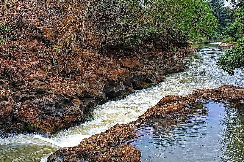
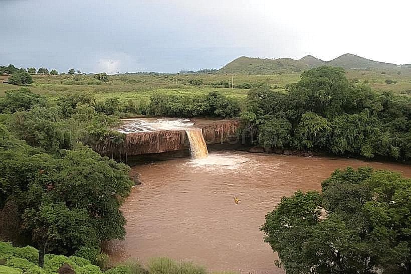
The landscape consists of rolling savannas with scattered acacia trees and baobabs. Elevation varies, with some areas featuring rocky outcrops and laterite soil. The dominant colors are earthy browns and greens, shifting seasonally. Water bodies, such as seasonal streams and permanent lakes, are present in depressions.
Location & Access Logistics
The primary access point is Ngaoundere. From the city center, trails radiate outwards. Major roads like the N1 highway pass through the region. Vehicle access to specific trailheads is via unpaved secondary roads, often requiring 4x4 vehicles during the wet season. Public transport to Ngaoundere includes buses from Yaounde and Douala. Within Ngaoundere, local taxis and motorcycle taxis can reach trail starting points.
Historical & Ecological Origin
The Adamaoua Plateau is an uplifted peneplain, formed by ancient geological processes. Its savanna ecosystem is a result of climatic conditions and historical land use, including pastoralism. The region has been inhabited for centuries, with evidence of early settlements and trade routes.
Key Highlights & Activities
Hiking is the primary activity. Specific trails include the ascent to Mount Ngaoundere for panoramic views. Birdwatching is possible throughout the plateau. Photography of the landscape and local flora and fauna is recommended. Observing traditional Fulani pastoralist practices is also a notable activity.
Infrastructure & Amenities
Basic amenities are limited along the trails. Restrooms are generally not available at trailheads. Shade is provided by scattered trees. Cell phone signal is intermittent and often absent in remote areas. Food vendors are typically found in Ngaoundere and larger villages; provisions should be carried for extended excursions.
Best Time to Visit
The dry season, from November to March, offers the most favorable conditions for hiking, with clear skies and lower humidity. The best time of day for photography is early morning or late afternoon for softer light. There are no tidal considerations.
Facts & Legends
Local folklore speaks of ancient spirits residing within the large baobab trees, which are considered sacred by some communities. A historical oddity is the presence of ancient megaliths in certain areas, the origin and purpose of which remain subjects of archaeological investigation.
Nearby Landmarks
- Mount Ngaoundere (1.5km West)
- Ngaoundere Central Market (3km South)
- Palace of the Lamido of Ngaoundere (3.5km South)
- Lake Tignere (25km Southwest)