Landmark: Vina River
City: Ngaoundere
Country: Cameroon
Continent: Africa
Vina River, Ngaoundere, Cameroon, Africa
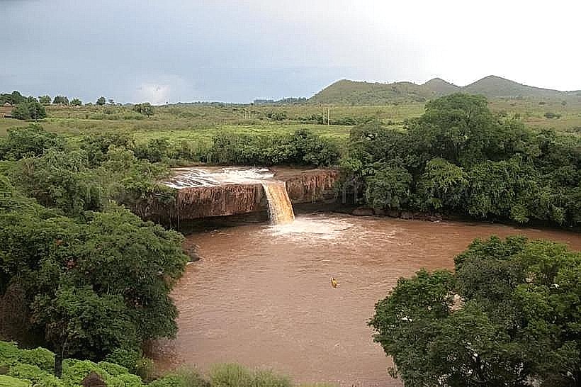
The Vina River is a significant waterway located within the city limits of Ngaoundere, Cameroon. It serves as a primary water source and a geographical feature within the Adamawa Plateau region.
Visual Characteristics
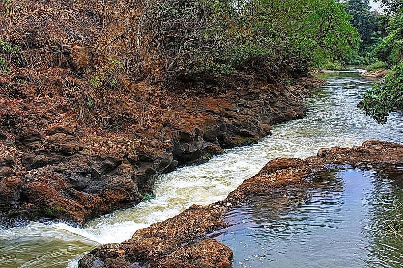
The Vina River exhibits a moderate width, typically ranging from 15 to 30 meters. Its water color varies seasonally, appearing brown and turbid during the rainy season (May-October) due to sediment runoff, and clearer, greenish-brown during the dry season. The riverbed consists of sand, gravel, and exposed rock formations. Banks are generally vegetated with grasses, shrubs, and scattered trees, including acacia and baobab species.
Location & Access Logistics
The Vina River traverses Ngaoundere from west to east. Access points are numerous along its course within the city. Major roads like Avenue des Nations Unies and Boulevard de la République run parallel to sections of the river, providing road access. Several unpaved tracks lead directly to the riverbanks. Parking is informal and available along these tracks and adjacent roads. Public transport within Ngaoundere consists of shared taxis; specific routes do not directly serve the river but can drop passengers at points near its banks.
Historical & Ecological Origin
The Vina River is a natural watercourse, part of the Benue River basin. Its formation is a result of the geological processes of the Adamawa Plateau, characterized by ancient crystalline rocks and lateritic soils. The river's flow is influenced by the region's tropical savanna climate, with distinct wet and dry seasons. It is a vital component of the local ecosystem, supporting riparian vegetation and providing water for wildlife and human use.
Key Highlights & Activities
Fishing is a common activity for local residents. Observing local life along the riverbanks is possible. During the dry season, shallow areas may be crossed on foot. No organized tours or specific recreational facilities are present.
Infrastructure & Amenities
Restrooms are not available directly at the river. Shade is provided by natural tree cover along the banks. Cell phone signal (2G/3G) is generally available in areas close to the river within Ngaoundere. Food vendors are not permanently stationed along the river but may be found in nearby markets and populated areas.
Best Time to Visit
For clearer water visibility and easier access, the dry season (November-April) is preferable. The late afternoon, between 16:00 and 18:00, offers softer lighting conditions for photography. High tide is not a relevant consideration for this river.
Facts & Legends
Local folklore suggests that the Vina River is inhabited by water spirits that protect its flow. A specific historical oddity is the river's role in the city's early development, with settlements often established along its course for water access and transportation before the advent of modern infrastructure.
Nearby Landmarks
- Ngaoundere Central Market (0.8km West)
- Palais de la Chefferie Ngaoundere (1.2km Northwest)
- Ngaoundere University Campus (2.5km North)
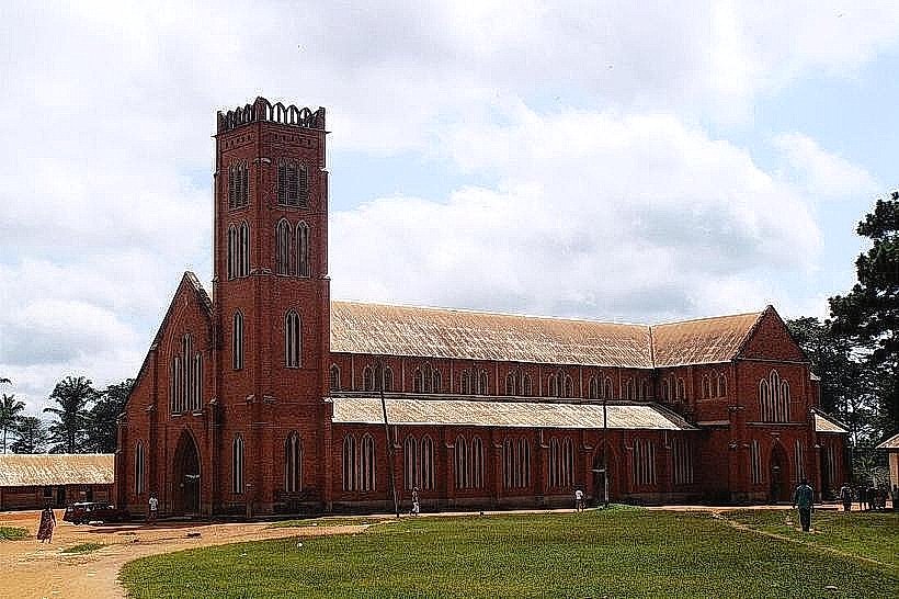
- Cathédrale Notre-Dame de Ngaoundere (1.5km West)
- Ngaoundere Airport (4.0km Southeast)