
Landmark: Amazon Region
City: Chiclayo
Country: Peru
Continent: South America
Amazon Region, Chiclayo, Peru, South America
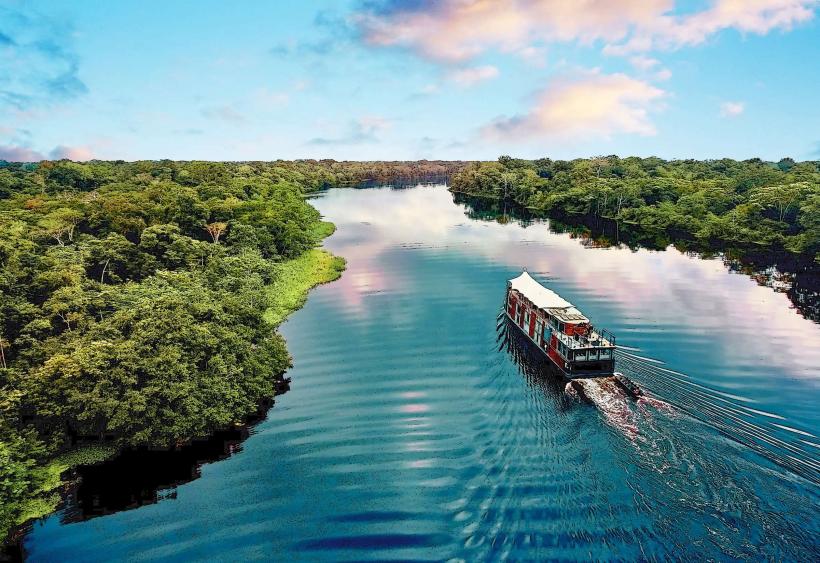
The Amazon Region near Chiclayo, Peru, is a segment of the vast Amazon rainforest accessible from the northern coast of Peru. This area provides a transition zone between the arid coastal plains and the dense jungle ecosystems.
Visual Characteristics
Vegetation is characterized by dense, multi-layered tropical rainforest. Dominant tree species include various palms, kapok trees, and mahogany. The undergrowth is thick with ferns and broad-leafed plants. Rivers and streams are typically brown due to sediment load. Wildlife is abundant but often concealed within the foliage.
Location & Access Logistics
Access to the Amazon Region from Chiclayo involves traveling east on the Pan-American Highway (PE-1N) for approximately 150 km towards Olmos. From Olmos, secondary roads, often unpaved and requiring 4x4 vehicles, lead further east into the rainforest. Travel time from Chiclayo to the edge of the rainforest can range from 3 to 5 hours depending on road conditions. Public transport to Olmos is available via interprovincial buses. No direct public transport penetrates the rainforest itself.
Historical & Ecological Origin
This region is part of the western Amazon basin, a geologically ancient area shaped by tectonic activity and riverine erosion over millions of years. Ecologically, it represents a transitional forest biome, influenced by both Andean runoff and Amazonian humidity, supporting a high biodiversity of flora and fauna adapted to tropical conditions.
Key Highlights & Activities
Boat excursions on rivers for wildlife observation. Guided jungle treks to identify plant species and observe insects. Birdwatching tours focusing on endemic species. Visits to indigenous communities (pre-arranged).
Infrastructure & Amenities
Basic eco-lodges with limited amenities are available in some accessible areas. Restrooms are typically found at lodges or designated stops. Shade is abundant under the forest canopy. Cell phone signal is generally absent within the dense jungle. Food vendors are not present in the rainforest; provisions must be carried.
Best Time to Visit
The dry season, from May to October, offers more accessible trails and reduced insect activity. The wet season (November to April) sees higher river levels, facilitating boat travel, but also increased rainfall. Early morning and late afternoon provide optimal lighting for wildlife photography.
Facts & Legends
Local folklore speaks of the "Yacumama," a giant water serpent said to inhabit the deeper rivers, capable of creating whirlpools. A specific tip for visitors is to carry insect repellent with a high DEET concentration, as mosquitoes and other biting insects are prevalent year-round.
Nearby Landmarks
- Huaca de la Luna (100km West)
- Sipán Archaeological Museum (95km West)
- Bosque de Pomac (110km West)
- Monsefú (105km West)


