Landmark: Austrian-Liechtenstein Border Trails
City: Mauren
Country: Liechtenstein
Continent: Europe
Austrian-Liechtenstein Border Trails, Mauren, Liechtenstein, Europe
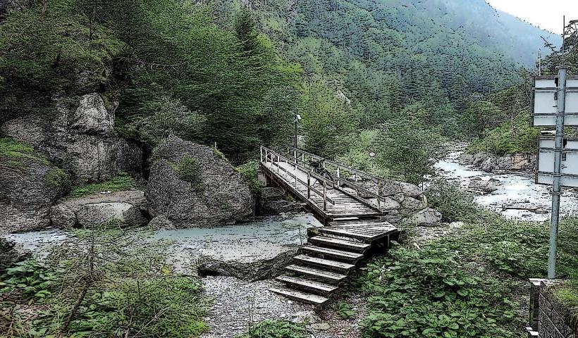
The Austrian-Liechtenstein Border Trails are a network of hiking paths tracing the national boundary between Liechtenstein and Austria, primarily accessible from the municipality of Mauren. These trails offer routes through varied terrain along the eastern edge of Liechtenstein.
Visual Characteristics
The trails consist of compacted earth and gravel paths, often winding through coniferous forests and open meadows. Border markers, typically small stone pillars or painted lines, are visible at regular intervals. Elevations vary, providing views of the Rhine Valley to the west and the Austrian Alps to the east.
Location & Access Logistics
The trails are accessible from multiple points in Mauren, Liechtenstein. A primary trailhead is located near the eastern edge of the village, approximately 2km east of Mauren's center via Hauptstrasse. Limited parking is is available at designated trail entrances. Public bus line 11 (operated by LIEmobil) serves Mauren, with stops within walking distance of several trail access points.
Historical & Ecological Origin
The trails follow the established border between the Principality of Liechtenstein and Austria, a boundary formalized over centuries. The current trail network was developed for recreational purposes, utilizing existing paths and newly constructed sections to highlight the border's historical significance and natural environment. The surrounding ecology is characterized by subalpine forests and agricultural land.
Key Highlights & Activities
Hiking and trail running are primary activities. Specific sections offer panoramic views of the Rhine Valley. Observing the historical border markers provides a unique geographical context. Interpretive signs detailing local flora and fauna are present on some segments.
Infrastructure & Amenities
Restrooms are not directly available on the trails but can be found in the village of Mauren. Shade is provided by forest sections. Cell phone signal (4G/5G) is generally reliable along the trails. Food vendors are not present on the trails; however, restaurants and shops are available in Mauren.
Best Time to Visit
The best time to visit is from late spring (May) through early autumn (October) when trails are clear of snow and weather is mild. Morning hours offer cooler temperatures and clearer visibility for photography. Specific trail conditions should be checked during periods of heavy rain due to potential muddy sections.
Facts & Legends
A unique aspect of these trails is the ability to walk directly along an international border, with one foot potentially in Liechtenstein and the other in Austria at certain points. The trails are part of a larger network of 'Liechtenstein-Weg' segments, offering a comprehensive exploration of the principality.
Nearby Landmarks
- Mauren Parish Church St. Peter and Paul: 1.5km West
- Eschnerberg: 2km West
- Ruggeller Riet Nature Reserve: 3km North-West
- Schellenberg Castle Ruins: 4km North