Landmark: Bocas del Toro Archipelago
City: Bocas del Toro
Country: Panama
Continent: North America
Bocas del Toro Archipelago, Bocas del Toro, Panama, North America
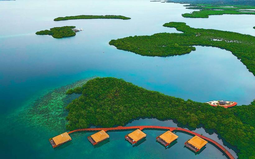
The Bocas del Toro Archipelago is a chain of islands located in the western Caribbean Sea, off the coast of Panama. It is part of the Bocas del Toro Province.
Visual Characteristics
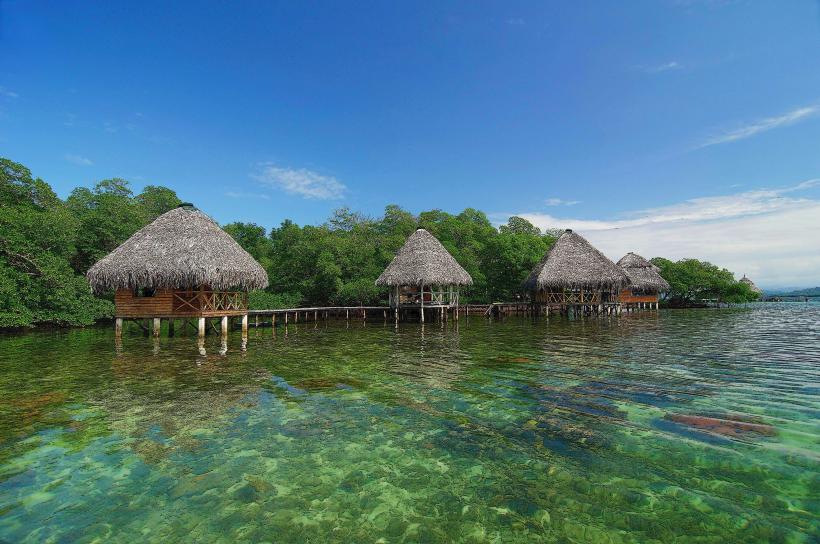
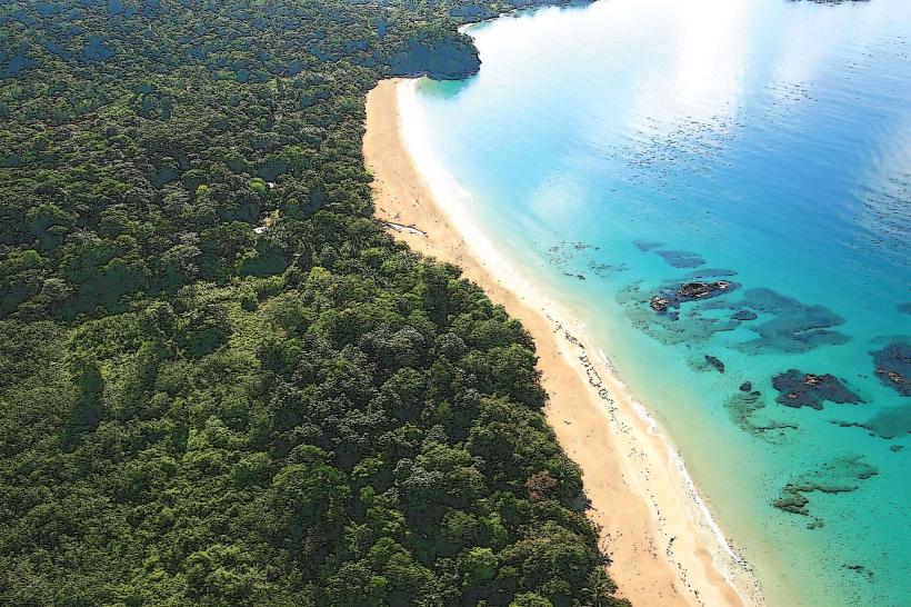
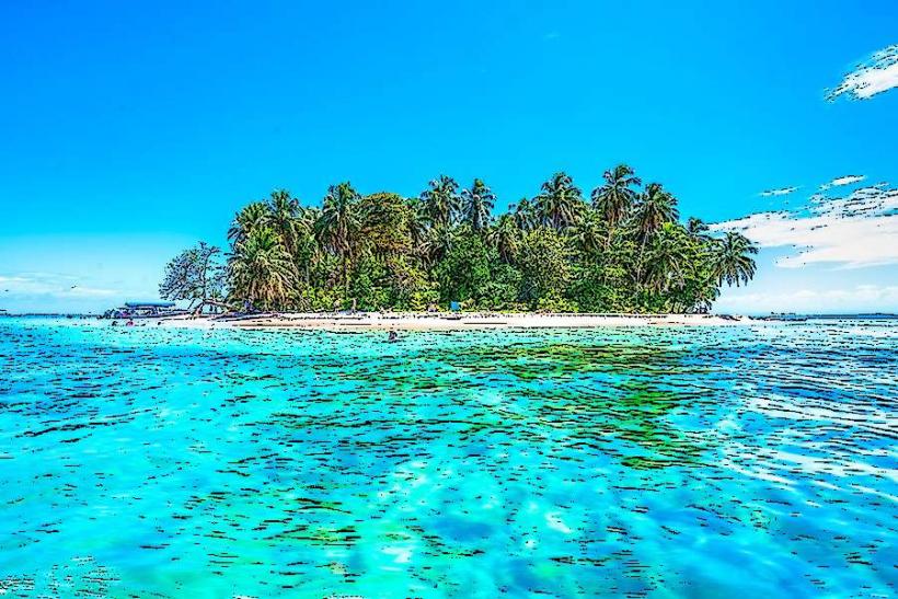
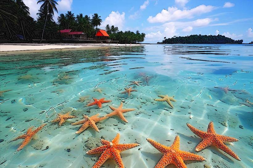
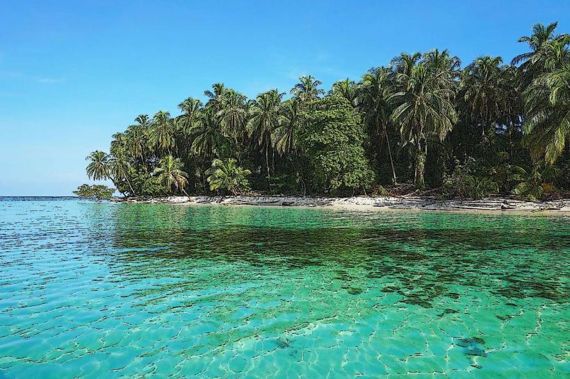
The islands are characterized by dense tropical rainforest vegetation, white sand beaches, and clear turquoise waters. Coral reefs are prevalent in the surrounding marine environment. Island topography ranges from low-lying coastal plains to volcanic hills.
Location & Access Logistics
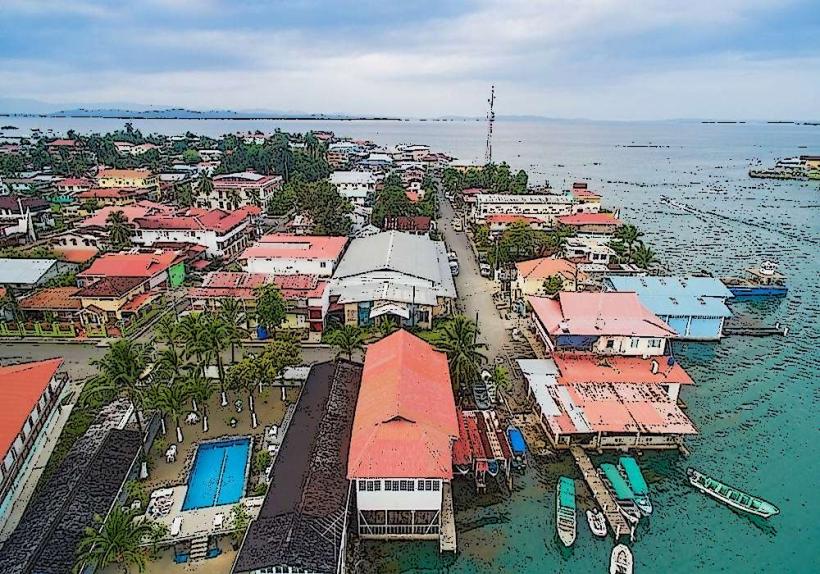
The archipelago is situated approximately 30 kilometers north of the Panamanian mainland. Access is primarily via Bocas Town (Isla Colón), which has an airport (Bocas del Toro International Airport - BOC) with flights from Panama City and other regional hubs. Ferry services operate from Almirante on the mainland to Bocas Town, a journey of about 30 minutes. Within the archipelago, water taxis are the main mode of transport between islands and to specific sites. Limited road infrastructure exists on Isla Colón, with taxis and rental scooters available in Bocas Town. Parking is available at the airport and ferry terminals in Almirante and Bocas Town.
Historical & Ecological Origin
The islands are of volcanic origin, formed by tectonic activity over millions of years. They were first explored by Europeans in 1502 during Christopher Columbus's fourth voyage. The region was historically inhabited by indigenous Ngäbe and Bribri peoples. The archipelago was designated a UNESCO World Heritage Site in 2000 due to its significant biodiversity and marine ecosystems.
Key Highlights & Activities
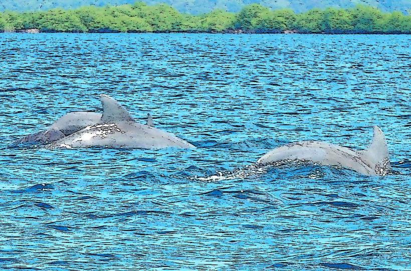
Activities include snorkeling and diving at coral reefs, observing marine life such as dolphins and sea turtles, exploring mangrove forests, and hiking through rainforest trails. Boat tours to various islands, including Cayo Zapatilla and Starfish Beach, are common. Birdwatching is also a popular activity.
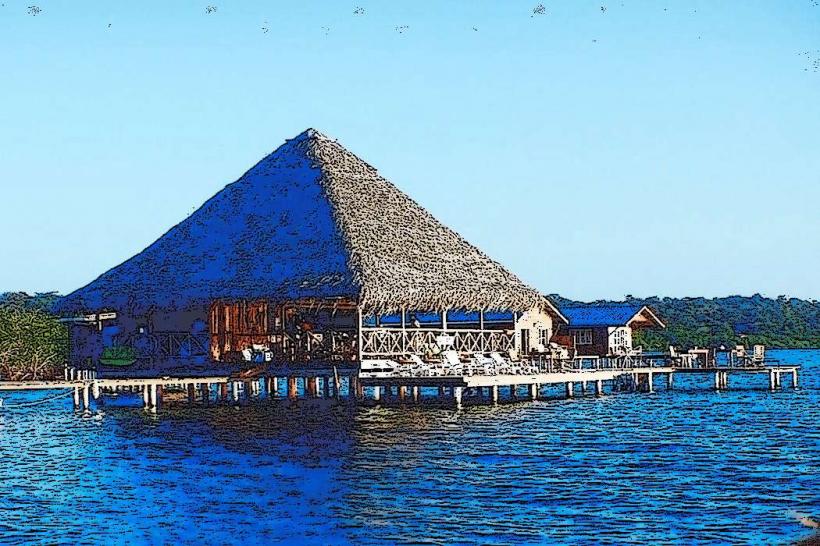
Infrastructure & Amenities
Restrooms are available at major tourist hubs and some restaurants. Shade is provided by natural tree cover and man-made structures in developed areas. Cell phone signal (4G) is generally available in Bocas Town and some other populated areas, but can be intermittent on smaller islands. Food vendors and restaurants are concentrated in Bocas Town and at popular tourist beaches.
Best Time to Visit
The driest months are typically from January to April and again from August to September. The wettest months are May, June, July, October, and November. For optimal underwater visibility for snorkeling and diving, calm seas are preferred, which are generally found during the drier periods. Sunrise and sunset offer distinct lighting conditions for photography.
Facts & Legends
A local legend suggests that the shape of Isla Colón resembles a reclining bat, hence the name "Bocas del Toro" (Mouths of the Bull), though the origin of the name is debated, with some attributing it to a cacique named Cabra. A specific tip for visitors is to be aware of the tides when visiting certain shallow reef areas to ensure access and avoid damaging coral.
Nearby Landmarks
- Almirante (0.5km South-West)
- Bastimentos National Marine Park (2km South-East)
- Red Frog Beach (3km South)
- Isla Colón (0km - main island)
- Popa Island (5km East)