Information
Landmark: Centennial TrailCity: Spokane
Country: USA Washington
Continent: North America
Centennial Trail, Spokane, USA Washington, North America
The Centennial Trail is a paved multi-use path located in Spokane, Washington, USA. It follows the Spokane River for a significant distance through the city and surrounding areas.
Visual Characteristics
The trail is primarily composed of asphalt, with some sections of concrete. It is generally 10-12 feet wide. The path is bordered by natural vegetation, including trees and shrubs, and offers views of the Spokane River, which varies in width and depth. Urban parkland and developed cityscapes are visible along certain stretches.
Location & Access Logistics
The Centennial Trail extends approximately 37 miles, with its western terminus near the Idaho border and its eastern terminus at Riverside State Park. Access points are numerous throughout Spokane. Major access points include:**
- Downtown Spokane: Parking is available in city garages and street parking. Bus routes 4, 10, and 25 serve downtown areas adjacent to the trail.
- Riverfront Park: Multiple parking lots are available within the park. Bus routes 4, 10, and 25 stop at or near the park.
- Riverside State Park: Day-use parking fees apply. Access is via Westসঙ্গত Road from US-2 West.
Historical & Ecological Origin
The Centennial Trail was conceived and constructed to commemorate Washington State's centennial in 1989. It was developed as a public works project to provide recreational access along the Spokane River corridor. Ecologically, the trail traverses an area shaped by glacial activity and the Spokane River's erosive power, supporting riparian habitats.
Key Highlights & Activities
Activities include walking, running, cycling, and inline skating. Birdwatching is possible along the riverbanks. Fishing is permitted in designated areas of the Spokane River. The trail passes through several city parks, offering opportunities for picnicking and relaxation. Specific sections are suitable for observing river rapids.
Infrastructure & Amenities
Restrooms are available at major access points and within Riverfront Park. Shade is provided by mature trees along many sections. Cell phone signal (4G/5G) is generally consistent in urban areas and may be intermittent in more remote sections of Riverside State Park. Food vendors are present in Riverfront Park and in downtown Spokane; limited options exist near other access points.
Best Time to Visit
For photography, early morning and late afternoon offer optimal lighting conditions due to the sun's angle. The best months for weather are typically May through September, with average temperatures ranging from 60-80°F (15-27°C). High tide is not a relevant factor for trail use. Winter months can bring snow and ice, impacting trail conditions.
Facts & Legends
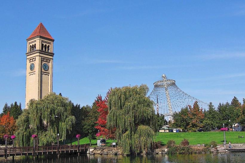
A unique historical feature is the Spokane Falls, which the trail passes near. These urban waterfalls are among the largest in the United States. A local tip is to check the Spokane Parks Department website for scheduled events or trail closures, particularly in Riverfront Park.
Nearby Landmarks
- Spokane Falls (0.2km East)
- Riverfront Park (0.3km East)
- Northwest Museum of Arts and Culture (1.5km West)
- Gonzaga University (2.0km Northeast)
- Manito Park (4.5km South)