Information
Landmark: Spokane RiverCity: Spokane
Country: USA Washington
Continent: North America
Spokane River, Spokane, USA Washington, North America
The Spokane River is a 110-mile long river flowing through Spokane, Washington, and into Idaho. It originates from the Coeur d'Alene Lake and empties into the Columbia River.
Visual Characteristics
The river's width varies, averaging approximately 100 feet in urban areas. Water color is typically a murky green to brown, influenced by sediment and algae. The riverbanks are a mix of natural vegetation, concrete embankments, and urban development. Several waterfalls, most notably Spokane Falls, are prominent features within the city limits.
Location & Access Logistics
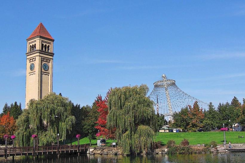
The Spokane River runs directly through the center of Spokane, Washington. Access points are numerous within the city. Parking is available at various city parks along the river, such as Riverfront Park, with specific lots designated for park users. Public transport options include multiple bus routes that service areas adjacent to the river, with stops at key points like the downtown transit center.
Historical & Ecological Origin
The Spokane River is a natural waterway shaped by glacial activity and subsequent erosion. Its current course and features, including Spokane Falls, are the result of millions of years of geological processes. Historically, the river was a vital resource for indigenous tribes and later for early settlers involved in logging and mining.
Key Highlights & Activities
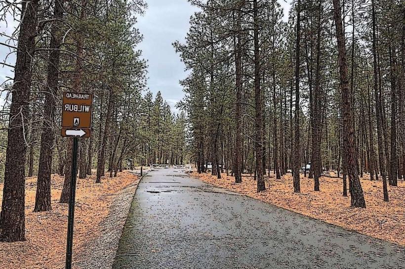
Activities include walking or cycling along the Spokane River Centennial Trail, which follows the river for 37 miles. Kayaking and paddleboarding are possible on calmer sections of the river, particularly upstream from the falls. Viewing platforms at Riverfront Park offer direct observation of Spokane Falls. Fishing is permitted in designated areas.
Infrastructure & Amenities
Restrooms are available at Riverfront Park and other developed access points. Shaded areas are present in parks and along the Centennial Trail. Cell phone signal (4G/5G) is generally strong throughout the urban sections of the river. Food vendors and restaurants are located in close proximity to Riverfront Park and the downtown core.
Best Time to Visit
For photography of Spokane Falls, early morning or late afternoon light provides optimal illumination. The months of May through September offer the most favorable weather conditions for outdoor activities. Water levels can fluctuate, impacting recreational opportunities; checking local conditions is advised.
Facts & Legends
Spokane Falls is one of the largest urban waterfalls in the United States. A unique tip for visitors is to explore the lower falls area via the Numerica SkyRide gondola for a different perspective of the water's power.
Nearby Landmarks
- Riverfront Park (0.1km West)
- Northwest Museum of Arts and Culture (0.8km West)
- Spokane Convention Center (0.3km West)
- Martin Woldson Theater at The Fox (1.2km Northwest)
- Gonzaga University (1.5km East)