Landmark: Deli River
City: Medan
Country: Indonesia
Continent: Asia
Deli River, Medan, Indonesia, Asia
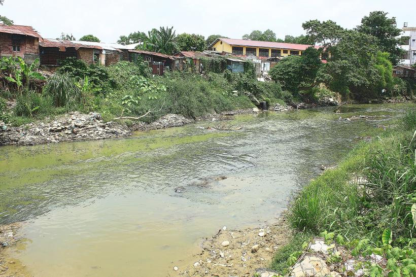
The Deli River is a waterway flowing through the city of Medan, North Sumatra, Indonesia. It serves as a significant geographical feature within the urban landscape.
Visual Characteristics
The river's water color varies from muddy brown to a lighter brown, depending on recent rainfall and sediment load. The banks are predominantly lined with concrete embankments in developed areas, transitioning to soil and vegetation further from the city center. Width averages 20-30 meters in the urban core.
Location & Access Logistics
The Deli River traverses Medan from the south to the north, emptying into the Strait of Malacca. Access points are numerous along its course within the city. Major roads running parallel include Jalan Gatot Subroto and Jalan Yos Sudarso. Public transport, specifically local minibuses (angkot) on various routes, frequently pass by sections of the river. Parking is generally available along adjacent streets, though it can be limited in densely populated areas.
Historical & Ecological Origin
The Deli River is a natural alluvial river, formed by the drainage of the Barisan Mountains. Its historical significance is tied to the development of Medan as a port city, with its banks serving as early trade routes. The river's ecosystem is characterized by freshwater aquatic life adapted to tropical conditions.
Key Highlights & Activities
Boating and small vessel transit are possible along certain stretches. Observation of urban riverine life and local activity along the banks is a primary engagement. Fishing by local residents occurs in less developed sections.
Infrastructure & Amenities
Restrooms are not consistently available along the riverbanks. Shade is limited in urbanized areas, primarily provided by existing structures. Cell phone signal (4G/5G) is generally strong throughout the city. Food vendors are present in proximity to accessible river sections, particularly in market areas.
Best Time to Visit
For clearer water visibility, early morning or late afternoon, after periods of less rainfall, is preferable. The dry season, typically from June to September, offers more stable water levels. High tide does not significantly impact river access within the city.
Facts & Legends
Local folklore suggests the river's currents can be unpredictable, with tales of spirits guarding its depths. Historically, the river was crucial for transporting agricultural produce, particularly tobacco, from plantations to the port.
Nearby Landmarks
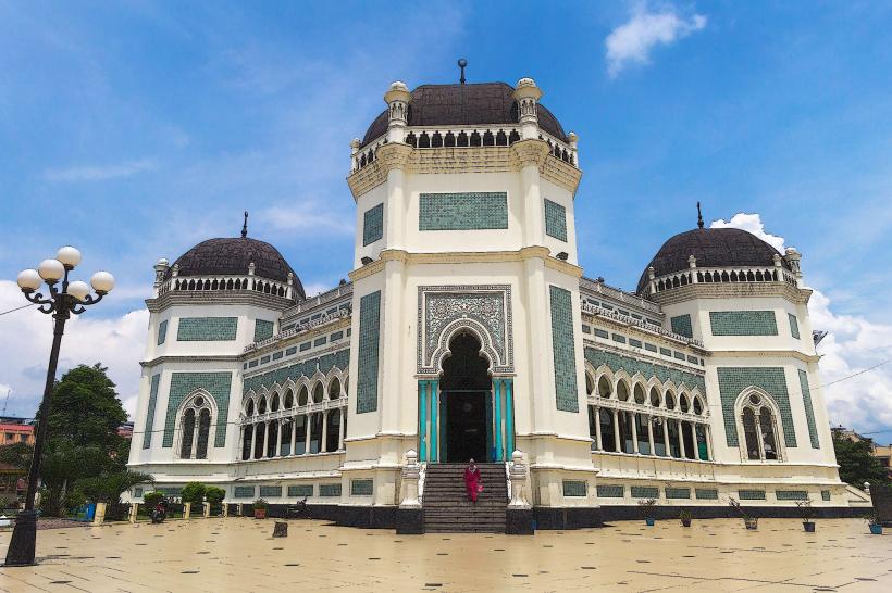
- Masjid Raya Medan (Great Mosque of Medan) - 1.5km Northwest
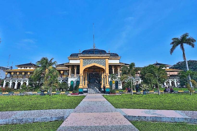
- Istana Maimun (Maimun Palace) - 1.8km Northwest
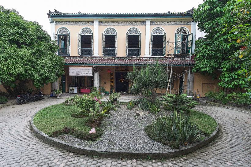
- Tjong A Fie Mansion - 1.9km Northwest
- Merdeka Walk - 2.2km Northwest
- Graha Maria Annai Velangkanni - 3.8km South