Landmark: Down the Islands (DITI)
City: Chaguaramas
Country: Trinidad and Tobago
Continent: North America
Down the Islands (DITI), Chaguaramas, Trinidad and Tobago, North America
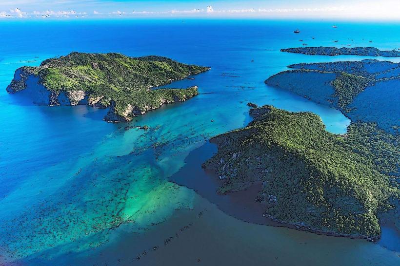
Down the Islands (DITI) is an archipelago of small islands located off the northwestern coast of Trinidad, within the Chaguaramas area of Trinidad and Tobago.
This chain of islands comprises several distinct landmasses, including Chacachacare, Monos, Huevos, Gaspar Grande, and Centipede Island.
Visual Characteristics
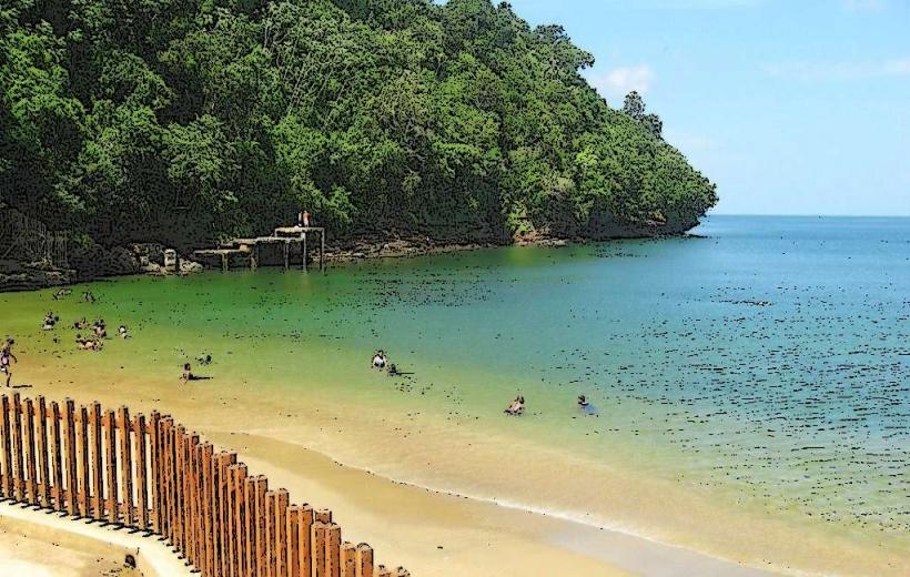
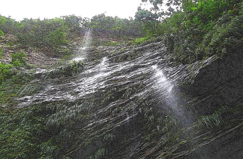
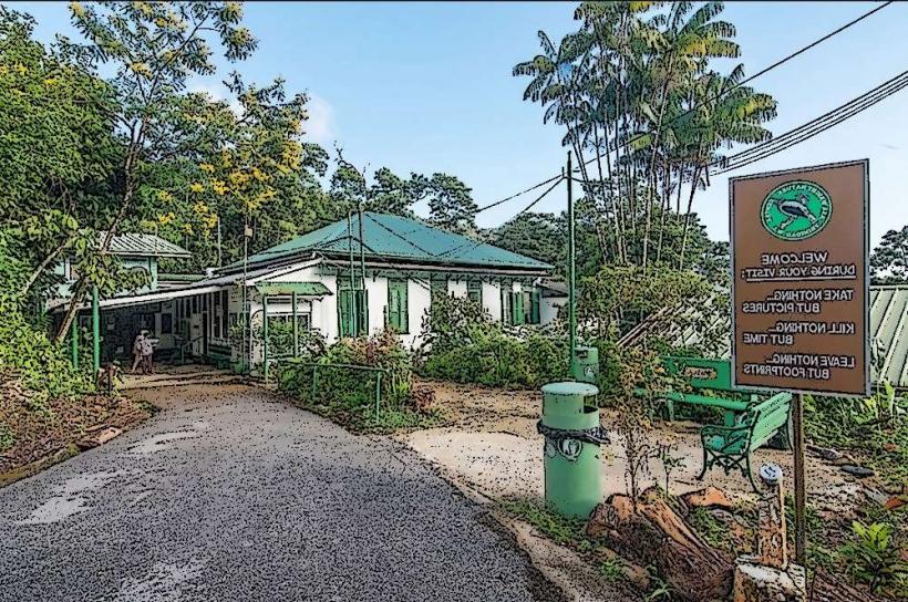
The islands are characterized by steep, verdant hillsides covered in dense tropical vegetation. Coastlines feature a mix of rocky outcrops and small, sandy coves. Water surrounding the islands is typically clear, with varying shades of blue and green depending on depth and seabed composition. Structures on the islands are generally limited to former colonial-era buildings, some of which are in a state of disrepair, and modern private residences or recreational facilities.
Location & Access Logistics
Access to Down the Islands is exclusively by boat. The primary departure point is the Chaguaramas Boardwalk and Marina, located approximately 20 kilometers west of Port of Spain. Private boat charters and water taxis are available from this location. Travel time to the closest islands, such as Gaspar Grande, is approximately 15-20 minutes. Larger vessels may require docking at designated jetties, while smaller boats can anchor in sheltered bays.
Historical & Ecological Origin
Historically, these islands served various purposes, including leper colonies (Chacachacare), military outposts, and private estates. Gaspar Grande, for instance, housed a leper colony from the late 19th century until the mid-20th century. Ecologically, the islands are part of the Northern Range foothills, exhibiting a tropical marine environment with diverse coastal flora and fauna. The geological formation is primarily sedimentary rock.
Key Highlights & Activities
Activities include swimming and sunbathing at accessible coves, snorkeling and diving in clear waters, and exploring abandoned structures. Boat tours often circumnavigate the islands, providing views of the coastline and marine life. Hiking trails exist on some of the larger islands, though they may be overgrown. Fishing is also a common activity.
Infrastructure & Amenities
Infrastructure is minimal and varies by island. Some islands have private residences with basic amenities. Public facilities are scarce; restrooms are generally only available at private establishments or designated picnic areas on specific islands. Shade is provided by natural tree cover. Cell phone signal can be intermittent, particularly on the outer islands. Food vendors are not typically present on the islands themselves; visitors are advised to bring their own provisions or dine at establishments in Chaguaramas before or after their trip.
Best Time to Visit
The best time for visiting is during the dry season, from January to May, when rainfall is lower and seas are generally calmer. Mid-morning to late afternoon offers optimal sunlight for water activities and photography. High tide is generally preferred for accessing some of the smaller coves.
Facts & Legends
A notable historical fact is the presence of the former leper colony on Chacachacare, which operated for decades and left behind remnants of its infrastructure, including a church and hospital buildings. Local lore sometimes speaks of shipwrecks and the ghosts of former inhabitants lingering on the islands.
Nearby Landmarks
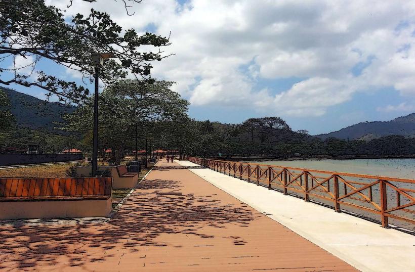
- Chaguaramas Boardwalk and Marina (0.5km West)
- Fort George (15km East)
- Maracas Bay (18km East)
- Piarco International Airport (35km East)
- Pitch Lake (70km Southwest)